Teddington Lock
Conservation Area Appraisal
Conservation area no.27
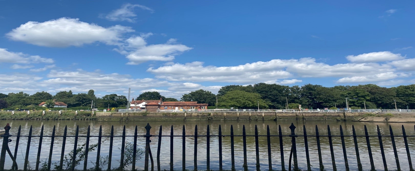
Figure 1 View of Lock scene
Contents
- Introduction
- Statement of Significance
- Location and Setting
- Historical Development
- Architectural Quality and Built Form
- Architectural Details
- Open Space, Parks, Gardens and Trees
- Management Plan
- References
1. Introduction
1.1 Purpose of this document
The principal aims of conservation area appraisals are to:
- Describe the historic and architectural character and appearance of the area which will assist applicants in making successful planning applications and decision makers in assessing planning applications.
- Raise public interest and awareness of the special character of their area
- Identify the positive features which should be conserved, as well as negative features which indicate scope for future enhancements.
This document has been produced using the guidance set out by Historic England in the 2019 publication titled Understanding Place: Conservation Area Designation, Appraisal and Management, Historic England Advice Note 1 (Second Edition). This document will be a material consideration when assessing planning applications.
1.2 What is a conservation area?
The statutory definition of a conservation area is an ‘area of special architectural or historic interest, the character or appearance of which it is desirable to preserve or enhance’.
The power to designate conservation areas is given to local authorities through the Planning (Listed Buildings and Conservations Areas) Act, 1990 (Sections 69 to 78).
Once designated, proposals within a conservation area become subject to local conservation policies set out in our Local Plan, the London Plan, and national policies of the National Planning Policy Framework (NPPF).
Our overarching duty which is set out in the Act is to preserve and/or enhance the historic or architectural character or appearance of the conservation area.
1.3 Buildings of Townscape Merit
Buildings of Townscape Merit (BTMs) are buildings, groups of buildings or structures of historic or architectural interest, which are locally listed due to their considerable local importance. The policy, as outlined in our Local Plan, sets out a presumption against the demolition of BTMs unless structural evidence has been submitted by the applicant, and independently verified at the cost of the applicant. Locally specific guidance on design and character is set out in the Council’s Buildings of Townscape Merit Supplementary Planning Document (2015), which applicants are expected to follow for any alterations and extensions to existing BTMs, or for any replacement structures.
1.4 What is an Article 4 Direction?
An Article 4 Direction is made by the local planning authority. It restricts the scope of permitted development rights either in relation to a particular area or site, or a particular type of
development anywhere in the authority's area. We have powers under Article 4 of the Town and Country Planning (General Permitted Development) Order 2015 to remove permitted development rights.
Article 4 Directions are used to remove national permitted development rights only in certain limited situations where it is necessary to protect local amenity or the well being of an area. An Article 4 Direction does not prevent the development to which it applies, but instead requires that planning permission is first obtained from us for that development.
For further information about Article 4 Directions, to check if any permitted developments rights in relation to a particular area/site or type of development apply in your area, visit Article 4 Directions.
1.5 What is a Conservation Area Appraisal?
A conservation area appraisal aims to describe the special historic and architectural character of an area. A conservation area’s character is defined by a combination of elements such as architecture, uses, materials and detailing as well as the relationship between buildings and their settings including landscape.
Many other elements contribute to character and appearance such as the placement of buildings within their plots; views and vistas; the relationship between the street and the buildings and the presence of trees and green space.
The Conservation Area Appraisal is an evidence base rather than a planning policy document. This means that it is the main document for recording what is of principal importance in terms of character and appearance of each conservation area.
However, the relevant policies are contained within the borough's Local Plan.
Designation and Adoption Dates
Teddington Lock Conservation Area was designated on the 7th September 1977.
It was subsequently extended on the 7th September 1982, 22nd February 2005, and 20th February 2019.
Following approval from the Environment, Sustainability, Culture and Sports Committee on the 5th April 2022, a public consultation on the draft Appraisal was carried out between the 20th June and 14th July 2022.
This Appraisal was adopted on the 30th March 2023.
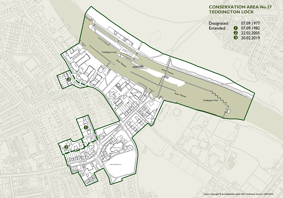
Teddington Lock Conservation Area map
View an interactive map of the conservation area
2. Statement of Significance
Summary of special architectural, historic interest of conservation area.
A comparatively small yet diverse conservation area, Teddington Lock includes a wide variety of buildings, structures and landscapes.
The conservation area can be divided into two distinct areas, although the whole conservation area is unified by its relationship to the river.
The western section of the conservation area, on the Teddington side of the river, includes a section of the High Street with shops and restaurants.
It also includes various residential streets such as Twickenham Road, Manor Road and Kingston Road.
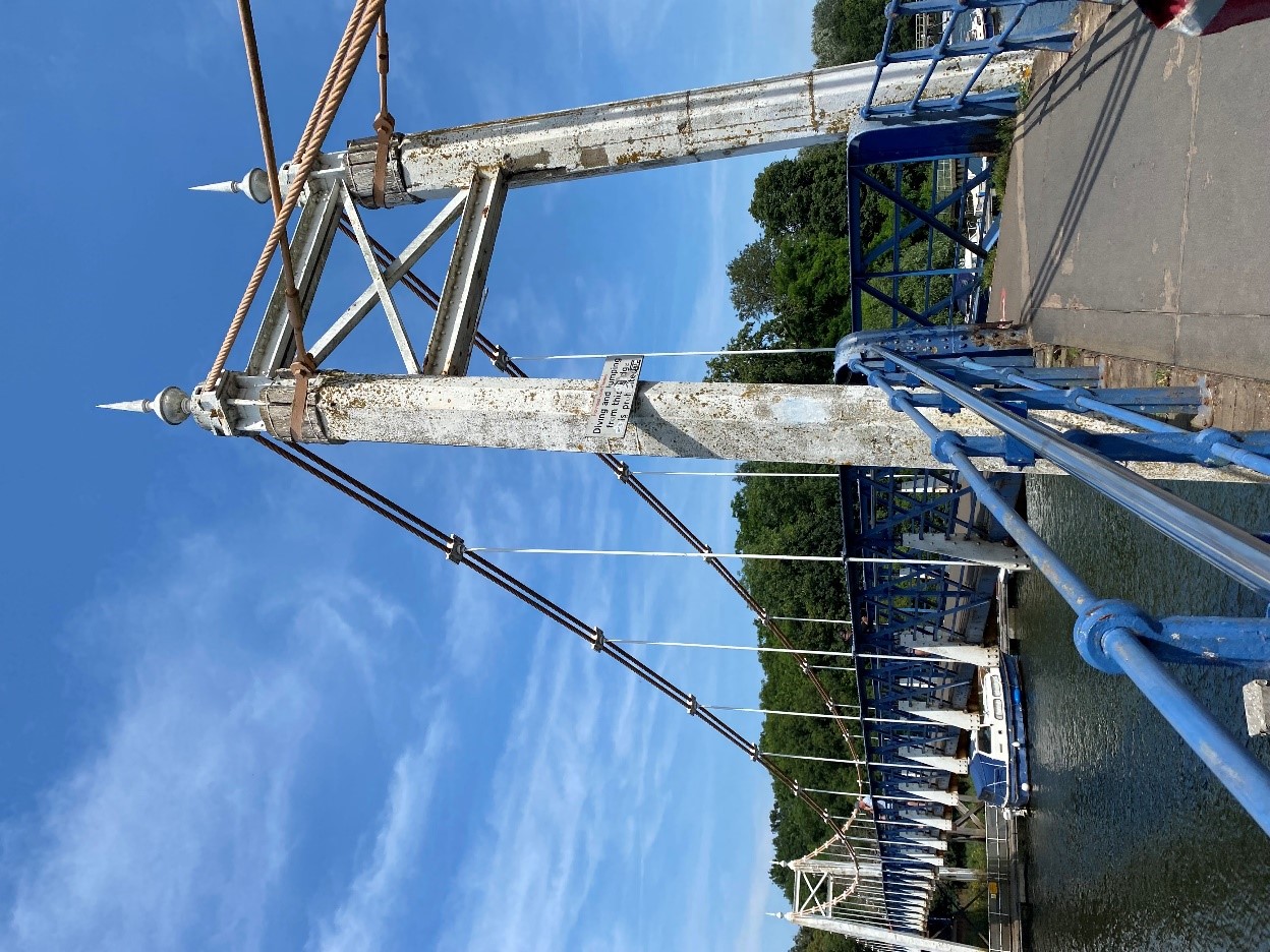
Figure 2 Teddington Lock footbridge
The area features two public houses, one church, lock houses, toll houses, boat houses, and two Grade II listed bridges.
The Ham side of the river, has a much more rural character with just two buildings. Accessible only by foot, across the bridges from Teddington or from Ham, this bank has retained its distinct pastoral quality.
3. Location and Setting
Teddington Lock Conservation Area is primarily a riverside conservation area but also incorporates part of the historic village core of Teddington, which lies midway between Twickenham and Hampton.
The area spans both sides of the Thames with the majority of development on the Teddington side of the river, with the Ham bank retaining its rural, natural character. It adjoins High Street Teddington (37) Conservation Area to the West.
Location OS Sheets: 1671
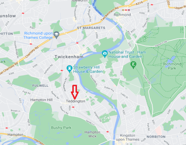
Figure 3 Map showing Teddington in wider context
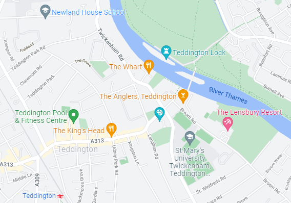
Figure 4 Focused map of Teddington
This conservation area generally runs north – south along the river Thames and Manor Road into Kingston Road. Intersecting this road axis is Ferry Road and the High Street.
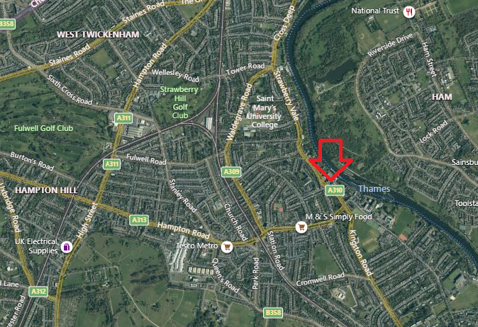
Figure 5 Aerial map of Teddington showing wider context
4. Historical Development
The evolution of the historical development of the area, including archaeology and plot morphology, that contribute to its special character.
Some prehistoric finds have been recorded within the settlement area of Teddington, albeit closer to the river rather than in the High Street area. Further palaeo-environmental remians and evidence of prehistoric activity are likely to be preserved within alluvium deposits along the Thames foreshore. There is little evidence of Roman activity, although it is possible there was a riverside route from Twickenham to Kingston of Roman origin.
The discovery of further paleoenvironmental and prehistoric archaeological finds may help to enhance our understanding of prehistoric settlement patterns along this stretch of the Thames. With the presence of an early Saxon settlement directly across the river at Ham, it is possible that the area has been of significance to river traffic since at least the Saxon period.
The riverside village of Teddington dates from at least the Anglo-Saxon period, with its associated name ‘Tudas Farm’. The Medieval period witnessed the first significant development of Teddington, seeing it expand westwards from the riverside.
Teddington belonged to Westminster Abbey in the later 13th century, when the parish church of St Mary was first recorded in 1217. The present building dates from the 16th century, and was extended in the 18th and 19th centuries. Following the arrival of the railway, and a subsequent increase in population, as well as pressure for space for more elaborate religious rituals, it was deemed necessary to build a larger church.The earliest medieval settlement may have formed around this church, located at the corner of the Twickenham to Kingston road and at the eastern end of the High Street. The settlement became part of Henry Vlll's hunting estate in the 16th century. The land returned to use as an independent manor in the years following Henry’s reign and was long dependant on agriculture as its economic base.
During the 17th and 18th centuries the appealing riverside setting of this area and the nearby Royal parkland attracted wealthy residents. As a result, many large houses were built such as Manor House, Udney House and Teddington Place (later named Udney Hall). Sadly, none of these houses survive.
However, a row of listed 18th century cottages, including Peg Woffington’s Cottage still survive, along with another listed 18th century detached house on the High Street.
The arrival of the railway in 1863, which cut through the village pond, resulted in Teddington becoming a viable commuter area for London. This resulted in intensified development, with many older buildings being remodelled or replaced with new housing and shopping parades.
There has been a church, the present St Mary with St Alban, on its site since 1217. The present building dates from the 16th century and was extended in the 18th and 19th centuries. Following the arrival of the railway, and a subseqent increase in population, as well as pressure for space for more elaborate religious rituals, it was deemed necessary to build a larger church.
The late 19th century former church of St. Alban, currently the Landmark Arts Centre, was built in the Early English style and designed by William S Nevin, a pupil of George Gilbert Scott. It stands opposite the smaller original parish church of St Mary. The church was built between 1887 and 1889, dedicated in 1889, and consecrated in 1896 but was never finished, with its 200ft tower remaining unbuilt and the nave being shorter than intended.
Many people were attracted to the new church by the preachings of the Rev. Francis Leith Boyd. However, when he left for a church in central London, the congregation began to diminish. This process was hastened by the two World Wars and the general decline in church attendance after the Second World War. In 1967 the congregation reverted to the much smaller St Mary’s across the road, leaving St Alban's unused from the 1970s onwards. It became derelict and badly vandalised and was declared redundant in 1977. It was eventually converted to community use, with the land to the rear on Langham Road being used to build housing.
Teddington Lock and weir were constructed in 1811 to control the river. The lock was originally made of timber but rebuilt in stone in 1857 in its current position.
The two footbridges, the western suspension bridge and eastern iron girder bridge were constructed in 1888 and replaced a former ferry. They are both now Grade II listed.
Teddington has long been associated with boat building, since at least 1848 when James Arthur Messenger opened his boatyard. There were also several wharfs along the Teddington bank at the time.
In terms of Teddington’s industrial history, there were linen and wax bleaching works in the fields between the river and Broom Road, but these were moved to a factory in Waldegrave Road in 1800.
The late 20th Century and early 21st century saw significant residential riverside redevelopment, including a number of larger scale apartment blocks north along the Thames. This included the demolition of Teddington Studios and the redevelopment of the site to residential use.
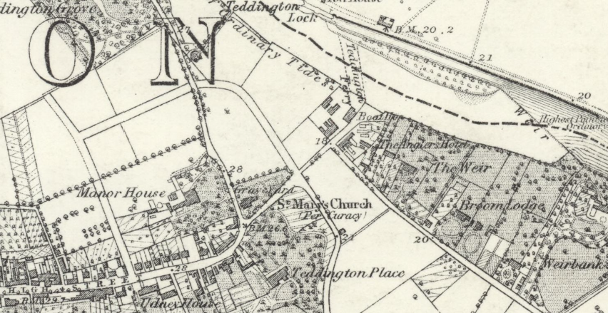
Figure 6 1860s
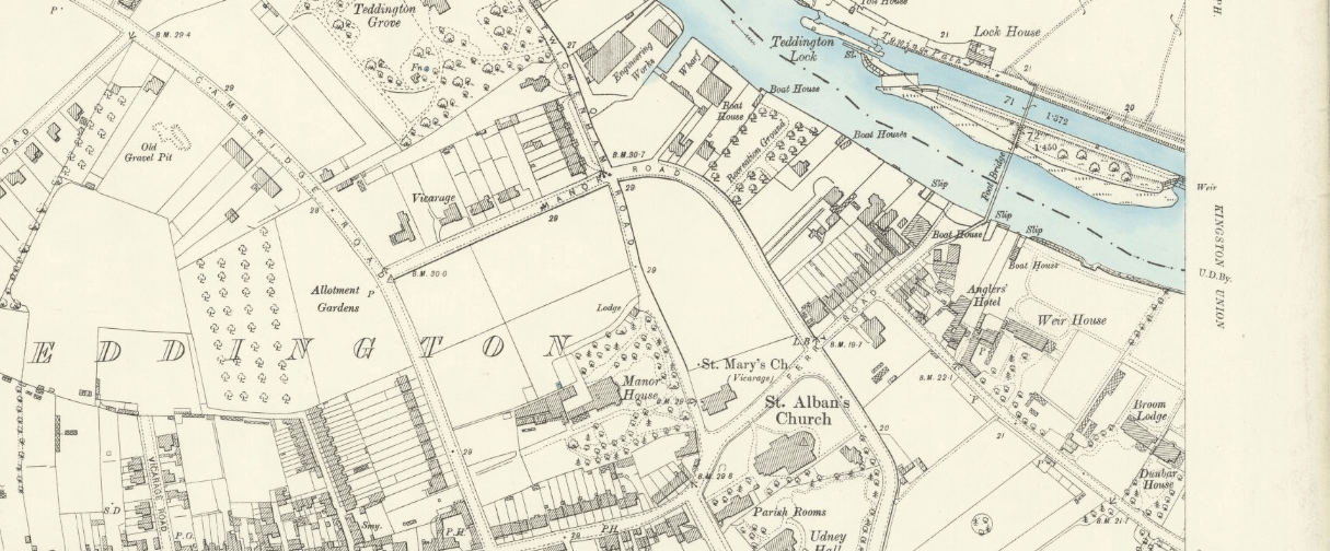
Figure 7 1890s
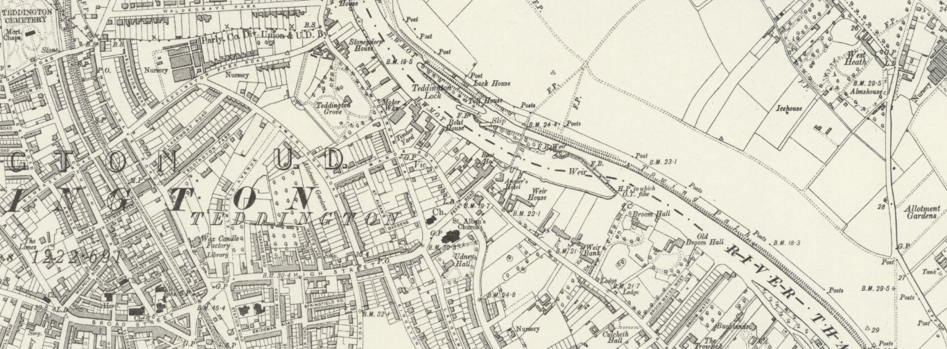
Figure 8 1910s
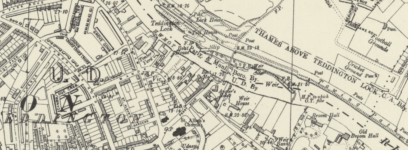
Figure 9 1930s
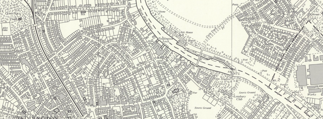
Figure 10 1950s
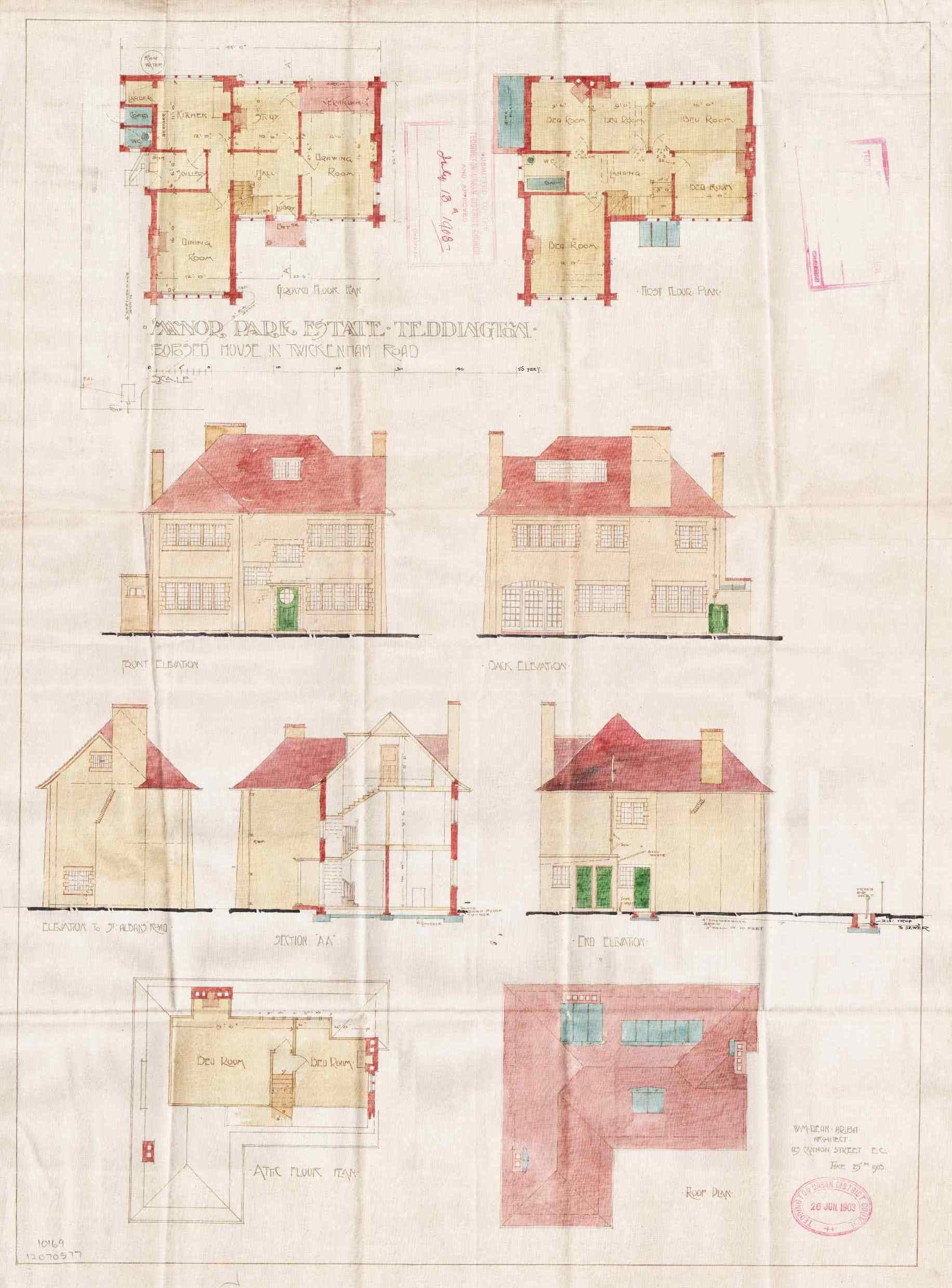
Figure 11 Architectural drawing of 7 Twickenham Road by W M Dean 1903
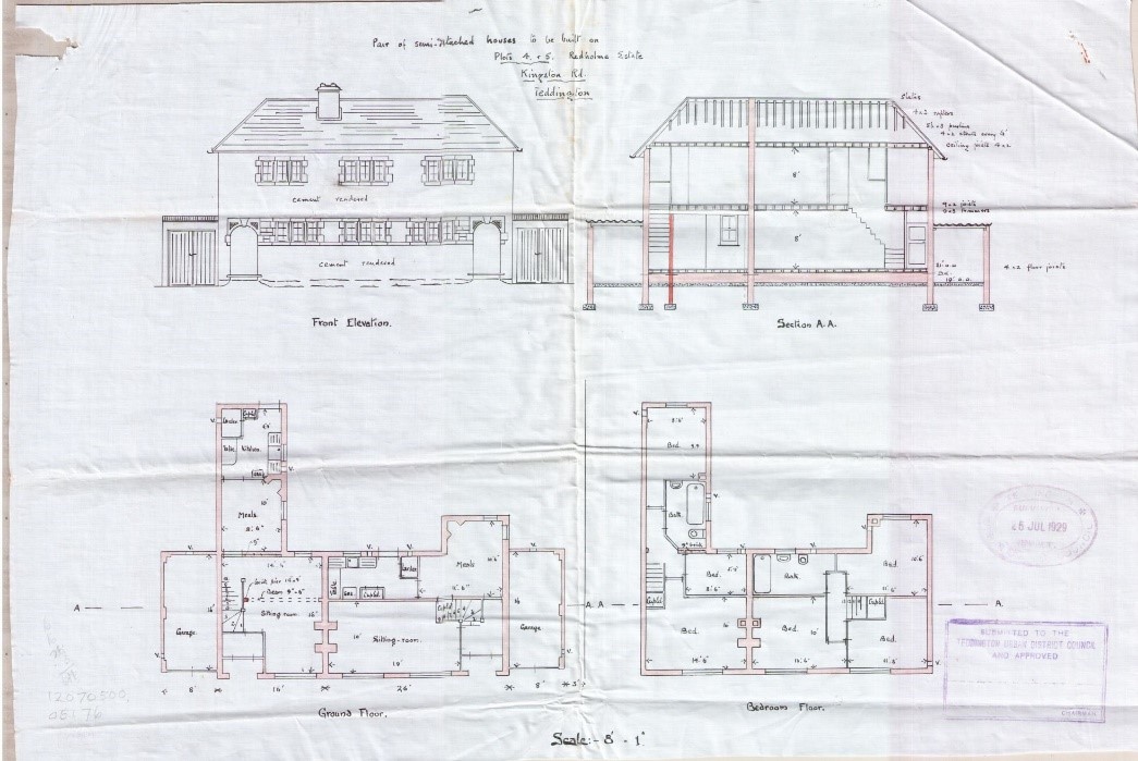
Figure 12 Architectural drawings of 1-3 Kingston Road from 1929
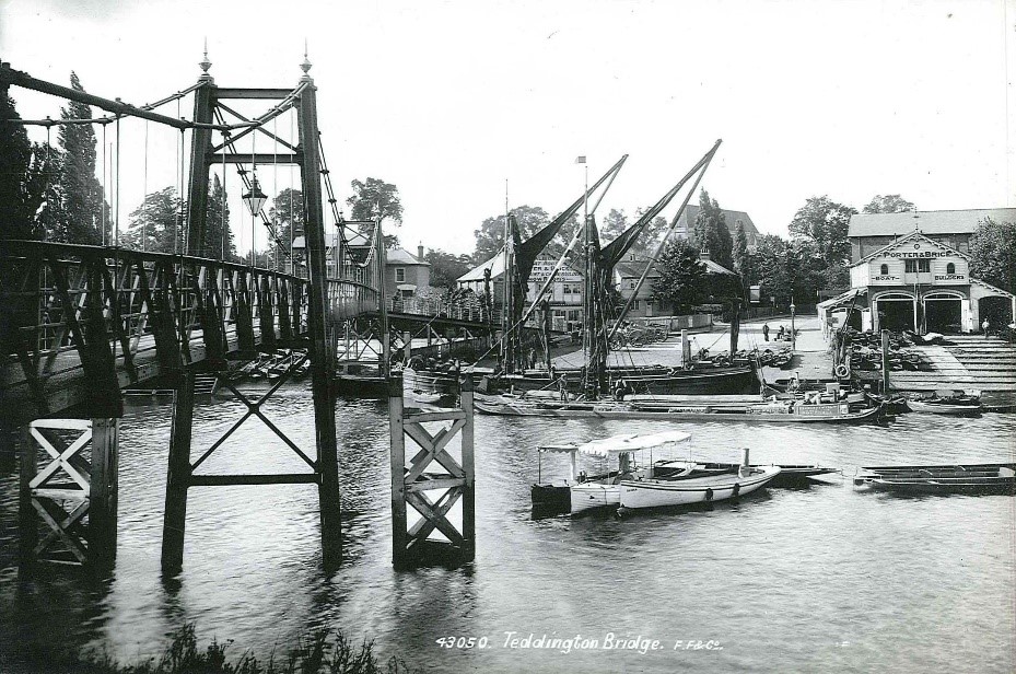
Figure 13 Teddington footbridge 1899
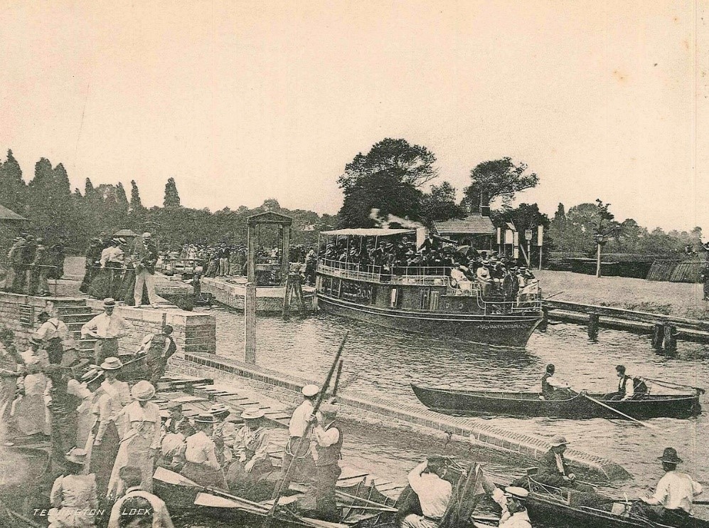
Figure 14 Lively river scene c1900
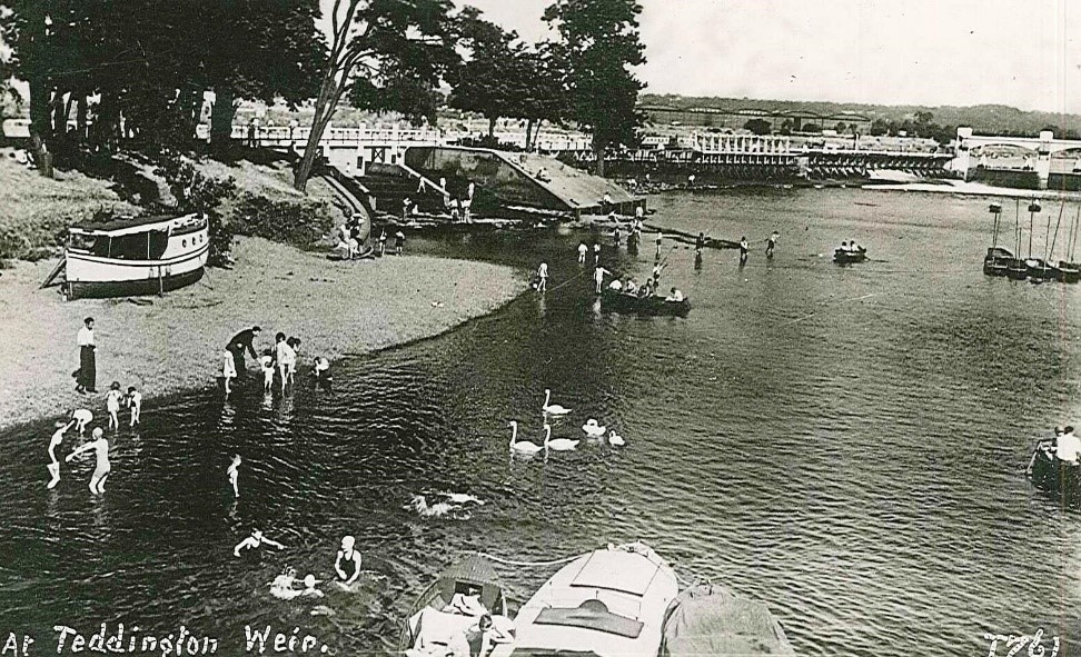
Figure 15 Teddington Weir 1938
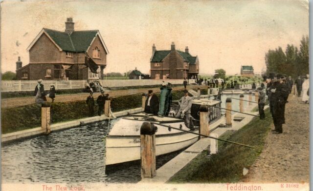
Figure 16 Lock scene showing lock house and toll house behind. Date unknown
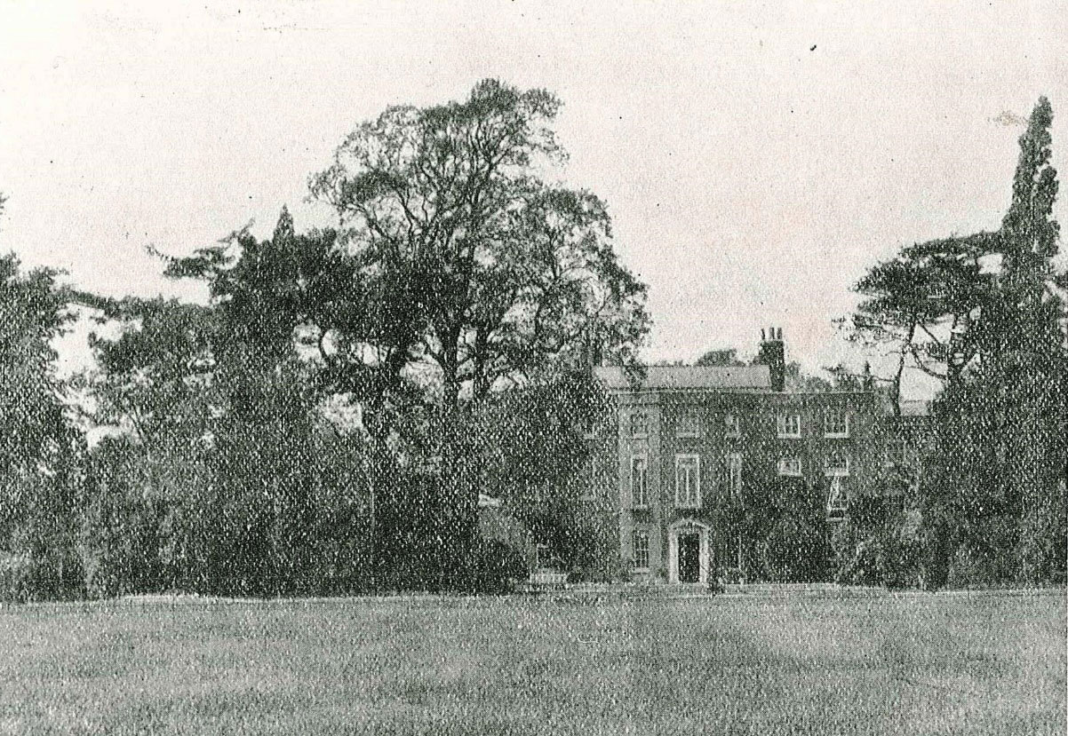
Figure 17 Udney House. Demolished c1900 for High Street development
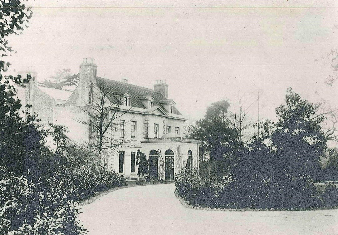
Figure 18 Udney Hall c1880. Demolished mid 20th century
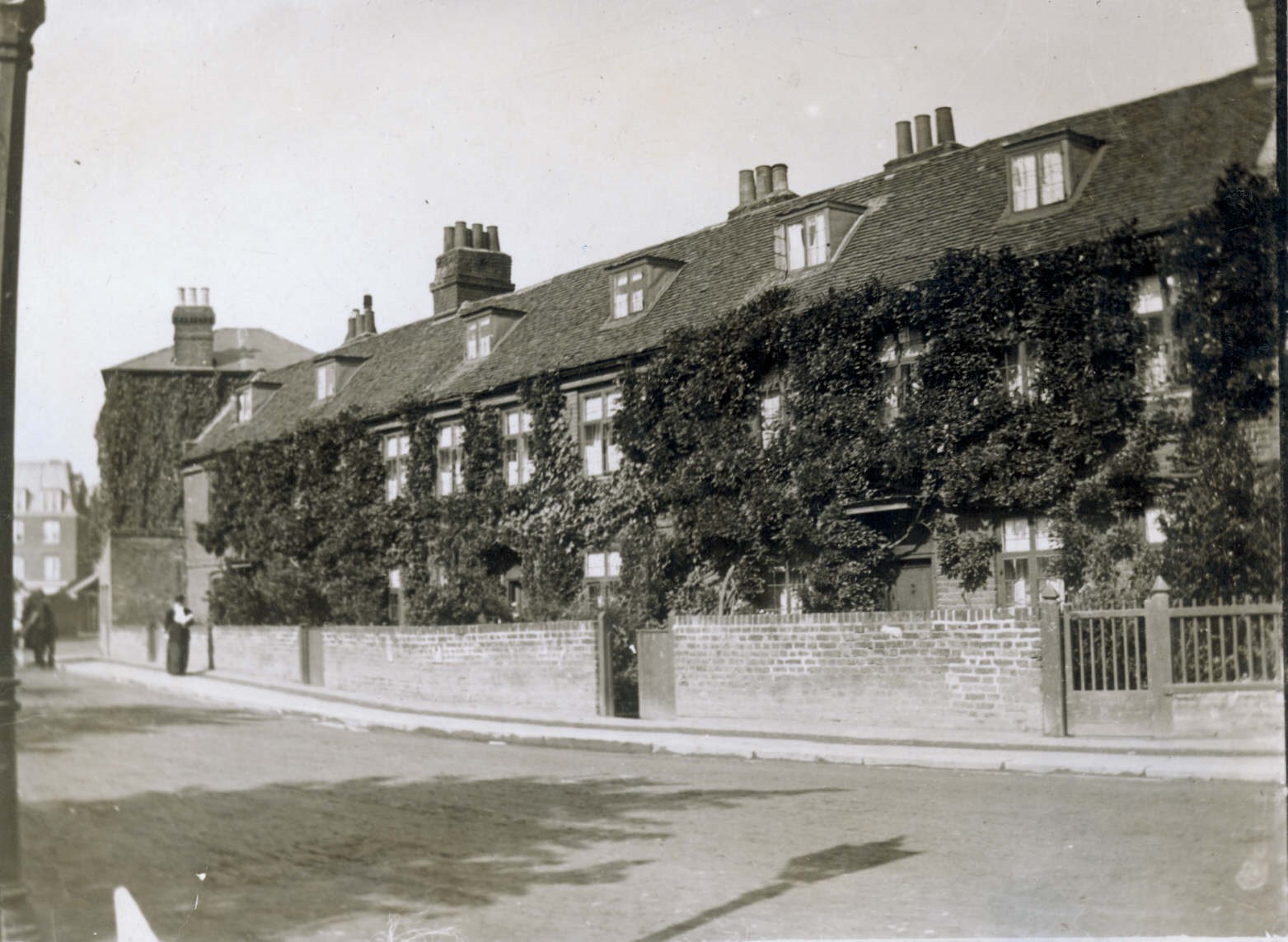
Figure 19 18th century cottages 163-167 High Street c1900
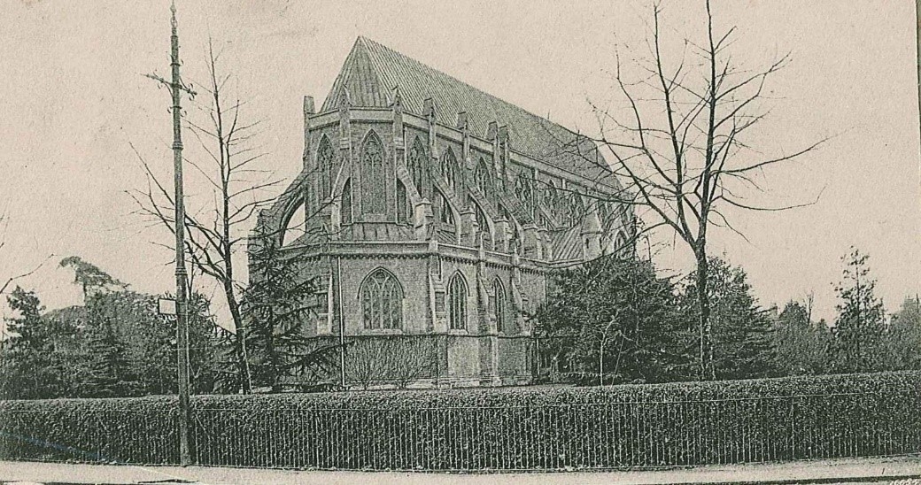
Figure 20 The former St Alban's church. Date unknown
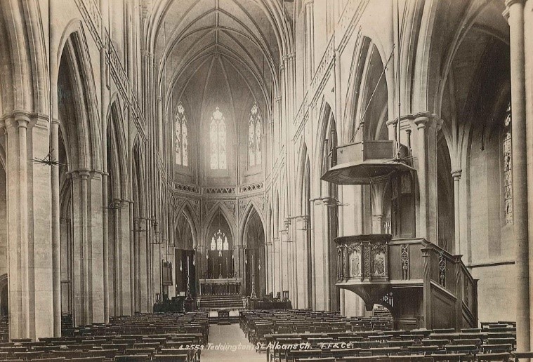
Figure 21 The former St Alban's church interior c1920
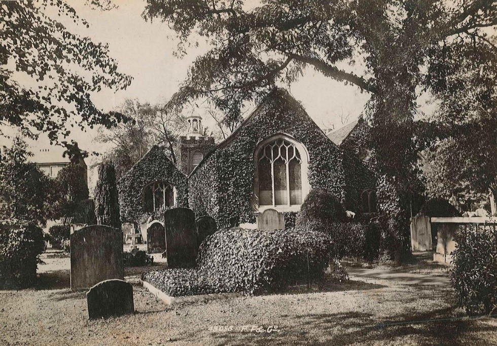
Figure 22 St Mary with St Alban parish church and graveyard 1920s
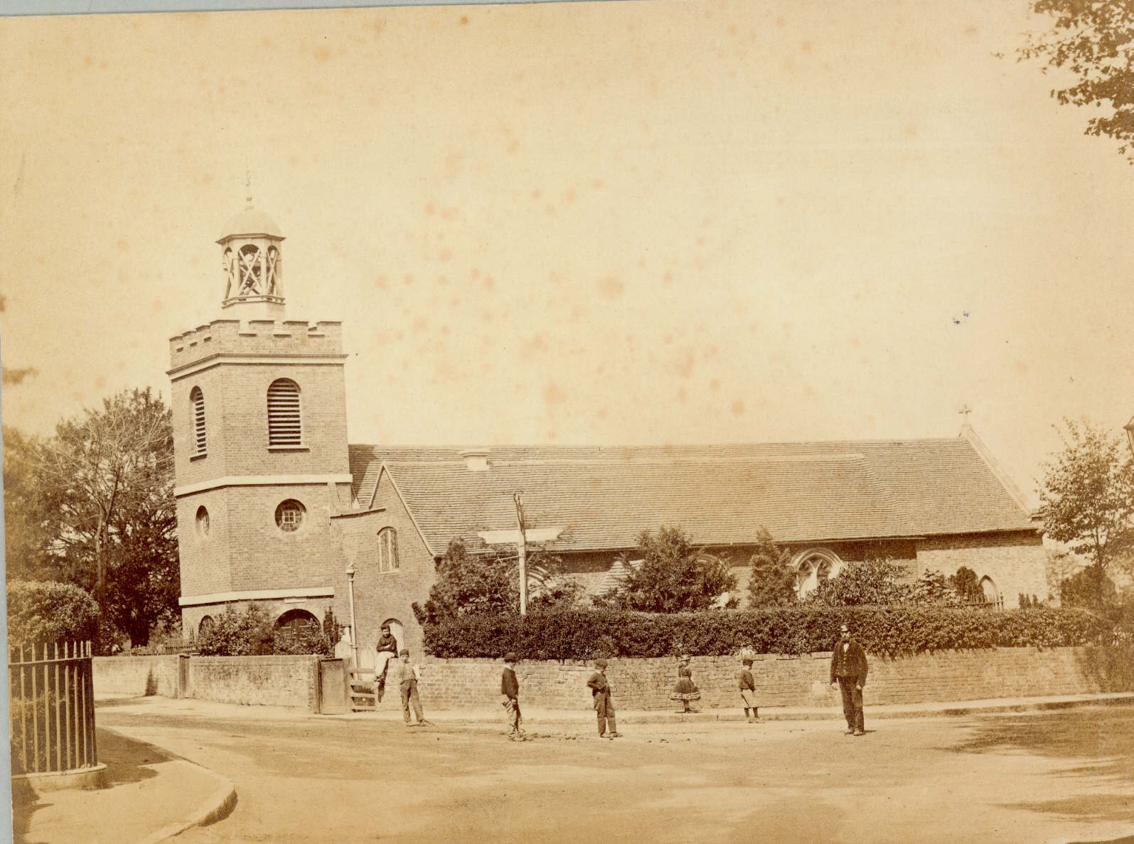
Figure 23 St Mary with St Alban parish church as viewed from High Street c1900
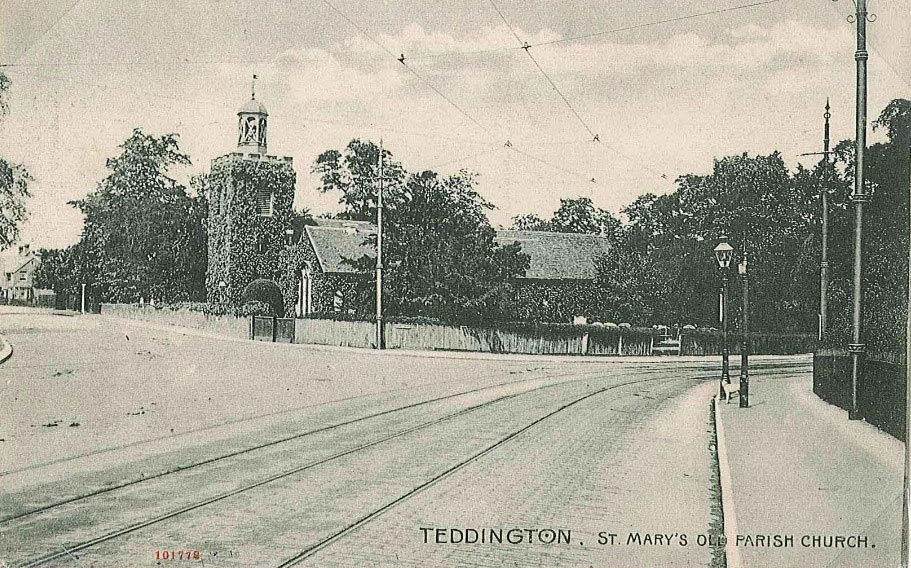
Figure 24 View of tramlines outside St Mary with St Alban parish church c1920
5. Architectural Quality and Built Form
A description of the dominant architectural styles in the area, the types and periods of buildings, their status and essential characteristics, and their relationship to the topography, street pattern and skyline. Also important is their authenticity, distinctiveness and materiality.
There are a number of listed buildings in this conservation area.
5.1 Listed Buildings
A listed building is a building that has been placed on the Statutory List of Special Architectural or Historic Interest. Buildings on this list may not be demolished, extended or altered without Listed Building Consent.
Iron suspension bridge – Grade II
The pair of bridges at Teddington Lock were built to replace the former ferry crossing operating between Teddington on the south bank and Ham on the north bank of the River Thames.
This single span steel suspension footbridge was designed by George Pooley and built in 1888. It features two pairs of steel towers surmounted by delicate finials, and connected with steel suspension cables. It links the Teddington bank to Creweyte/ Swan Ait Island.
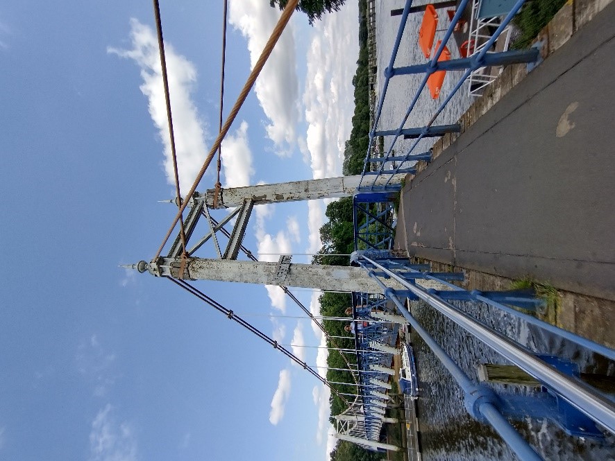
Figure 25 Iron suspension bridge
Steel girder bridge - Grade II
This single span steel footbridge of riveted sectional girder construction with cross ties is more modest than its neighbouring suspension bridge. It features partly rendered concrete piers whereas that on the south of the bridge incorporates a brick arch to allow pedestrian access beneath.
There are moulded stone coping stones to the south pier. It connects Creweyte/Swan Ait Island to the Ham bank.
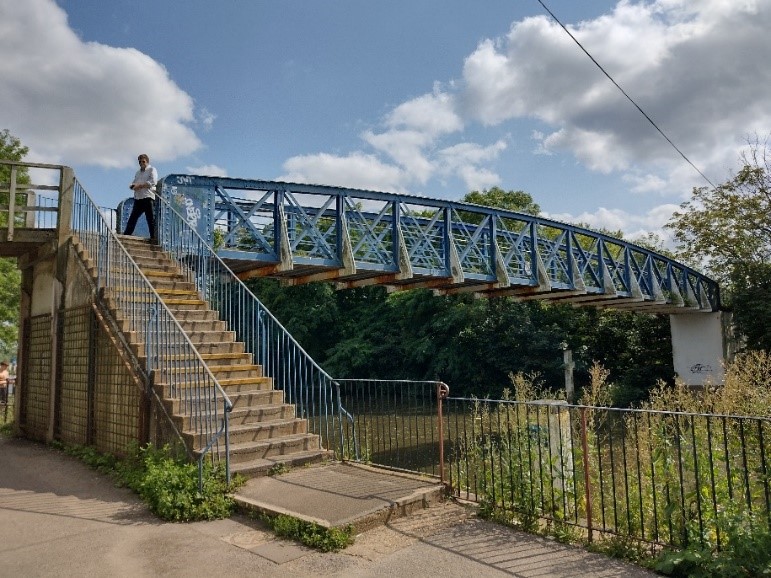
Figure 26 Steel girder bridge
Boathouse (27 Ferry Road) – Grade II
Adjacent to Teddington Lock, the boatyard in Ferry Road dates from the mid-19th century, with a map showing it in 1850.
The boathouse was probably built in 1862 (the date is inscribed on several bricks on the south gable wall).
It was extended by the mid-1890s, with the addition of a lean-to on the north-west side, and altered again in the 1970s, when an upper floor was added to the riverside gable and the interior of the boathouse was opened up to house larger boats. It is possible that the upper floor was added in the later C19.
James Messenger, the first known tenant and a champion sculler, established a flourishing business at the yard; in 1862 he was appointed Queen’s Bargemaster, a post he held until 1890. During the first World War the yard supplied vessels for the shipbuilders Thornycrofts, whose yard was based at Platts Eyot further upstream.
The main building is red brick at ground floor level with a cogged eaves line lying between this and the weatherboarded upper storey with a slate roof. There are two shallow brick arches over the doorways, with recessed brickwork under the arches, creating the appearance of brick pilasters on either side of and between the arches. The lean-to extension to the south is also of brick construction but has been painted cream. This lean-to is quite plain but features a series of semi-circular windows. Otherwise, all of the windows to the building are plain painted timber casements.
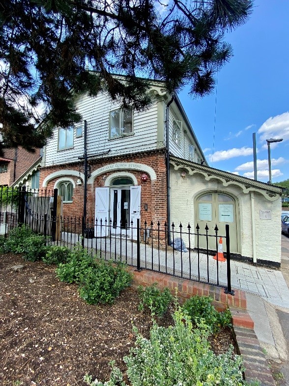
Figure 27 Boathouse at termination of Ferry Road
St Mary with St Alban Church – Grade II*
St Mary's St Mary with St Alban parish church is a Grade II listed brick-built church dating from the 16th century with 18th century tower and 19th century chancel.
The south aisle features red Tudor brick with dark vitrified headers forming diaper pattern detailing. There are stone dressings to the 18th century nave. This church features a wide variety of materials; the north aisle and tower are made of brown brick with the chancel made of yellow brick.
The 18th century castellated west tower was built in 3 stages, with round arches. The north aisle also features 3 round arched windows. There is a three-light perpendicular window to east end. The church includes monuments to Peg Woffington, Henry Hitcroft and John Walters - founder of The Times.
The church is set within a modest church yard which includes a graveyard, closed to burials since 1884, but including a memorial area for those cremated in recent years, as well as a sensory area at the east end.
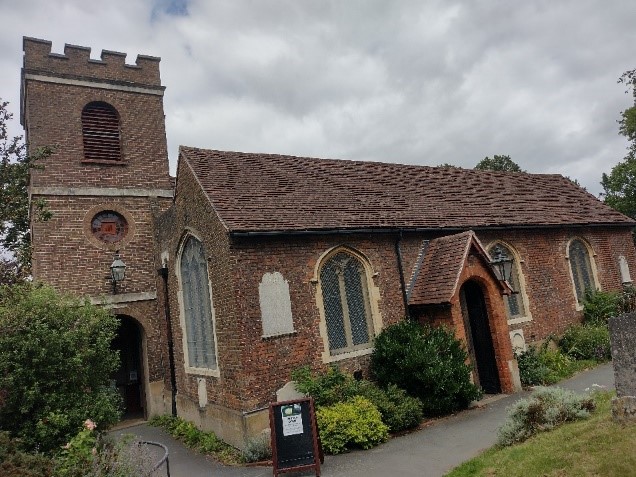
Figure 28 View of St Mary with St Alban
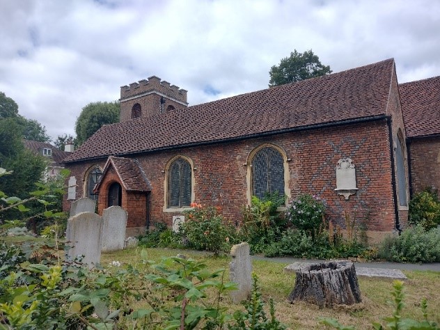
Figure 29 View of St Mary with St Alban from the graveyard
Former St Alban's Church – Grade II*
Built between 1887 and 1889, this large neo-Gothic stone church with green copper roof was designed by William Nevin in the Early English style. The west end is incomplete, and a tower was planned to be added to the north side. The flying buttresses to the nave are also incomplete.
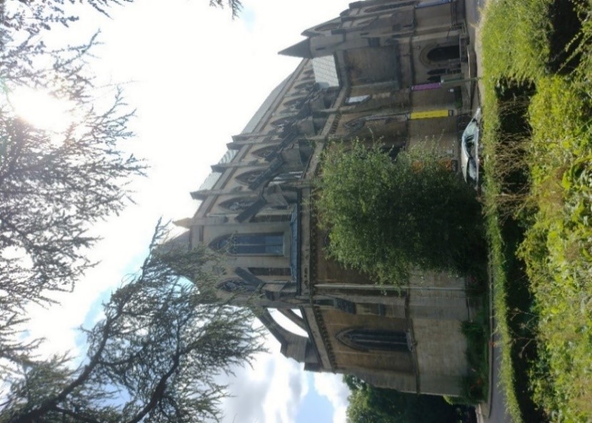
Figure 30 View of former St Alban's church
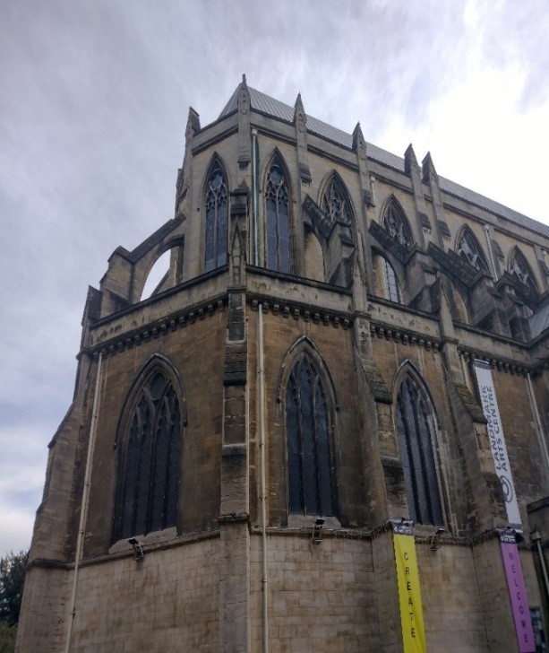
Figure 31 Detailed view of former St Alban's church
163-167 High Street – Grade II
Early 18th century group of two storey plus attic terraced cottages. These cottages are quite wide, each having four windows at first floor level and two dormers. The roof is covered with traditional clay tiles and the dormers are flat roofed with lead cheeks. Brick built with first floor band course. No 165 is known as 'Peg Woffington Cottage' with plaque bearing date 1759. Timber framed casement windows of varying designs – some with leaded lights, some with timber glazing bars, all with segmental heads to ground floor. The cottages have very shallow front gardens with boundary hedges, with the westernmost cottage having a low brick wall with railings instead.
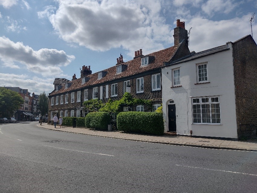
Figure 32 163-167 High Street
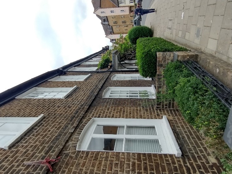
Figure 33 View of the shallow front gardens
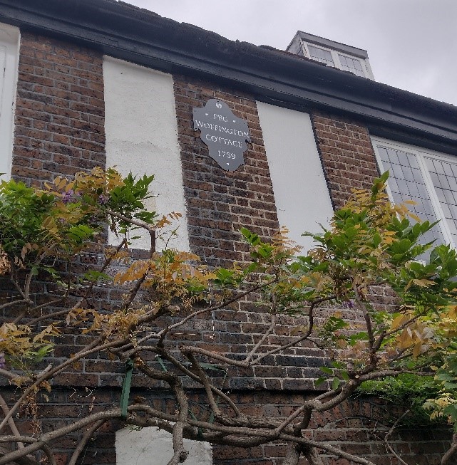
Figure 34 Peg Woffington cottage
Oak Cottage, 159 High Street – Grade II
This modest 18th century two storey, timber framed rendered cottage features a small section of weatherboarding on its gable end. Its steeply pitched roof is formed of traditional clay tiles and has a central brick chimneystack.
The first-floor timber sash windows break through the eaves slightly. The lower windows are canted bays with timber casements.
Oak Cottage lies behind a mature hedge while the adjoining 157 High Street, has an unpainted picket fence.
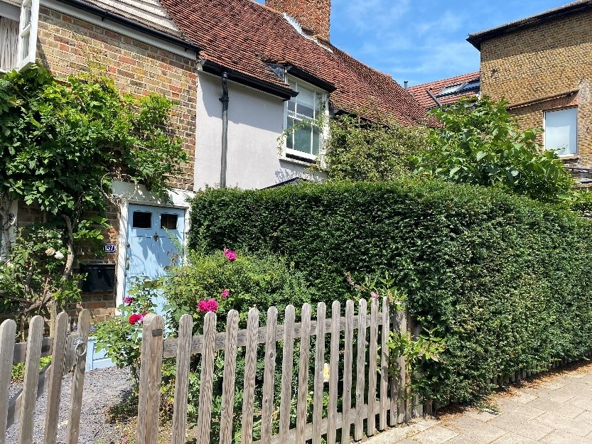
Figure 35 157-159 High Street
5.2 Ferry Road
Ferry Road, which extends from the riverside, retains its historic village character by virtue of its informal mix of building ages, uses and architectural styles. It serves as the gateway to the High Street and River Thames and provides views of the suspension bridge and lock beyond.
The eastern end of the road comprises a mix of modest two storey cottages, more substantial late Victorian four storey semi-detached houses, and the distinctive timber clad boathouse at its terminus.
3-13 Ferry Road is a group of three pairs of semi-detached four storey houses. They are built of mixed stock brick with red brick banding. Their height and formality are in contrast to the modest cottages and boat building premises elsewhere on Ferry Road.
The front doors have pointed brick arches and there are double height canted bays at ground and first floor levels. The westernmost pair (3-5) have had their original front doors and associated arches replaced by simple windows, relocating the entrances to the side. This disrupts the consistency of the group. The brick arches of the central pair (5-7) have been painted. All three pairs of houses have their boundary walls intact.
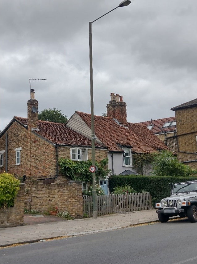
Figure 36 157-159 High Street
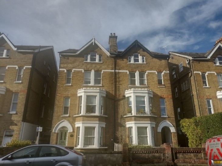
Figure 37 7-9 Ferry Road
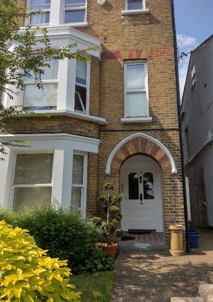
Figure 38 13 Ferry Road with unpainted brick arch intact
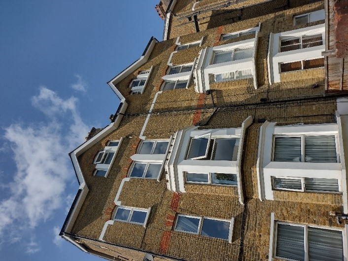
Figure 39 3-5 Ferry Road showing uPVC windows at number 3. These are poor replacements of the original sashes.
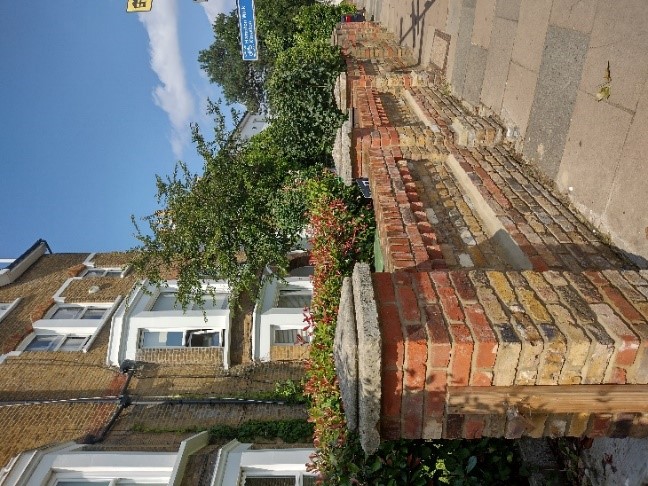
Figure 40 brick front boundary walls intact
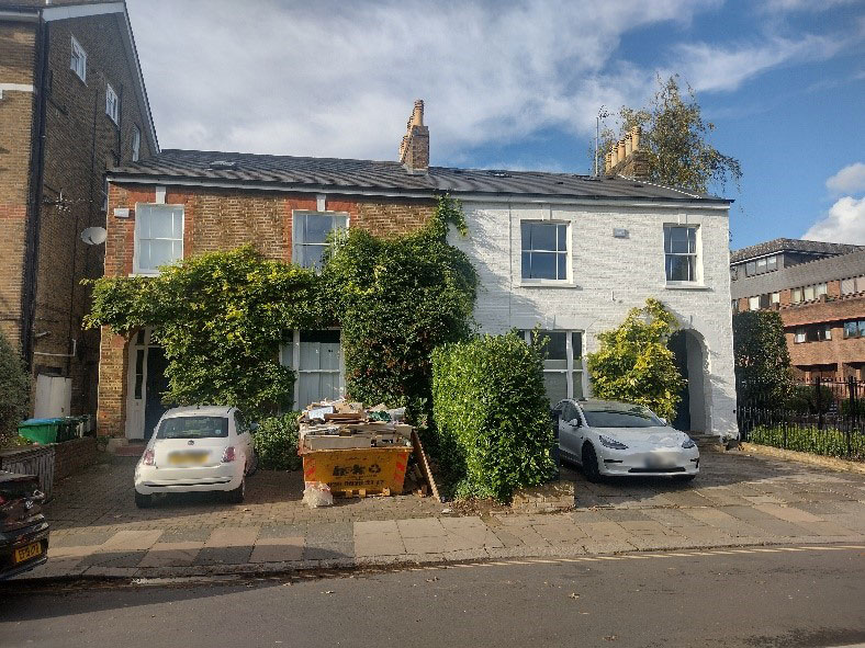
Figure 41 15-17 Ferry Road
Immediately to their right is a lower pair of two storey semi-detached houses 15-17 Ferry Road, again of stock brick with red dressings. There was originally a third house in this group but this was demolished to make way for the entrance to Quay West Court.
This pair of houses have rounded red brick arches over the porches. Both houses retain their original painted timber sash windows which sit under flat brick arches with keystones. Both houses also retain their open recessed porches. The house on the right has been painted which covers the contrasting brick detail and detracts visually in terms of the matched pair.
The front gardens of these houses along with the front boundaries have been lost to car parking. The loss of front boundaries, which create visual and spatial separation between the building and the road compromises the setting of the building and in turn its character. The loss of front gardens results in a loss of the intended green setting of a building which has a detrimental effect on the character of the building and overall street scene. The loss of gardens should also be avoided from and environmental and ecological point of view.
The Tide End Cottage, now a public house, is a modest building with painted render, timber sash windows, a plain clay tiled roof and canted bays at ground floor.
Adjoining Tide End Cottage to the east is a terrace of three modest cottages. Unfortunately, all three front doors have been replaced with the same unsympathetic modern door. They have also all been painted, covering the brickwork. The original timber sash windows, however, remain.
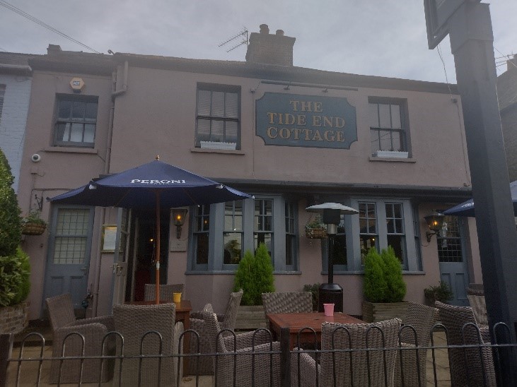
Figure 42 Tide End Cottage Public House
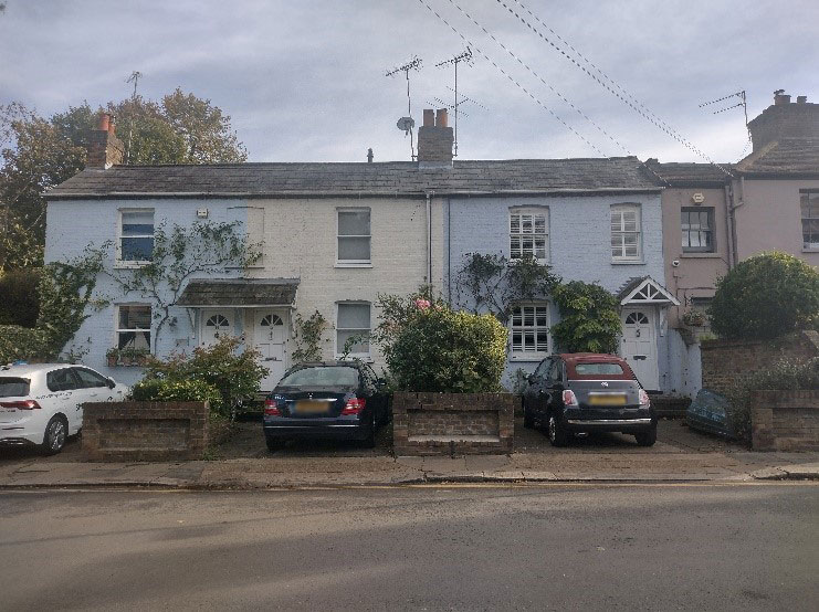
Figure 43 10-14 Ferry Road
These cottages sit opposite the gated entrance to Quay West Court, a dark brown brick four storey development. This probably dates from the late 1970s or early 1980s. The graduated arrangement of the floors facing the river is key to the unobtrusive nature of this development, particularly in terms of its effect on the river scene. It is also set back from the river edge behind garden and lawn. This helps to retain the green landscape character when seen from the river.
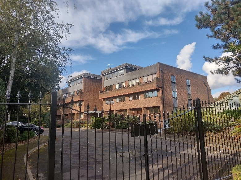
Figure 44 Quay West Court as viewed from Ferry Road
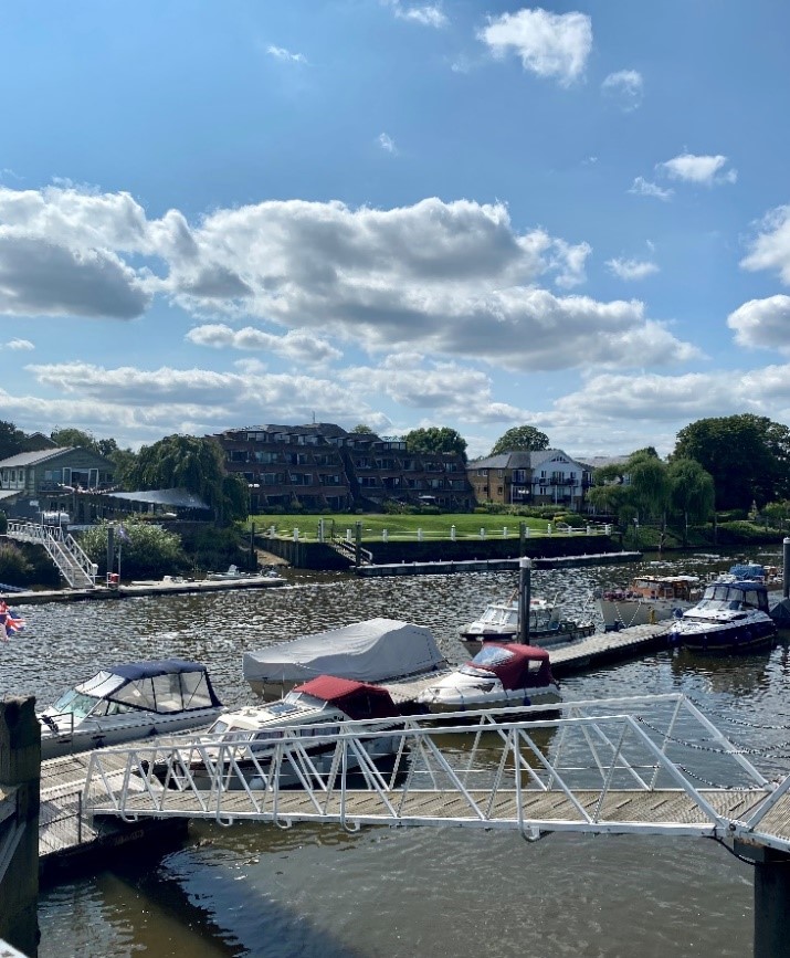
Figure 45 Quay West Court as viewed from the river. Note significant green space between it and the river edge.
5.3 Broom Road
At the entrance to Broom Road is a group of converted outbuildings facing directly onto the road; they are associated with one of the two storey houses on Ferry Road directly north. They provide visual interest by means of their multiple pitched roofs.
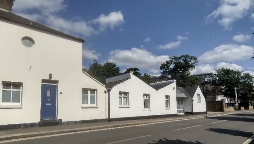
Figure 46 1A Ferry Road
The Anglers hotel and pub fronts onto Broom Road. The two-storey 18th century building has a parapeted roof, white painted render finish and timber sash windows. This building is quite simple and elegant. The rear elevation, as seen from Teddington Footbridge, is more rustic in character with red/brown brick and black sash windows of more square proportions.
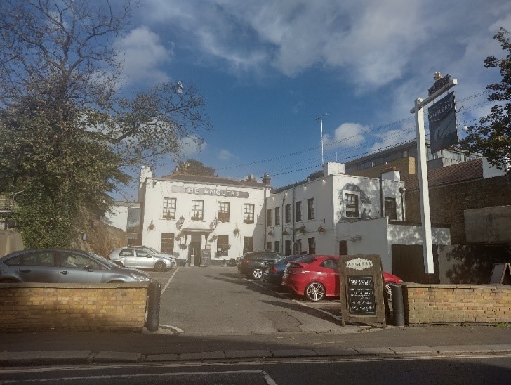
Figure 47 Anglers Hotel and Pub showing car park
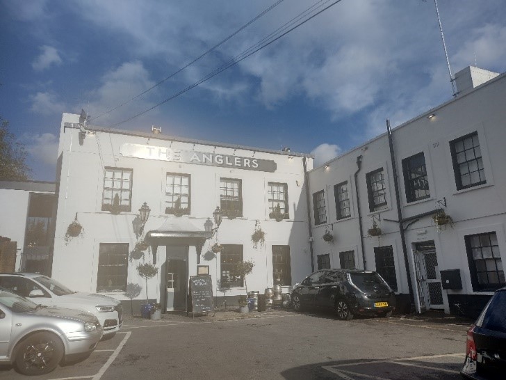
Figure 48 Anglers Hotel and Pub
2016 saw the demolition of Teddington Studios and its replacement with residential apartments. Though this is just outside the conservation area, this redevelopment does impact on the view from the river and Ham bank. The Teddington Riverside development replaced the large-scale buildings of Teddington Studios. Because of the presence of riverside trees, views are to some extent filtered and the development appears more integrated with its setting than riverside apartment blocks to the north side of the footbridge.
Numbers 4-10 Broom Road are a group of four houses characterised by their stone window dressings. All four houses have been built to a design possibly inspired by the works of C F A Voysey.
The northernmost building, number 4, is a large, detached house with its buff stone window surrounds and mullions intact.
6 Broom Road, in contrast, has been damaged by the painting of the stone window surrounds.
8-10 Broom Road is a pair of semi-detached houses, built in the same style but with dark brick window surrounds.
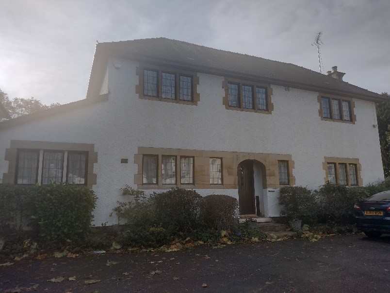
Figure 49 4 Broom Road
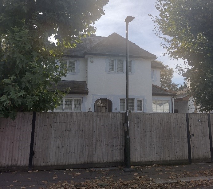
Figure 50 6 Broom Road
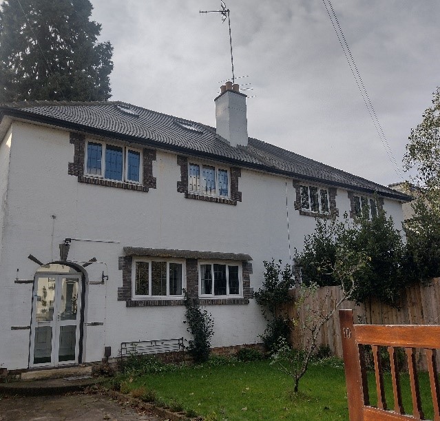
Figure 51 8-10 Broom Road
5.4 Kingston Road
At the junction between Ferry Road and Kingston Road are a series of five early 20th century detached houses (numbers 1-9).
These have a painted roughcast render finish, with hipped roofs and buff stone window dressings.
There is an original drawing of this pair from 1929. See Figure 12.
They are similar in style to those at Broom Road. Considering they back on to one another it is likely they were built at the same time.
The Kingston Road examples have a strong collective character in that there are a larger number, are consistent in detail and are in better original condition. They have generous front gardens and closed boarded fences as front boundaries.
There is an Article 4 Direction![]() (pdf, 872 KB) dating from 1996 covering these houses on Broom Road, Kingston Road and Twickenham Road.
(pdf, 872 KB) dating from 1996 covering these houses on Broom Road, Kingston Road and Twickenham Road.
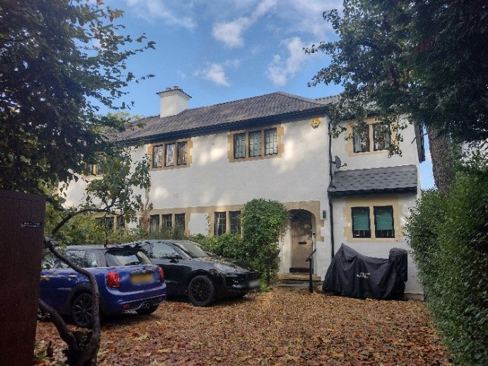
Figure 52 3 Kingston Road
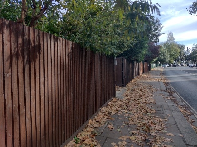
Figure 53 Boundary fencing outside 5 Kingston Road adjoining the Landmark Arts Centre
The Old Vicarage on Kingston Road, adjoining the former St Alban's church, is a large red brick two storey plus attic detached house.
It features an off-centre projecting front gable, gabled dormers and an arched porch, with Gothic detailing which may have been an intentional reflection of its use and connection with the neo-Gothic former St Alban's.
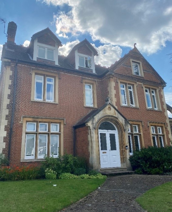
Figure 54 2 Kingston Road, The Old Vicarage
5.5 Twickenham Road
7-17 Twickenham Road is a distinctive early 20th century group of large houses consisting of two semi-detached pairs and two detached houses. An original drawing (see Figure 11) for 7 Twickenham Road shows a W M Dean as the architect.
They feature a roughcast render finish, buff stone window dressings and plain clay tiled hipped roofs. They are similar in character to contemporary groups on Broom and Kingston Roads. The northernmost pairs of semi-detached houses retain their unpainted roughcast render finish, though they are of different colours. It is unclear which is the original finish.
The houses sit behind generous front gardens with brick boundary walls and original design timber gates.
All houses in this group are in an excellent state of original repair, retaining their leaded light windows and front doors and make a positive contribution to the conservation area.
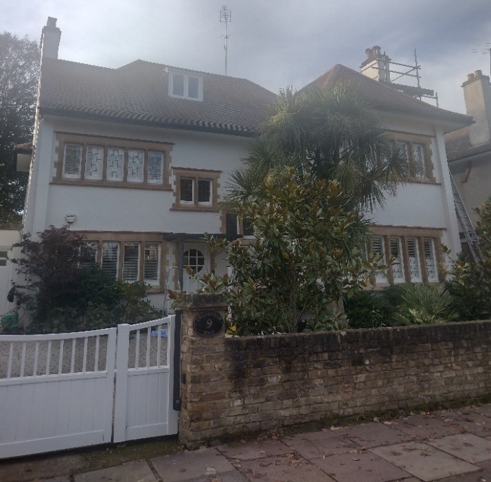
Figure 55 9 Twickenham Road
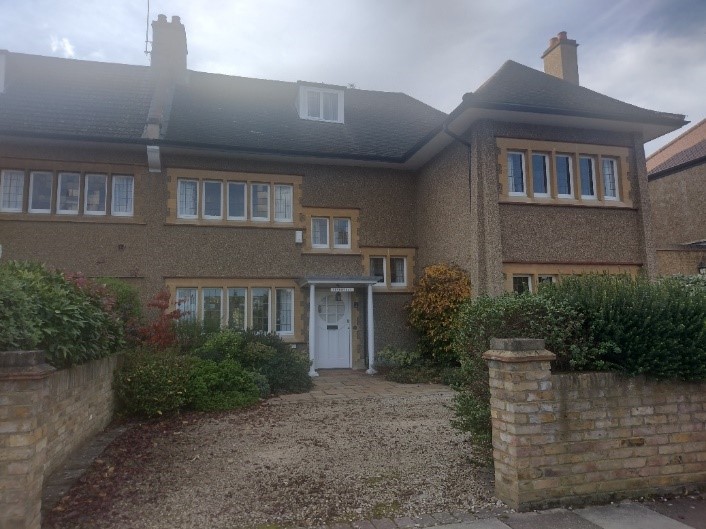
Figure 56 17 Twickenham Road
Perhaps the most distinctive group of buildings on the riverside, when viewed from the Ham bank, is the series of 1990’s apartment blocks consisting of Regatta House, Fairmile House and Admiral House, all fronting Twickenham Road and overlooking the Thames behind.
They were built on former boatyards which were distinctive features of the riverine landscape until the late 20th century.
The blocks range from 5 to 7 storeys in height and are painted a combination of terracotta and magnolia with white plain glazed windows and metal balconies.
These flats are in stark contrast with other parts of the area in terms of their size, massing and design. However they have well landscaped settings and are well set back from the road.
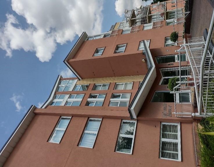
Figure 57 Fairmile House
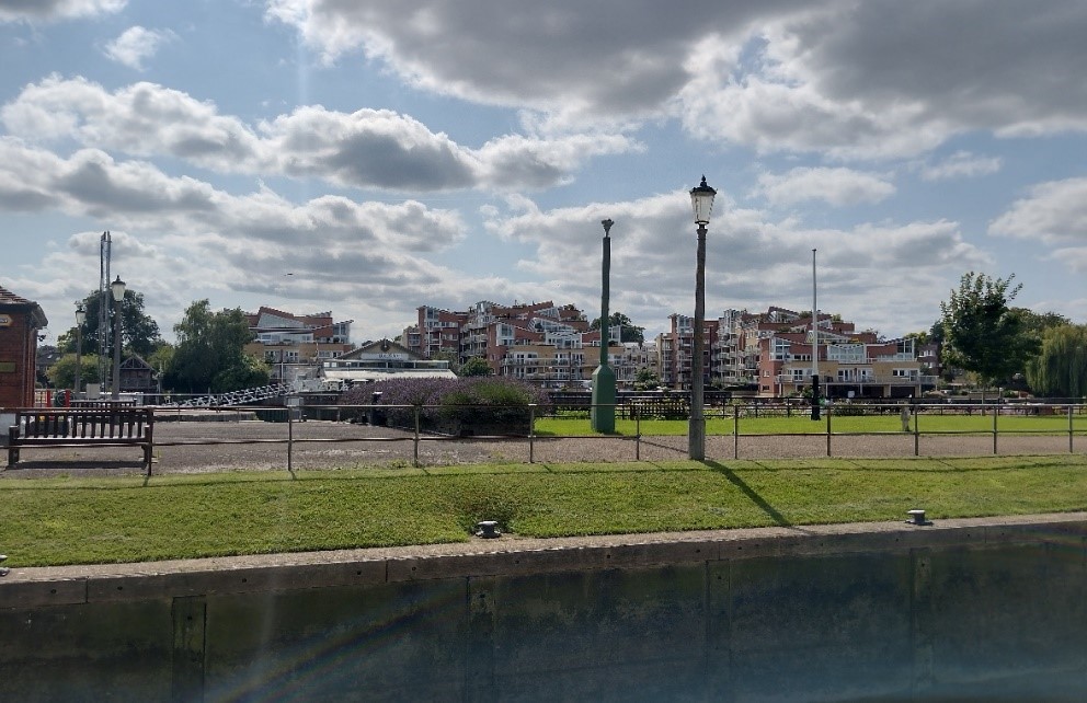
Figure 58 View of Fairmile, Regatta and Admiral House from the river
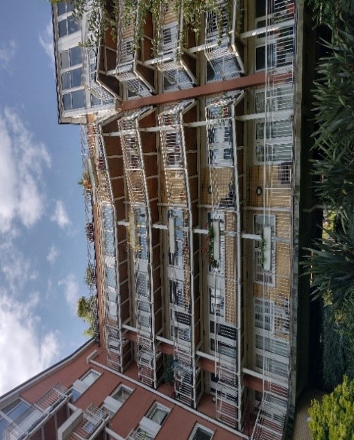
Figure 59 Balconies of Fairmile House
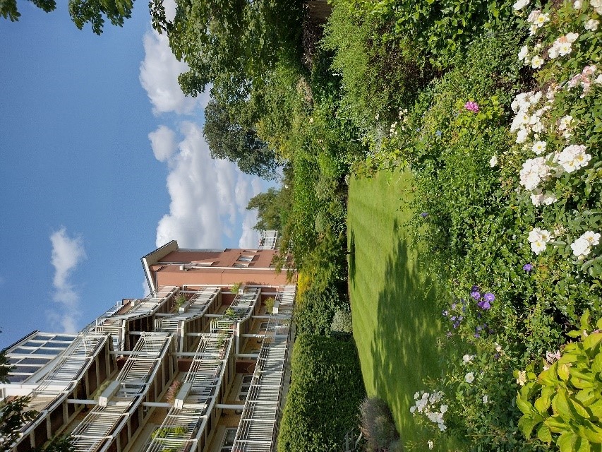
Figure 60 Well landscaped Admiral House
Opposite these, and in direct contrast, is a terrace of Victorian villas at 37-49 Twickenham Road. The houses are built over four storeys including a basement and attic level with original gabled dormers. They are built of mixed stock brick and the timber sash windows have decorative white painted window surrounds. Recessed porches lie behind painted arched doorways
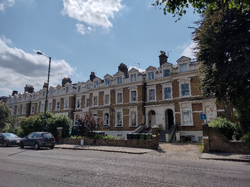
Figure 61 37-49 Twickenham Road
The Wharf building, a surviving reminder of the former boatyard, is built of stock brick with sash windows. It is currently a restaurant and can be accessed between Fairmile House and Admiral House. It is a Building of Townscape Merit. It is more visible from the river than from the road.
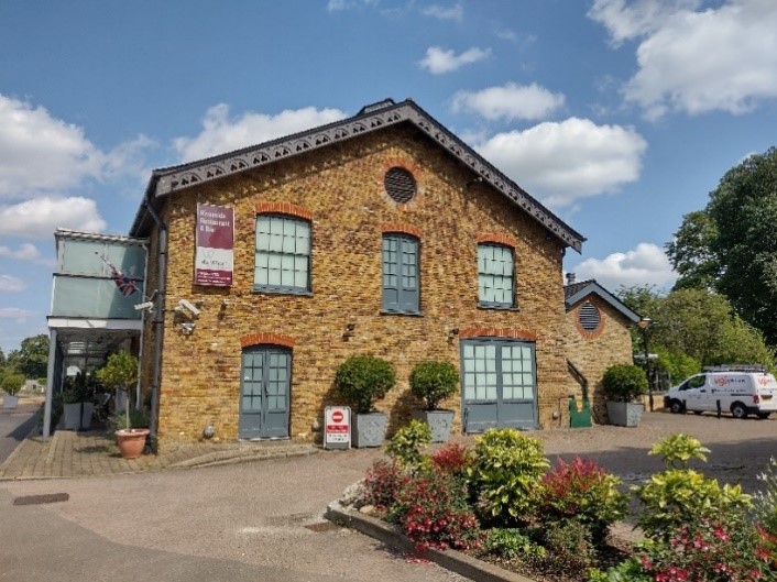
Figure 62 The Wharf
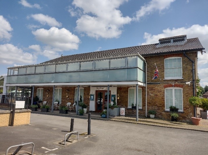
Figure 63 Northern elevation of the Wharf building showing a glazed terrace
Braemar House and 4-6 Manor Road are large modern buildings with no particular architectural merit. They do however benefit from being well set back from the road, obscured by planting and in well landscaped settings.
5.6 Eastern end of Ferry Road
St Mary with St Alban’s church and the Landmark Arts Centre form both the bridge and the divide between the character areas. Ferry Road merges into the High Street as it turns the gentle corner at Peg Woffington’s Cottage, obscuring the High Street from view as you approach from Ferry Road.
5.7 High Street
The attractive listed group of cottages, including Peg Woffington Cottage mark the gateway to the High Street.
These modest two storey cottages dating from the 18th century, along with nearby Oak Cottage, are the earliest surviving domestic buildings in the conservation area.
These cottages, along with parish church of St Mary, are evocative of the original village character of Teddington.
Further to the west, the High Street has a more urban character consisting of later Victorian and Edwardian buildings enclosing the street, which blends into the adjoining conservation area of High Street, Teddington (37).
Opposite the cottages is an old garage building which has been converted to a Sainsburys Local. Its Art Deco design adds visual interest to the High Street
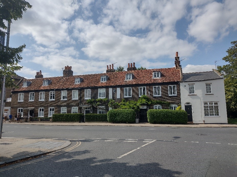
Figure 64 163-167 High Street
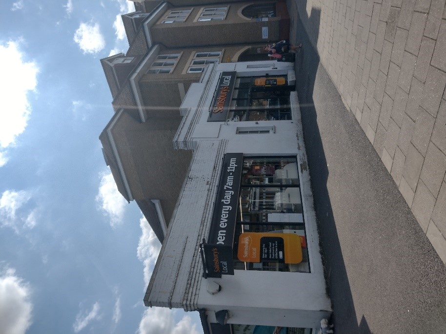
Figure 65 196 High Street, currently Sainsburys Local
180 High Street is a large early 21st century building on the south side of the High Street. Its four-storey height means it towers over the neighbouring converted garage building. Despite its size, it blends in relatively well due to its overall design and use of sympathetic materials. It is built of mixed stock brick and has sash windows and a clay tiled roof.
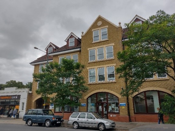
Figure 66 180 High Street
141-155 High Street is a group of four semi-detached pairs of villa style stock brick houses. They comprise four storeys including basement and attic floors. The westernmost two pairs match, with three out of four of the houses having painted brick arches; this detracts from their visual appearance. The third pair is of similar proportions but the houses have highly decorated door and window surrounds as opposed to plain brick arches.
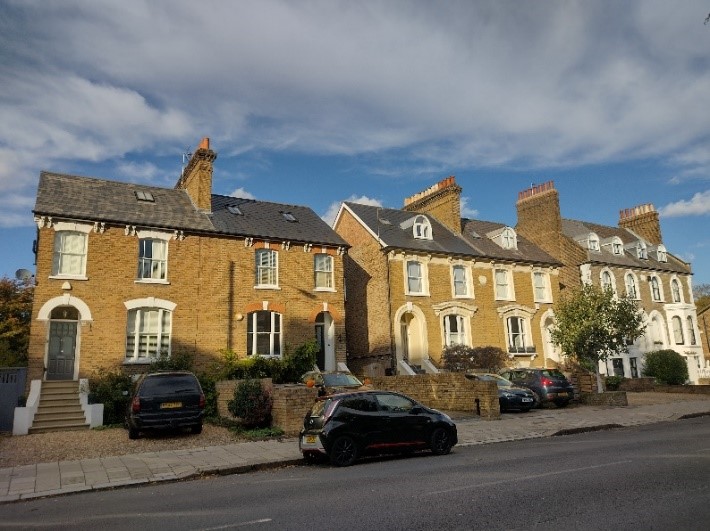
Figure 67 141-155 High Street
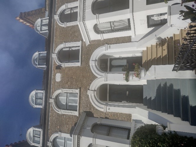
Figure 68 153-155 High Street
The final pair is similar to the third in detail in terms of its door surrounds, but with more rounded window heads and double height canted bays at ground and first floor levels. All of the villas have substantial front gardens, many of which have been lost to car parking; this detracts from their character and that of the High Street.
Guidance on the use of front gardens for car parking can be found in the Transport SPD. We will normally resist replacement of gardens with hard standings for car parking, where planning consent is required. However, in the limited cases where it would be acceptable (for example, where the removal of kerbside parking would enable the widening of a pavement, the provision of a cycle lane or relieve traffic congestion) it is very important that off street parking, should be designed to cause minimum intrusion and harm.
Opposite, there is a group of buildings incorporating shops and restaurants at ground floor level. 174-176 High Street represents a two-storey red brick building dated 1910 with a pedimented parapeted roof. This building is not in particularly good condition and some of the timber windows have been replaced unsympathetically with uPVC.
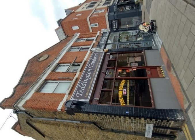
Figure 69 174-176 High Street
To the west 170-172 is a modern four storey building built of red brick with concrete banding with a restaurant at ground floor level. This is slightly out of scale with its surroundings.
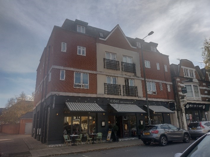
Figure 70 170-172 High Street
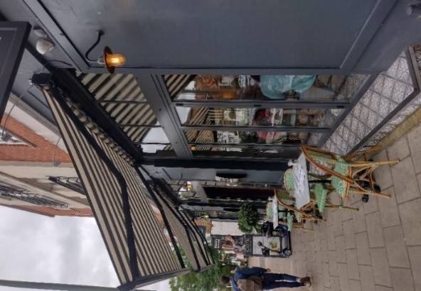
Figure 71 Ground floor elevation of 170-172 High Street
Further west 164-168 is a three-storey red brick Edwardian parade of shops featuring first floor canted bays, white painted stone banding, and rather squat Dutch gables with mansard roofs behind. Some shops in this parade retain their original timber shop fronts with decorative corbels capped with triangular pediments, decorative glazing and patterned tiled recessed entrances.
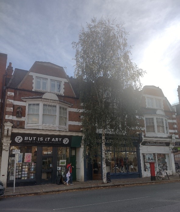
Figure 71 Ground floor elevation of 170-172 High Street
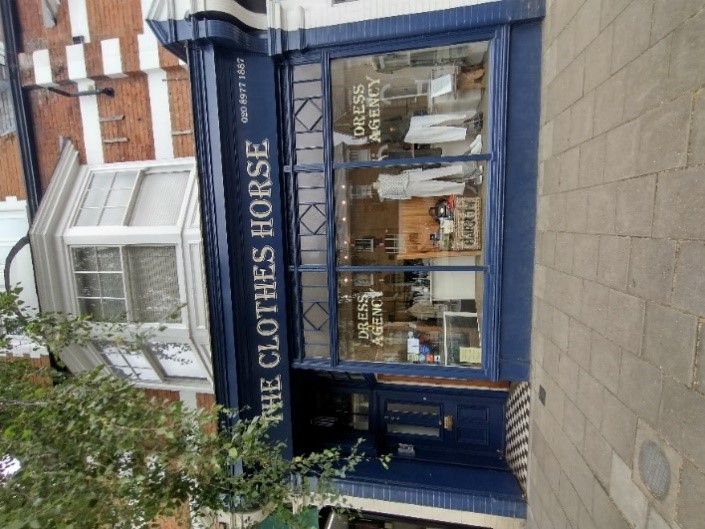
Figure 73 166 High Street
5.8 Langham Road
Langham Road extends south from the High Street and gives access to Udney Hall Gardens.
St Mary's Parish Hall is a late 19th century red brick building with buff stone window dressings and a steeply pitched roof. It was refurbished in the late 20th century and is well used by the local community.
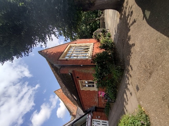
Figure 74 St Mary's Parish Hall
5.9 Riverside
The Porter and Bryce Building at the terminus of Ferry Road was used as the Royal Boathouse in the late 19th century, illustrating Teddington's status on the River Thames on the route between Hampton Court and Kew. Boat building became an established industry in Teddington and is now an important part of the area's character.
Along the riverside there is still a busy collection of boathouses, moored boats, wharfage and slipways which create a rich panorama of riverside activity and make this a centre of navigation and tourism on the Thames.
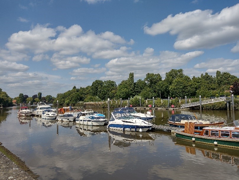
Figure 75 River scene with moored boats
However, the more recent introduction of large apartment blocks fronting the River Thames has changed some of the character from water-borne commercial activities to a denser residential living environment.
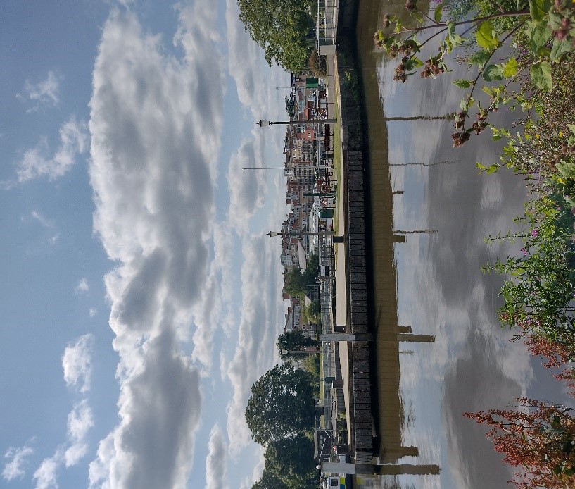
Figure 76 View of the Lock
5.10 Lock and Weir
There is a distinct contrast between the noise and action of the weir and the peaceful neatness of the well-tended lock area.
Teddington Lock, the weir and the suspension footbridge between the Teddington and Ham banks are key landmark features. The bridges provide wide views up and down stream.
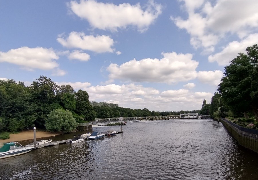
Figure 77 View of the weir
The lock itself is a robust concrete structure in the same position as the stone lock of 1858, which was built at the same time as the skiff lock.
In 2007 significant refurbishment works were undertaken, including the replacement of various walls with new concrete walls, and replacing the wooden gates with steel gates.
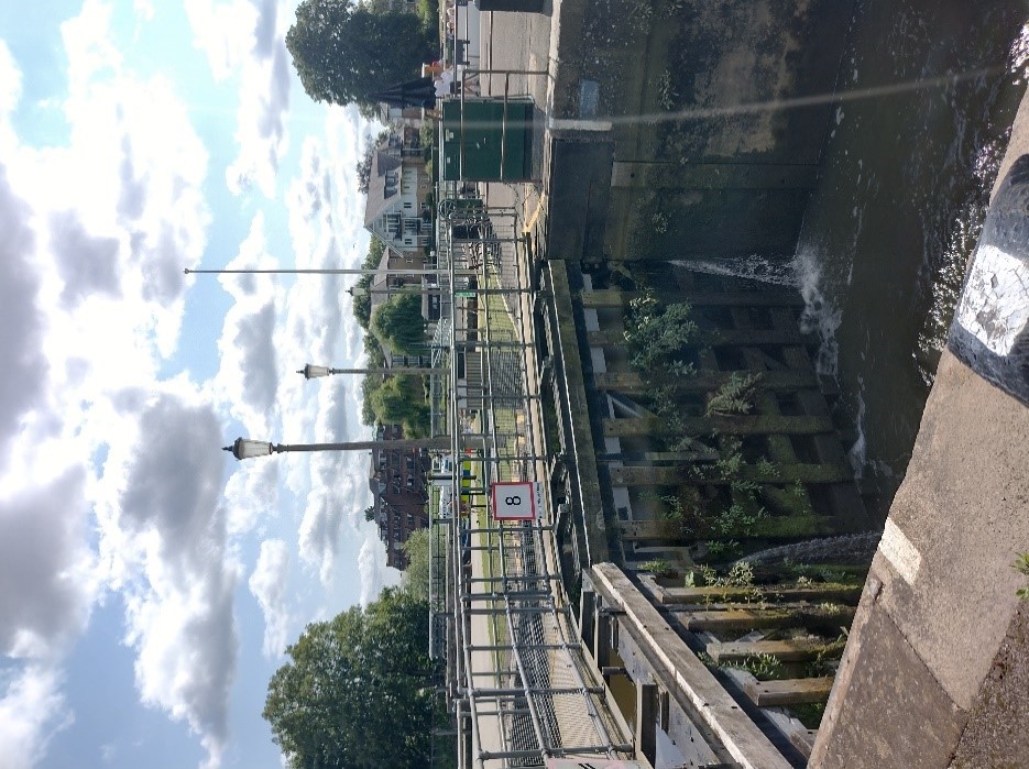
Figure 78 Detailed view of the Lock
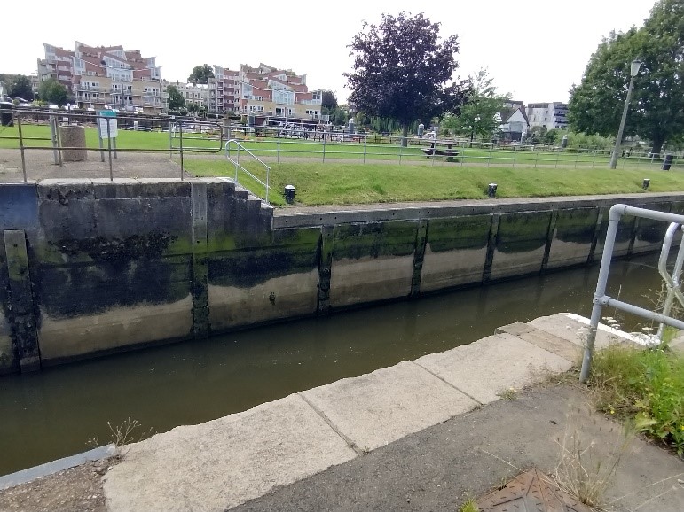
Figure 79 Concrete walls of Lock structure
The lock structure itself seems to be in good condition.
The abundance of railings and safety information signage, although essential, detracts visually from the lock scene.
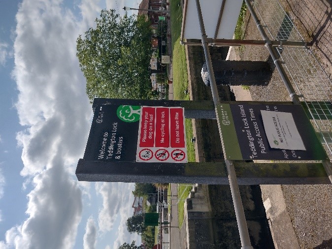
Figure 80 Health and Safety signage
The early 20th century toll house is brick built with half-timbered gables. This modest single storey building replaced an earlier toll house on the Ham bank which remains.
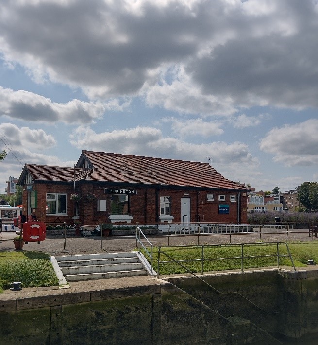
Figure 81 Toll House
The early 20th century toll house is brick built with half-timbered gables. This modest single storey building replaced an earlier toll house on the Ham bank which remains.
The river and Ham bank form a secluded, semi-rural environment framed by dense tree cover on the islands
The Thames Path, which stretches 213 miles from the Cotswolds to the Thames Barrier, follows the Ham bank and attracts visitors to Teddington from both the Kingston and Richmond directions.
5.11 Ham Bank
The Ham side of the bank has remained rural in nature, being inaccessible except on foot.
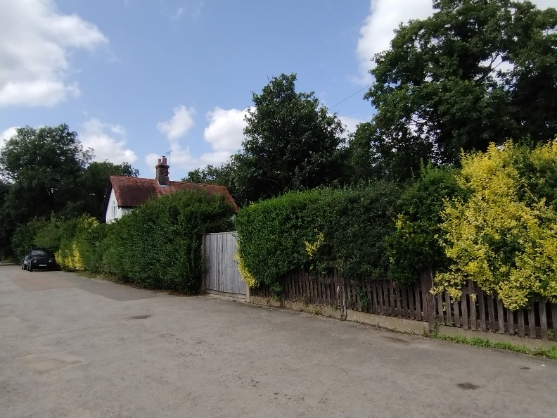
Figure 82 View of the Ham bank with the old Toll House in the background
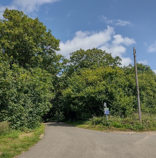
Figure 83 Path leading to Ham, through the Ham Lands Nature Reserve
In contrast to the Teddington bank, the Ham bank has a rural character providing a well treed backdrop to the lock and its neat cottages. The towpath on this bank forms part of the Thames Path and is well used by walkers and cyclists.
The19th century two storey lock house stands proudly on the Ham bank. Along with the old Toll House below they are the only visible buildings in this part of the conservation area.
It has a central projecting gable and is built of red brick and roughcast render.
It has a shallow jettied first floor with timber sprocketed detailing beneath and an impressive open timber porch,
Hidden behind the mature hedging lies the old Toll House which has similar detailing to the nearby lock house, so may be of the same age.
It features painted roughcast render walling and a plain clay tiled roof. Its original timber windows have regrettably been replaced with uPVC versions.
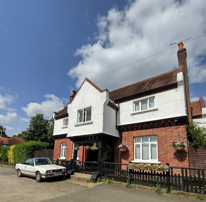
Figure 84 Lock House
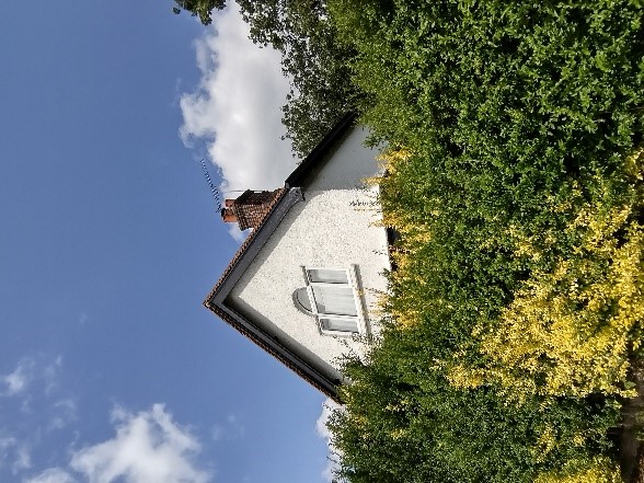
Figure 85 Obscured view of the old Toll House
6. Architectural Details
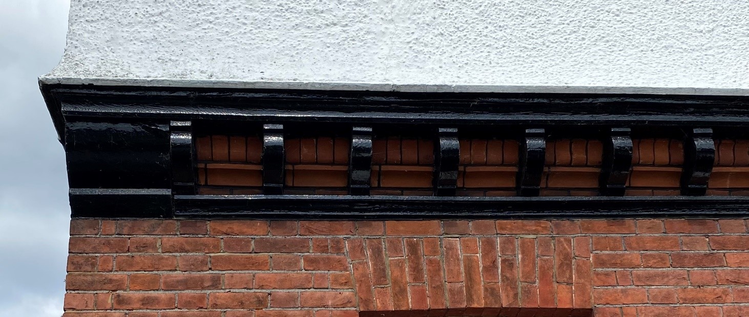
Figure 86 Sprocketed eaves of the Lock House
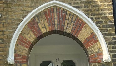
Figure 87 Brick arch at 13 Ferry Road
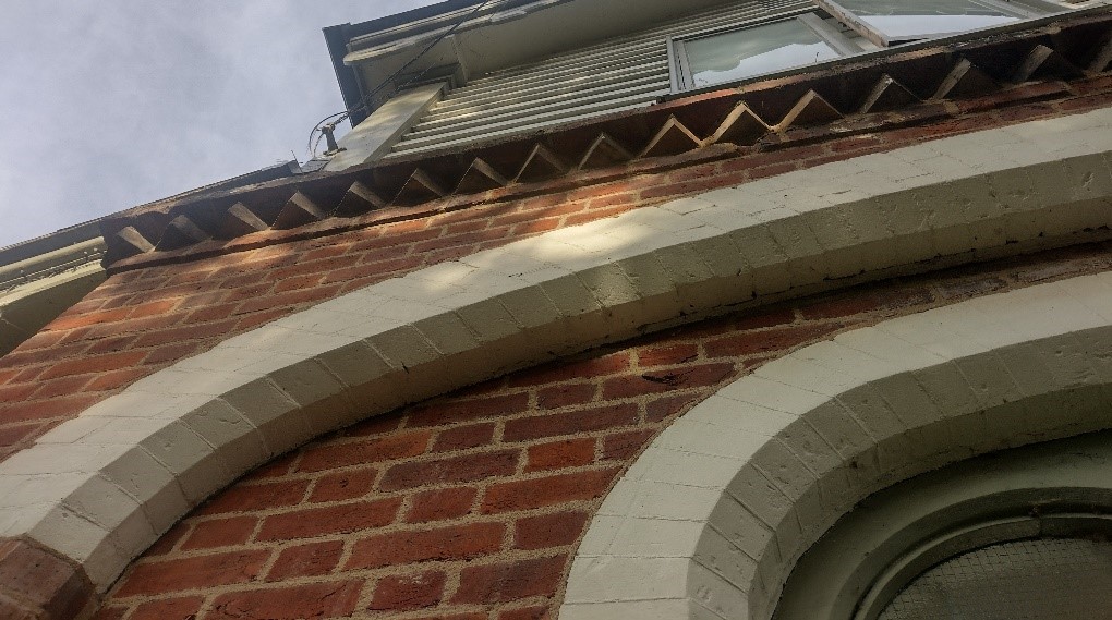
Figure 88 Cogged eaves at the boathouse on Ferry Road
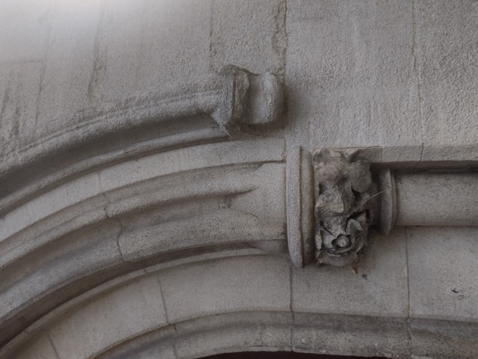
Figure 89 Stone door surround at the former St Alban's church
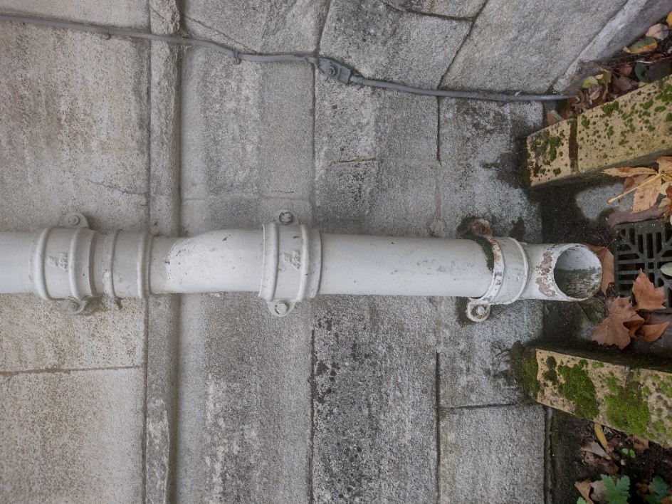
Figure 90 Cast iron downpipe at the former St Alban's Church
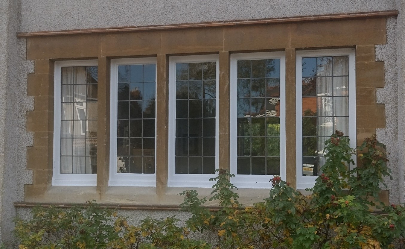
Figure 91 Leaded light windows in buff stone window surrounds at 11 Twickenham Road
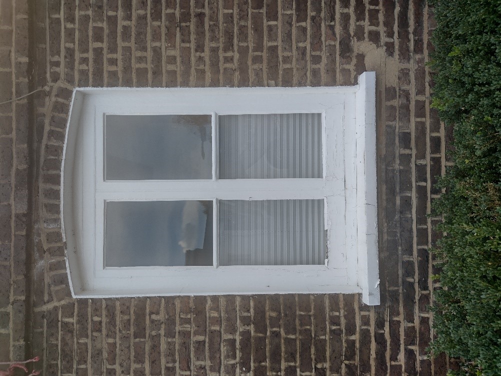
Figure 92 Timber casement window with simple rounded brick arch at 163 High Street
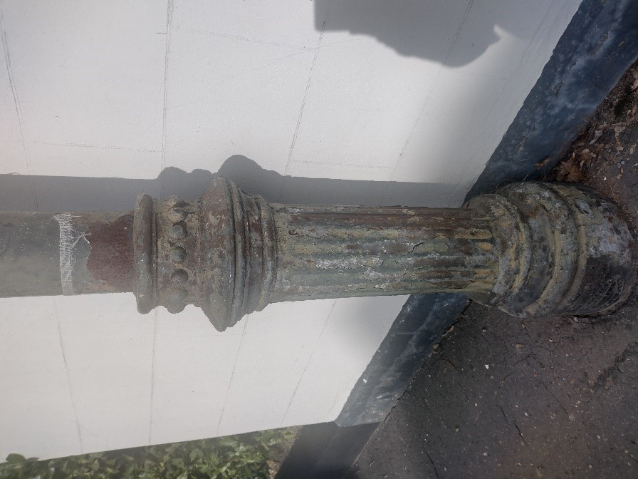
Figure 93 Streetlight column on Ferry Road
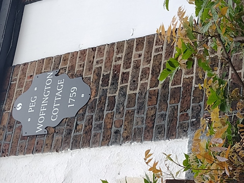
Figure 94 Peg Woffington's Cottage plaque at 167 High Street
7. Open Space, Parks, Gardens and Trees
An overview of private and public spaces; front gardens, trees, hedges, street planting, historic parks and gardens, civic spaces and their contribution to the character and experience of an area.
7.1 Udney Hall Gardens
This pleasant area of green space, immediately south of the Landmark Arts Centre and St Mary with St Alban parish hall, lies on the site previously occupied by Udney Hall, formerly Teddington Place. This was the former seat of magnate Sir Charles Dunscombe, one of the richest men of his day and Lord Mayor of London in 1709. The 18th century house was demolished in 1946.
The gardens feature large areas of lawn and several mature trees. There are benches and bins for public use. The gardens are included on the London Gardens Trust Inventory.
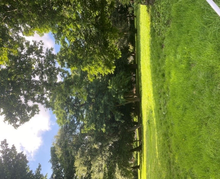
Figure 95 Mature trees in Udney Hall Gardens
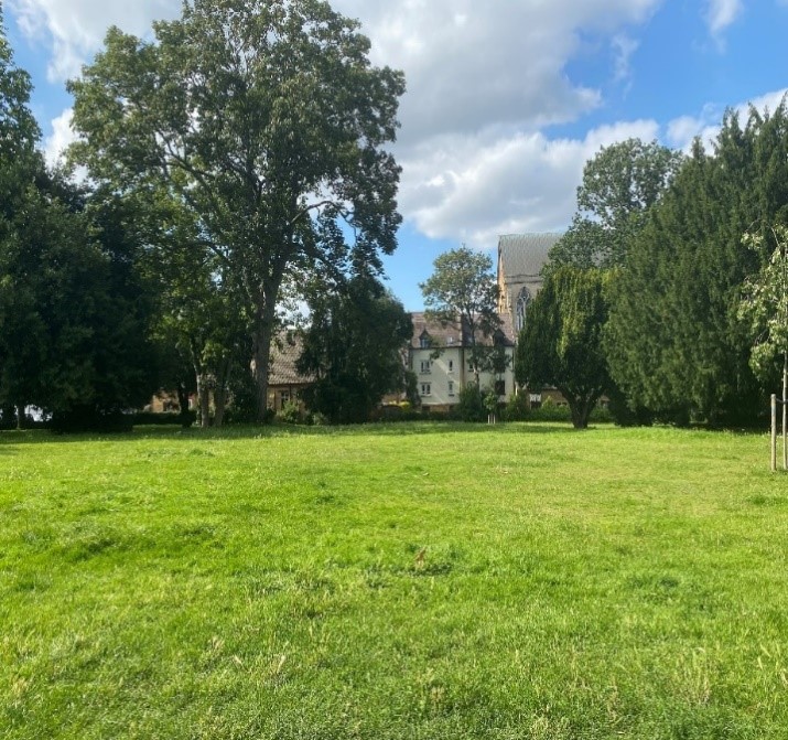
Figure 96 View of St Alban's church in Udney Hall Gardens
7.2 Manor Road Recreation Ground
Manor Road Recreation Ground is an important area of public space which provides wide views of the lock from Twickenham Road which helps to tie this area with the riverside. It is listed in the London Gardens Trust Inventory.
This quiet verdant space with wide open lawn and mature trees has a pleasant aspect, overlooking the lock. There is an old boat house to the north end of the grounds. Though this is in private ownership, it adds to the overall enjoyment of the grounds. There is also a Metropolitan Drinking Fountain and Cattle Trough Association drinking fountain. This is in the 1929 design common across many parks and schools. Sadly it is no longer functional.
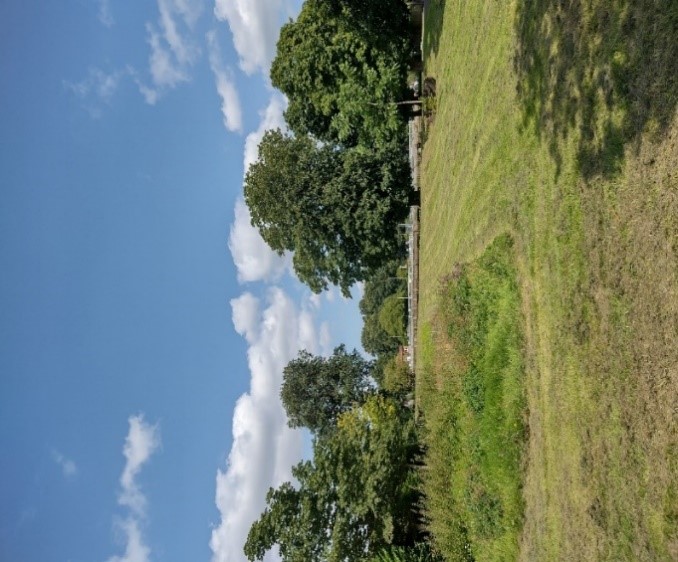
Figure 97 Expansive lawn at Manor Road Recreation Ground
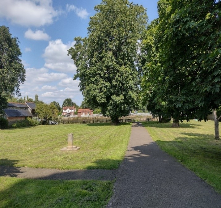
Figure 98 Tarmacadam path in Manor Road Recreation Ground
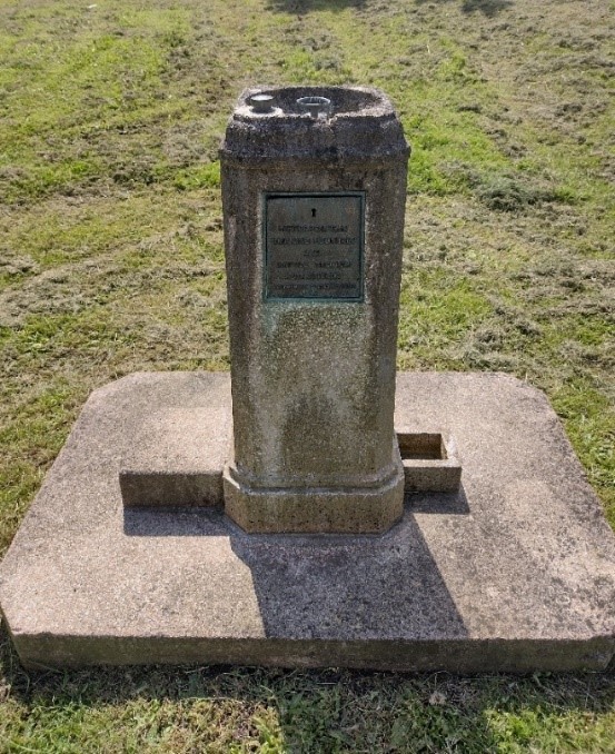
Figure 99 Drinking fountain
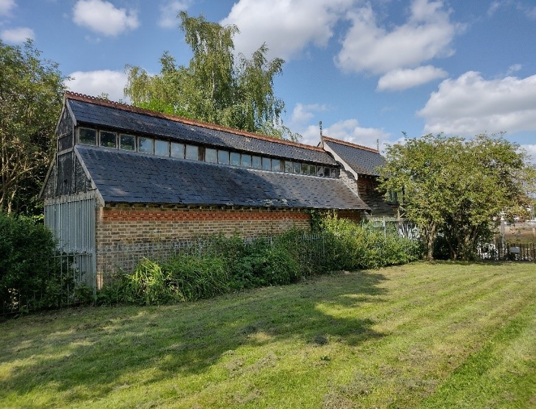
Figure 100 Old boathouse in Manor Road Recreation Ground
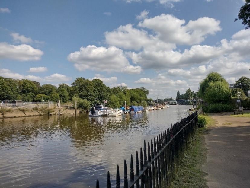
Figure 101 View of Lock with the suspension bridge in the distance
There is a small triangular section of land across from St Mary with St Alban church on the corner of Ferry Road and Twickenham Road. It has two benches and several trees of varying degrees of maturity.
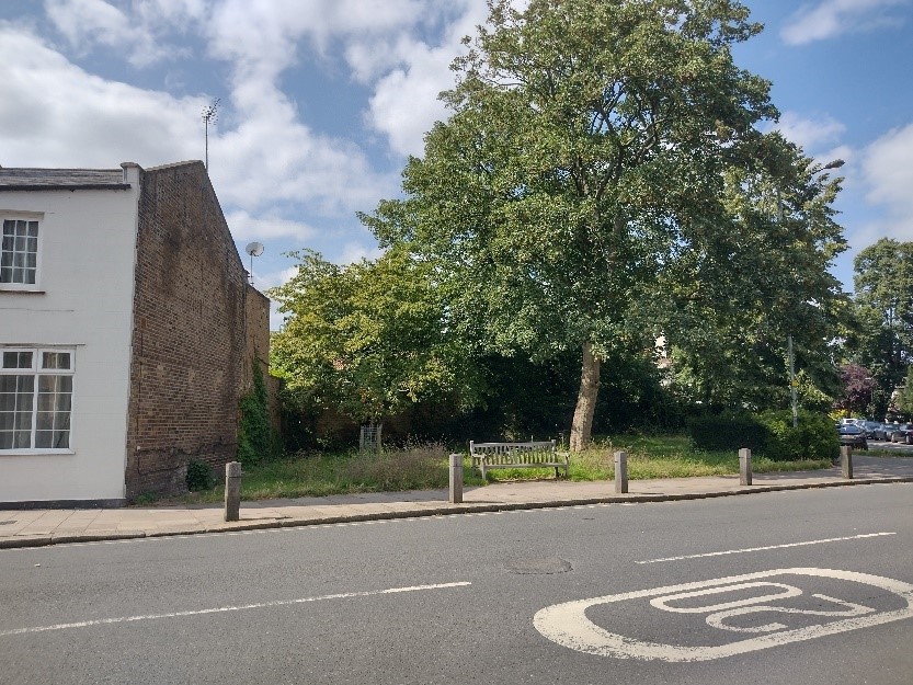
Figure 102 Section of land on corner of High Street and Twickenham Road, opposite St Mary with St Alban parish church
The former St Alban's church has ample grounds with mature trees. A large proportion of the grounds are now car parking for local residents. There is a mixture of lawn, planting and bark mulch. There are no formal benches but there are various tree stumps on which to sit.
St Mary's, in its modest plot is mostly occupied by graves and tombs of considerable age. It also boasts many mature trees and wildflowers, the trees being protected by a Tree Preservation Order. Though the churchyard is owned by the Diocese of London, as it was closed in 1884 under the Burial Act 1853, the Council is responsible for maintaining the churchyard under the Local Government Act 1972.There is a policy and plan, agreed between the Council and the church in 2019, for the maintenance and development of the churchyard, which now includes a sensory area, In order to protect and enhance habitats, the churchyard has to be actively managed.
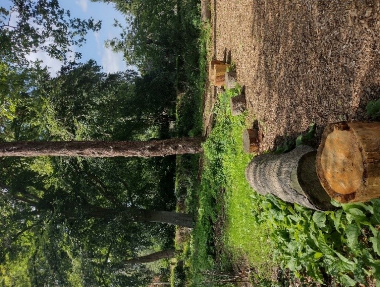
Figure 103 Grounds of former St Alban's church centre with tree stumps serving as seats
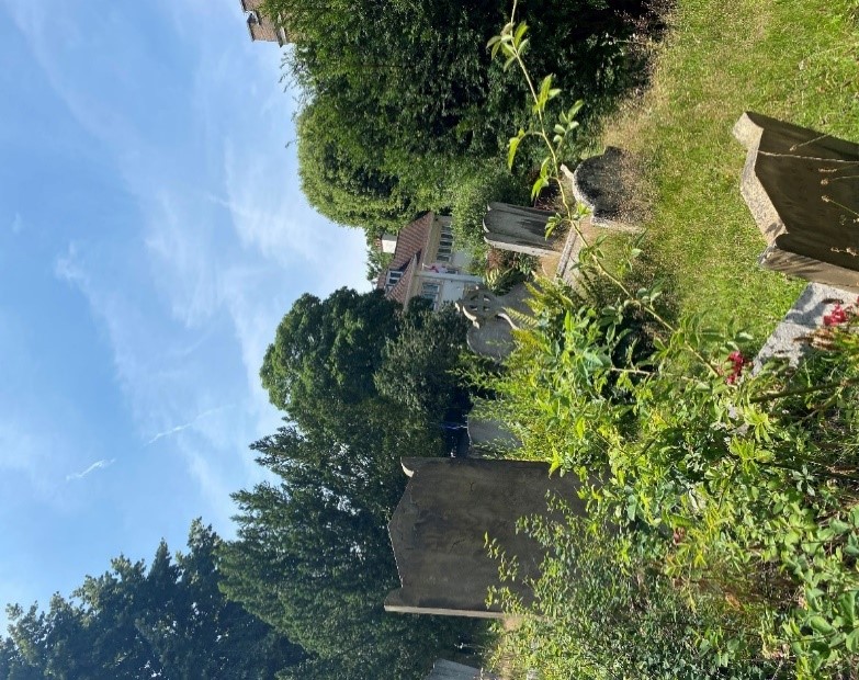
Figure 104 Graveyard of St Mary with St Alban parish church
The lock itself has a notable amount of lawn and contributes to the overall green character of the riverside.
Across the river, the Ham bank is heavily wooded, providing lush green views. Ham Lands is a 72-hectare Local Nature Reserve and Site of Metropolitan Importance for Nature Conservation with a mixture of habitats ranging from woodland, grassland to wetland. Noted for its invertebrates and interesting grassland plant diversity.
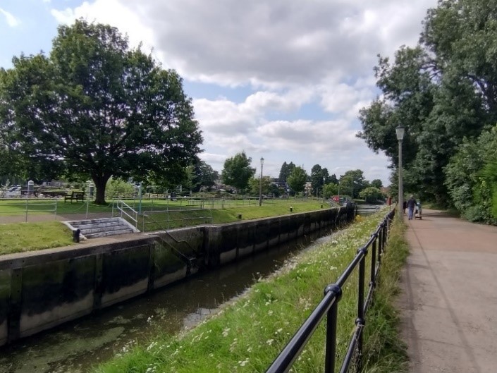
Figure 105 Grass on the Lock and banks of the Lock
7.3 Street trees
There are very few street trees in this conservation area.
There are just three on the high street, one outside St Mary’s church, one outside the boathouse on Ferry Road and several beside the suspension bridge.
There are three on Manor Road in front of Fairmile House and Regatta House.
7.4 Public realm and street furniture
Bins
There are very few bins in this conservation area. Only five were noted, all of differing designs. There is one outside Sainsburys on the High Street, one outside Udney Hall Gardens on Langham Road, one beside the bus stop on Ferry Road, one beside the bus stop on Kingston Road, and one on the corner opposite St Mary's church.
Bollards
Generally, in Teddington Lock Conservation Area there are wooden bollards with tapered tops. This distinct difference from the usual metal bollards further enforces the more rural nature of this conservation area.
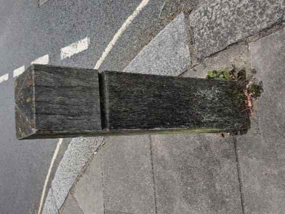
Figure 106 Example of wooden bollard
Benches
There are two wooden benches in the small area of green space across from St Mary with St Alban church. There are four benches within the churchyard. There are also several wooden benches in Udney Hall Gardens.

Figure 107 Bench across from St Mary with St Alban church
Streetlights
Generally, the streetlights in this area are not of a traditional style.
The streetlights on the High Street, Manor Road, Kingston Road and along the western end of Ferry Road are very tall and modern. They are not consistent in colour, being a mixture of green and unpainted stainless steel. They angle the light directly downwards.
There are different streetlights on the residential streets such as Ferry Road, Twickenham Road and Langham Road. These are less tall and have less of a projecting lamp but still direct the light downwards. These are not particularly attractive and look quite industrial.
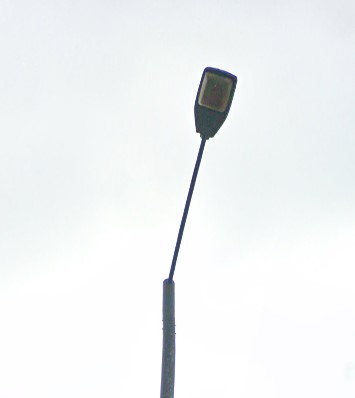
Figure 108 Streetlight on the High Street
Cycle stands
There are two on the high street, next to one another both in stainless steel. While the finish is clearly of high quality, they do not match the predominant dark green colour palette of the street furniture in the area.
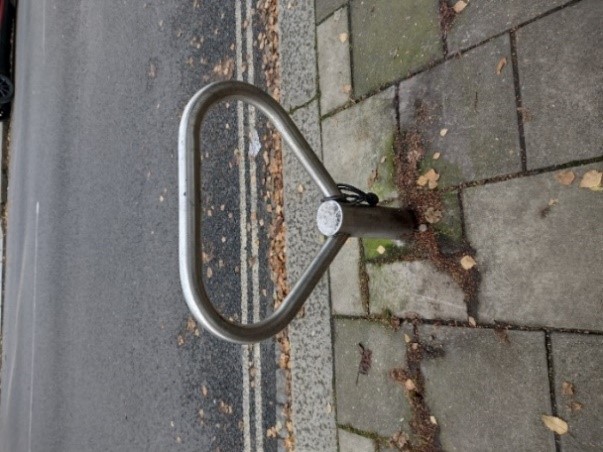
Figure 109 Cycle stand on the High Street
Post boxes
There is a George V pillar box post box on the High Street and a Victorian post box in the wall at the junction of Twickenham and Ferry Roads.
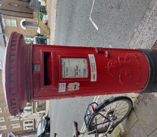
Figure 110 George V post box on the High Street
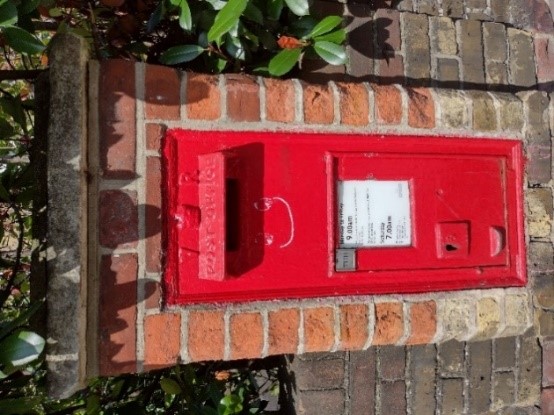
Figure 111 Victorian post box
Paving quality and material
The paving in this conservation area is not of particularly good quality and is generally paved with plain high load concrete slabs, many of which are cracked.
There are also sporadic smaller sections of tarmacadam and poured concrete.
The pavements are generally edged in granite kerbs.
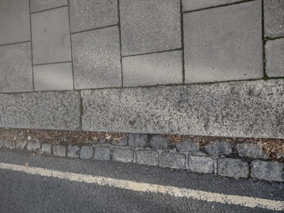
Figure 112 High load concrete slap pavement edged in granite kerbs
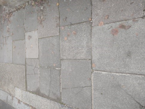
Figure 113 Example of cracked concrete slabs
8. Management Plan
This Management Plan outlines how we intend to preserve and enhance the character and appearance of the conservation area in future. We have a duty to formulate and publish these proposals under the Planning (Listed Buildings and Conservation Areas) Act 1990.
8.1 Problems and pressures
- Development pressure which may harm the balance of the river and landscape-dominated setting, and the obstruction or spoiling of views, skylines and landmarks
- Loss of traditional architectural features and materials due to unsympathetic alterations and extensions
- Loss of boundary walls and garden space in residential areas for hard standings and front lightwells.
- Lack of coordination and poor quality of street furniture and surfacing
- Use of poor-quality products in building works such as UPVC, roofing felt and GRP (Glass fibre reinforced polymers) products
8.2 Opportunities for enhancement
- Improvement and protection of river and landscape setting
- Preservation, enhancement and reinstatement of architectural quality and unity that is preferably based upon historic evidence
- Seek the reinstallation of boundary treatment and front garden planting alongside planning applications for refurbishment or development
- Coordination of colour and design and improvement in quality of street furniture
- Seek to locate lightwells to the side or rear of properties and to ensure that they are of modest proportions
- Seek to encourage good quality and proportionate design and quality materials that are sympathetic to the period and style of the building
- Preservation of visual gaps between properties
- Plant more street trees
8.3 Streetscene
- Instate better quality, traditional paving slabs and kerbs
- Retain granite kerbs and drainage channels
- Lamp posts, traffic related columns, bollards and cycle stands to be green-black finish (RAL 6012)
- All bollards, benches to remain in timber
- There are opportunities to regularise and improve parking signage
- More street trees to be planted
- Footway tree surrounds to be permeable bonded gravel
- The approach to the footbridge from Ferry Road and riverside seating area could benefit from an overall enhancement scheme including paving, seating area and street furniture improvement
- Paving and street furniture changes should accord with the guidance in the Public Space Design Guide
References
Archive photographs: Richmond Local Studies Library
Historic Maps: National Library of Scotland National Library of Scotland - Map Images
Listed building information: Historic England
