
Richmond Hill
Conservation Area Appraisal
Conservation Area no.5
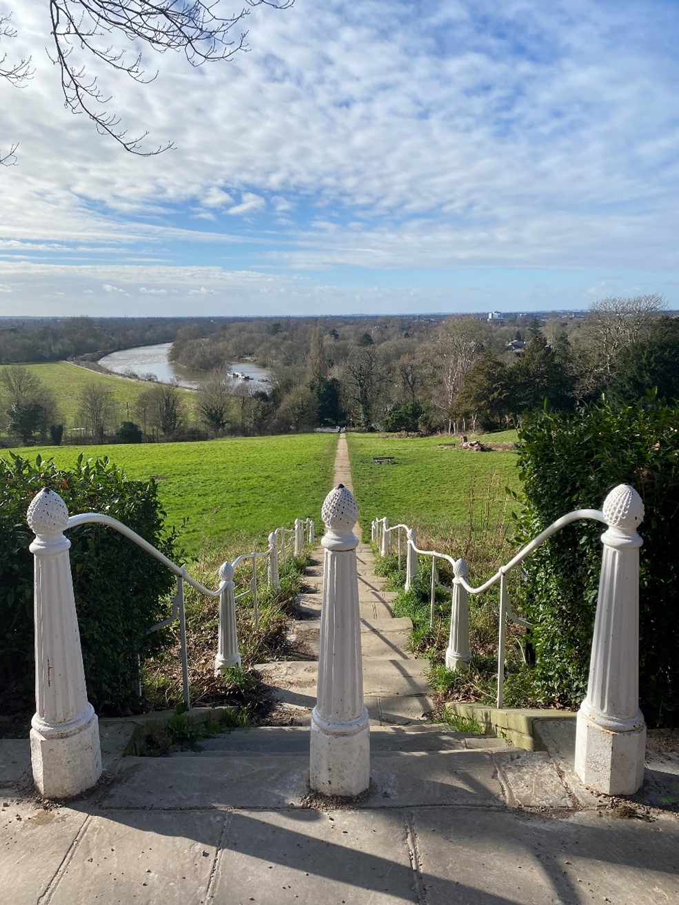
Figure 1 View from Richmond Hill
Contents
- Introduction
- Statement of Significance
- Location and Setting
- History and Development
- Architectural Quality and Built Form
- The Riverside: Richmond and Twickenham banks
- Petersham Road
- Richmond Hill: Richmond Hill, Hill Rise
- Queen's Road area: Queen's Road and adjoining streets
- Vineyard area: The Vineyard, Ormond Road, The Hermitage, Halford Road
- Architectural Details
- Open Space, Parks, Gardens and Trees
- Management Plan
- Problems and Pressures
- Opportunities for Enhancement
1. Introduction
Purpose of this document
The principal aims of conservation area appraisals are to:
- describe the historic and architectural character and appearance of the area which will assist applicants in making successful planning applications and decision makers in assessing planning applications.
- raise public interest and awareness of the special character of their area
- identify the positive features which should be conserved, as well as negative features which indicate scope for future enhancements.
This document has been produced using the guidance set out by Historic England in the 2019 publication titled Understanding Place: Conservation Area Designation, Appraisal and Management, Historic England Advice Note 1 (Second Edition).
This document will be a material consideration when assessing planning applications.
What is a Conservation Area?
The statutory definition of a conservation area is an ‘area of special architectural or historic interest, the character or appearance of which it is desirable to preserve or enhance’.
The power to designate conservation areas is given to local authorities through the Planning (Listed Buildings and Conservations Areas) Act, 1990 (Sections 69 to 78).
Once designated, proposals within a conservation area become subject to local conservation policies set out in the Council’s Local Plan and national policies of the National Planning Policy Framework (NPPF).
Our overarching duty which is set out in the Act is to preserve and/or enhance the historic or architectural character or appearance of the conservation area.
Conservation Areas SPD (pdf, 653 KB)
Buildings of Townscape Merit
Buildings of Townscape Merit (BTMs) are buildings, groups of buildings or structures of historic or architectural interest, which are locally listed due to their considerable local importance. The policy, as outlined in the Council’s Local Plan, sets out a presumption against the demolition of BTMs unless structural evidence has been submitted by the applicant, and independently verified at the cost of the applicant. Locally specific guidance on design and character is set out in the Council's Buildings of Townscape Merit Supplementary Planning Document (2015) (pdf, 895 KB), which applicants are expected to follow for any alterations and extensions to existing BTMs, or for any replacement structures.
What is an Article 4 Direction?
An Article 4 Direction is made by the local planning authority. It restricts the scope of permitted development rights either in relation to a particular area or site, or a particular type of development anywhere in the authority's area. The Council has powers under Article 4 of the Town and Country Planning (General Permitted Development) Order 2015 to remove permitted development rights.
Article 4 Directions are used to remove national permitted development rights only in certain limited situations where it is necessary to protect local amenity or the well being of an area. An Article 4 Direction does not prevent the development to which it applies, but instead requires that planning permission is first obtained from us for that development.
View further information about Article 4 Directions, to check if there are any restrictions on permitted developments rights in relation to a particular area/site or type of development apply in your area.
What is a Conservation Area Appraisal?
A conservation area appraisal aims to describe the special historic and architectural character of an area. A conservation area’s character is defined by a combination of elements such as architecture, uses, materials and detailing as well as the relationship between buildings and their settings including landscape.
Many other elements contribute to character and appearance such as the placement of buildings within their plots; views and vistas; the relationship between the street and the buildings and the presence of trees and green space.
The conservation area appraisal is an evidence base rather than a planning policy document. This means that it is the main document for recording what is of principal importance in terms of character and appearance of each conservation area.
However, the relevant policies are contained within the borough’s Local Plan. Refer to the Council’s website for the latest Local Plan.
Designation and Adoption Dates
Richmond Hill Conservation Area was designated on the 14th January 1969.
It was subsequently extended on the 16th September 1975, 5th July 1977, and 17th January 2000.
Following approval from the Environment, Sustainability, Culture and Sports Committee on the 21st June 2022, a public consultation on the draft Appraisal was carried out between the 4th July and 1st September 2022.
This Appraisal was adopted on the 30th March 2023
Map of Conservation Area
2. Statement of Significance
Richmond Hill Conservation Area is a very rich historical and architectural landscape.
The Conservation Area was originally designated in 1969 and was among the first Conservation Areas to be designated within the borough.
The originally designated section of the Conservation Area continues to make up the majority of the area, with the addition of the East Twickenham Riverside and Petersham Meadows in 1975; and the Kingsmead/ Grove Road Gardens area in 1977.
The age and quality of the architecture within this Conservation Area provide tangible links to its layers of history, adding greatly to its significance.
From cottages, almshouses, shop units to hotels, grand terraces and substantial residences this varied architectural landscape contributes to and enriches the character of the Conservation Area.
There is a high proportion of green space in this Conservation Area, with various parks and gardens interspersed between the built form. This green setting adds to the character and significance of the Conservation Area.
The view from Richmond Hill has inspired artists and writers from the 18th century to modern times including Sir Joshua Reynolds, J M W Turner, Charles Dickens and Sir Walter Scott.
The hill offers the only view in England to be protected by an Act of Parliament. The Richmond, Ham and Petersham Open Spaces Act was passed in 1902 to protect the land on and below it and thus preserve the fine views to the west and south.
To read more on the importance of this view, please refer to the Borough-wide Urban Design Study..
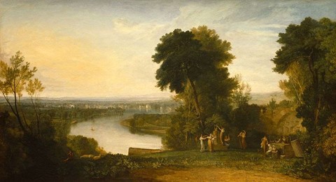
Figure 2 'Thompson's Aeolian Harp' JMW Turner, 1809
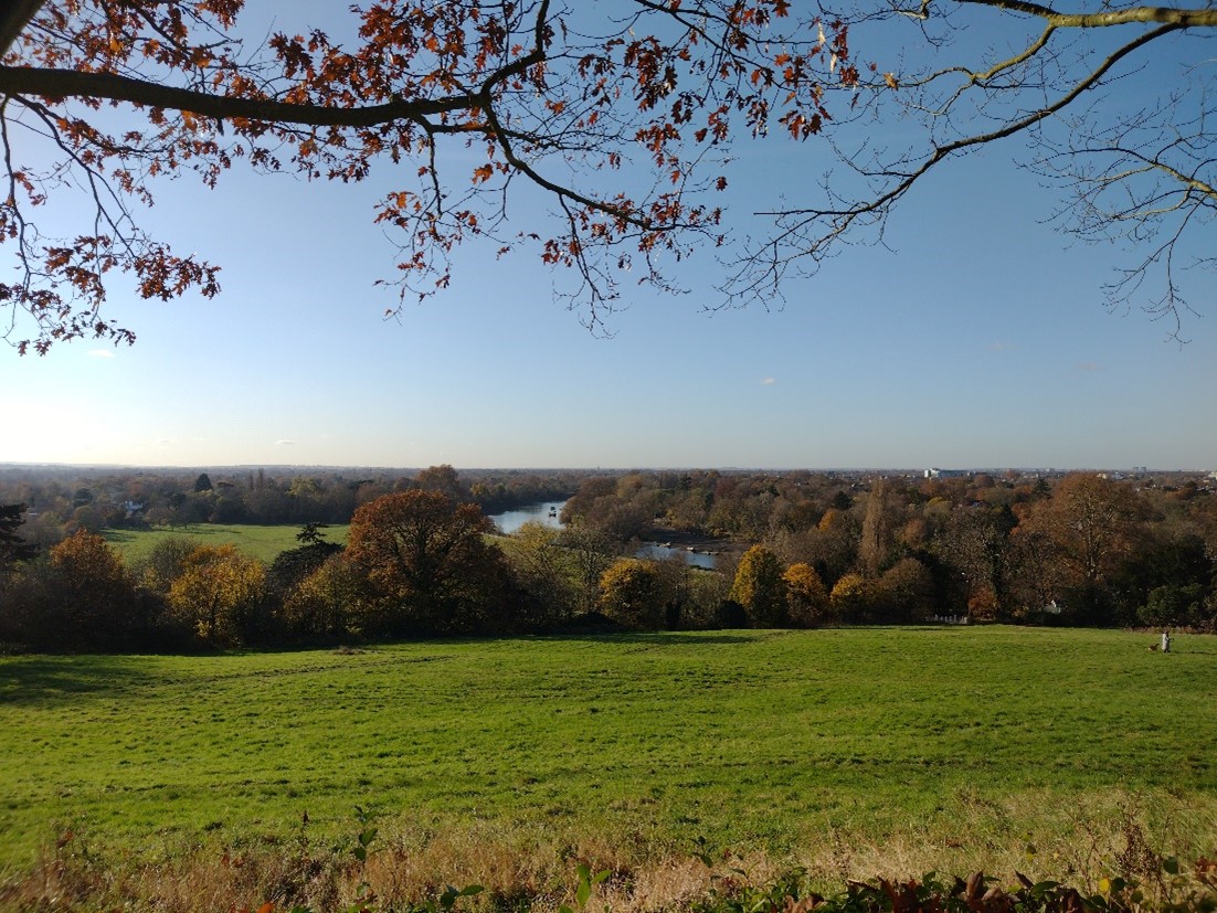
Figure 3 View of the Thames from Richmond Hill
3. Location and Setting
Situated to the south west of London, Richmond lies between two significant areas of green space: The Old Deer Park/ Kew Gardens to the north and Richmond Park and Ham lands to the south. It is north east of Twickenham, north of Ham, south east of Isleworth, south west of Chiswick and west of Putney.
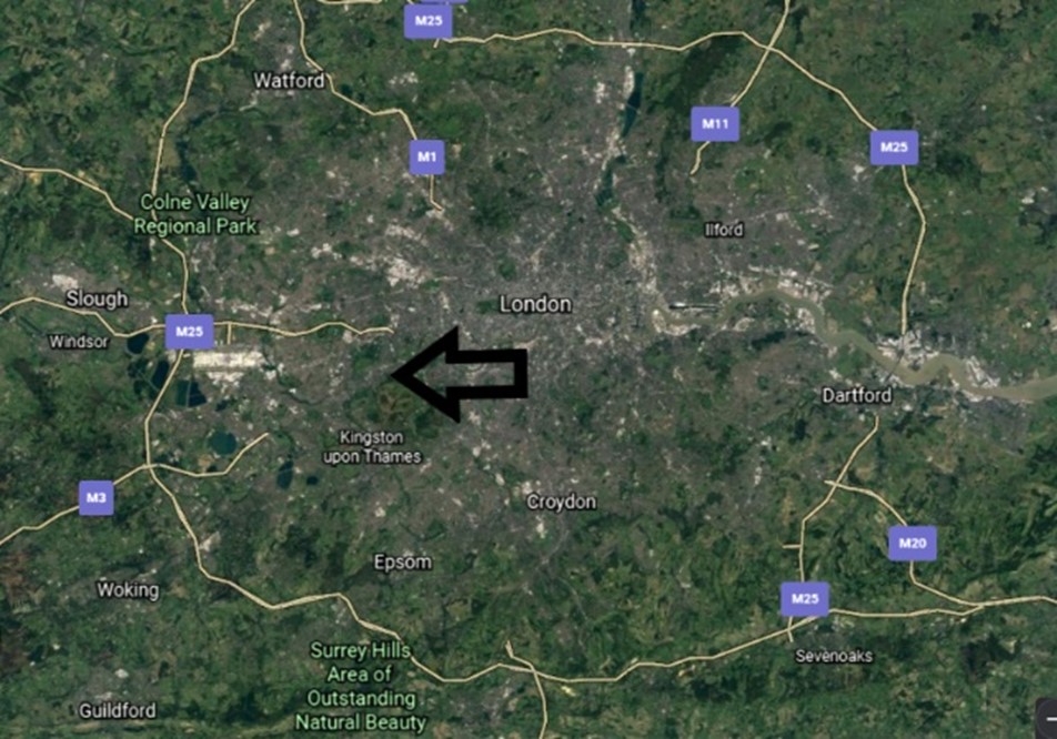
Figure 4
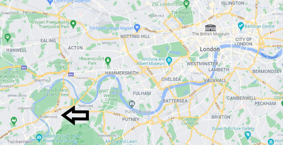
Figure 5
Richmond Hill Conservation Area is almost entirely bordered by other Conservation Areas, making up part of a rich historical and architectural landscape.
Figure 6
Conservation Area spans the River Thames, and incorporates a dramatic contrast between townscape and landscape, underscored by the ground rising steeply from the river on the Richmond side.
Development becomes denser as you move further away from the river.
Figure 7
The Conservation Area generally runs north – south along the river Thames with Hill Rise, Richmond Hill, Petersham Road and the towpath further solidifying this linear vertical emphasis. Smaller residential roads intersect these primary routes.
The Vineyard, Ormond Road, and Queens Rd being the lateral secondary routes.
Richmond Bridge and Richmond Park form strong, definite boundaries in this Conservation Area.
Topographically, the Conservation Area incorporates many significant inclines. Most visibly, Hill Rise merges into Richmond Hill along a noticeable incline which continues to the entrance to Richmond Park. Petersham Road falls away from Hill Rise and continues to do so until it meets Buccleuch Gardens. With this difference in levels, there are naturally various sloped roads and gardens which form connections between the two areas such as Nightingale Lane and Terrace Gardens. It is also the highest point within the borough, along with Richmond Park. This provides a vantage point for long distance views and vistas.
The Conservation Area is a predominantly residential area but has a number of high-quality shopfronts, particularly along Hill Rise and Richmond Hill. The presence of these shopfronts provides welcome variety in the streetscene and the consistency of commercial uses is key in ensuring the vitality of the high streets.
4. Historical Development
Evidence has been found of Stone and Bronze Age settlements towards the top of Richmond Hill. The area was part of the Royal Manor in the Domesday Survey, and had a royal presence from as early as 1125.
The 'Vineyard’ street name refers to the vineyards outside the medieval settlement, with the development pattern relating-to the early field patterns.
Previously known as Sheen, Richmond has had a long connection with royalty. Sheen Palace was established By Edward I in the 14th century on the site of a former manor house. This remained in use until the turn of the 16th century when it was rebuilt by Henry VII and renamed Richmond Palace. This followed the general renaming of Sheen to Richmond as Henry VII was the Earl of Richmond in Yorkshire. It was used by Henry VIII, Cardinal Wolsey, Ann of Cleves and was a particular favourite of Elizabeth I who died there in 1603. The palace was largely demolished following the execution of Charles I in 1649. Some structural elements remain both above and below ground level.
Around 1635 Charles I enclosed Richmond Park, including most of Petersham Common; the park was encircled with a high brick wall, similar to other royal parks in the area. Various peripheral developments followed this, including the construction of the first almshouses, such as the original buildings of Bishop Duppa's and Michel's Almshouses. Almshouses funded and named after wealthy benefactors became a feature of Richmond.
At the beginning of the 18th century, a medicinal spa was discovered, leading to the establishment of the Richmond Wells spa. As a result, Richmond saw significant development during this period. This was strengthened by a demand for an escape from London, possibly accelerated by the plague of the 1660s. it also became very fashionable due to its association with royalty and aristocracy. The picturesque nature of the area attracted numerous writers and artists.
The beginning of the 18th century also saw Terrace Walk at the top of Richmond Hill being laid out with an avenue of trees. Richmond Hill became increasingly popular in the second half of the 18th century and a number of important houses were built in this period, including Doughty House, Ancaster House, The Wick and Wick House, with similar development along the river. All took advantage of the spectacular river views. By the 1760s, the Wells spa had been closed but this did not diminish the popularity of the area. Richmond Bridge was completed in 1777, which allowed easy access across the river to Twickenham and beyond.
A number of individual houses remain from the 18th century, as well as terraces in Ormond Road and Church Terrace, and some buildings which now include commercial premises at the foot of Hill Rise and the start of Petersham Road.
Twickenham and Richmond were a hive of artistic activity in the late 18th and early 19th centuries. In particular, Wick House on Richmond Hill was built for Sir Joshua Reynolds in 1772.
The start of the 19th century saw significant infill development. Gaps were gradually filled between existing buildings. Several places of worship were built, including the Church of St. Elizabeth and the Congregational Church in The Vineyard. With the arrival of the railway in 1846, there was increased demand for housing and streets such as The Hermitage and Halford Road were developed. With a growing population, shops began to be established on Hill Rise, with the ground floor of some existing houses being converted to commercial premises.
The Star and Garter Hotel grew in popularity, welcoming guests such as Charles Dickens and Louis-Philippe of France and was visited by Queen Victoria and Prince Albert in 1850. In 1887 part of the grounds of Buccleuch House and Lansdowne House were opened to the public as Terrace Gardens; Terrace Field was also made accessible around this time. Lansdowne House, which once sat in the middle of what is now Terrace Gardens, was demolished in the late1800s, and Buccleuch House in the 1930s, leaving only the outbuilding which is now called Langholm Lodge remaining.
Richmond Theological College / Richmond College trained missionaries and ministers between 1843 and 1972.
The Petersham Hotel opened in 1865 and remains in use as a hotel. The Italian gothic building with its contrasting brick banding and tower is an impressive and imposing structure in its setting. It is most visible from the Twickenham bank but its roofscape is visible from Richmond Hill.
In 1902 the Richmond, Petersham and Ham Open Spaces Act of Parliament safeguarded the famous view from Richmond Hill following proposals for development on the Twickenham bank.
Throughout the 20th century several larger houses were replaced with blocks of flats, such as the large-scale development at Richmond Hill Court in the 1930s, which incorporated tennis courts and its own garage and replaced Hill Side House, and the 1980s Richmond Place which replaced Cambourne House.
Several houses, including Gothic House, were demolished along Petersham Road, some for intended road widening. However, a number of houses have survived as hotels, such as the Richmond Hill, Richmond Gate (Harbour Hotel), Hobart Hall and Bingham Hotels and The Old Vicarage as a school.
The late 20th century saw change to the townscape, including to the confluence of Hill Rise and Petersham Road and the development of the former workhouse land into Queens Road Estate.
The 21st century has seen further development in the form of flats and office blocks, particularly on Petersham Road.
2014 saw the Star and Garter change use once again, this time being turned into apartments.
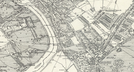
Figure 8 1860s
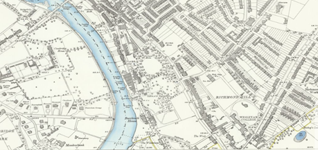
Figure 9 1890s
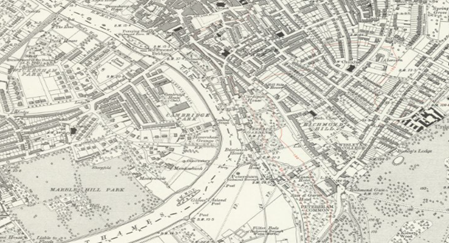
Figure 10 1910s
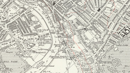
Figure 11 1930s
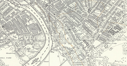
Figure 12 1950s
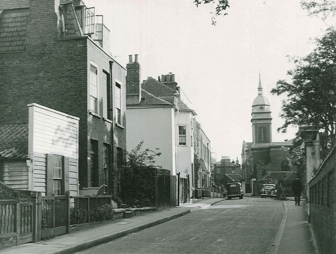
Figure 13 View of St Elizabeth's from the Vineyard, 1952
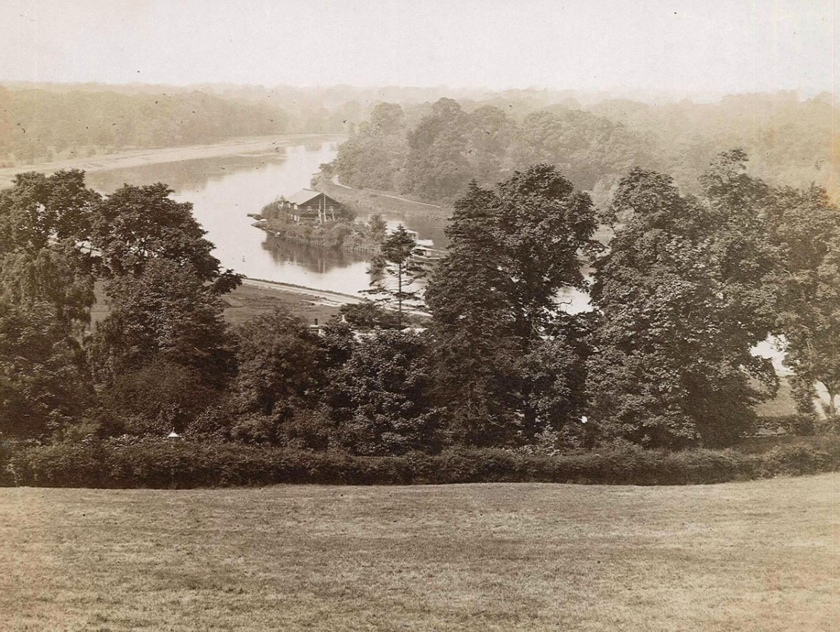
Figure 14 View of Richmond Hill 1884
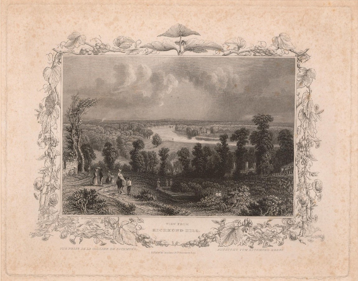
Figure 15 Drawing of view from Richmond Hill 1845
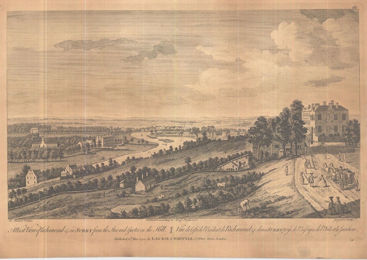
Figure 16 View of Thames from Star and Garter Hill, 1752
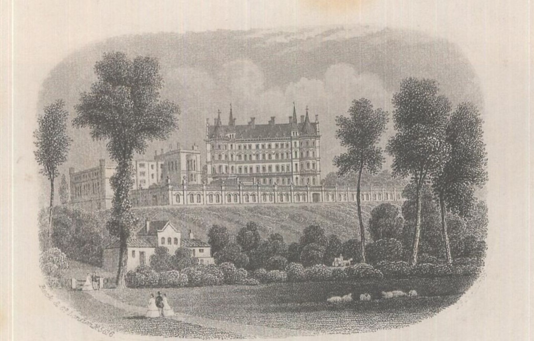
Figure 17 Star & Garter Hotel 1866
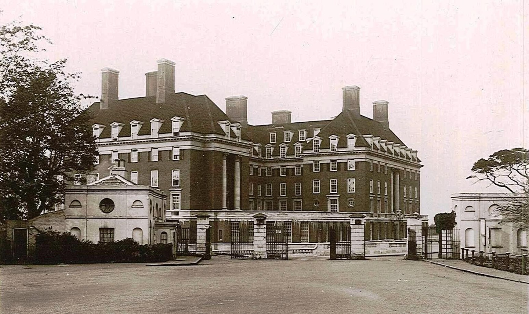
Figure 18 Star & Garter Home, c1950
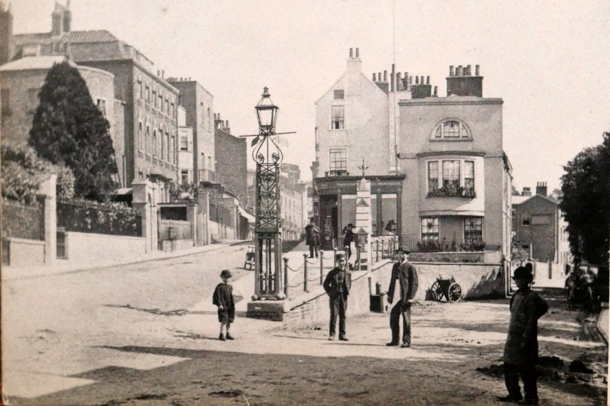
Figure 19 Junction of Hill Rise and Petersham Road c1870
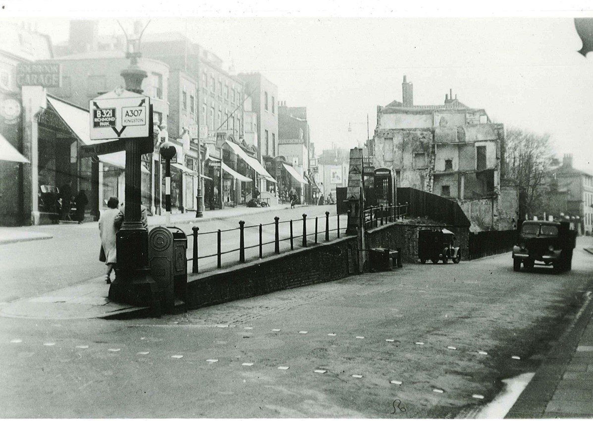
Figure 20 Junction of Hill Rise and Petersham Road 1939. Note the dilapidated state of the buildings in the centre and the presence of shops to the left where front gardens exist in the photo above
5. Architectural Quality and Built Form
The Conservation Area is comparatively large and includes a number of distinct character areas. The study has been divided into five character areas in order to reflect this, although this does not imply that each area below is of uniform character. The whole Conservation Area is unified by its relationship to Richmond Hill.
- The Riverside: Richmond and Twickenham banks
- Petersham Road
- Richmond Hill: Richmond Hill, Hill Rise
- Queen's Road area: Queen's Road and adjoining streets
- Vineyard area: urban streets and spaces around The Vineyard
The character of the Conservation Area varies significantly across these areas but together they form a unified whole. From Hill Rise with its bustling commercial scene to the serenity of the riverside and its surrounding gardens, this variety enriches the overall character of the Conservation Area.
Predominant building materials are mixed stock bricks mainly sourced from local quarries, slate roofs, and use of red brick on the Twickenham side.
This study cannot realistically cover every aspect of quality, and therefore the omission of any particular building, feature or space should not be taken to indicate that this is not of interest.
5.1 Character area 1 - Riverside
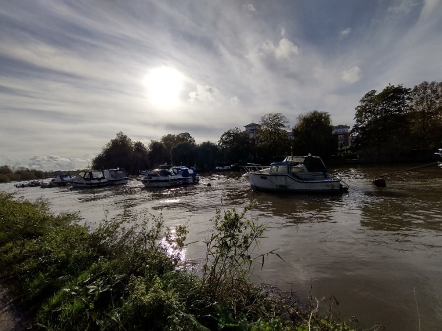
Figure 21 View of the Thames from the Richmond bank
The riverside covers a diverse area between Richmond Bridge and Marble Hill Park, with impressive views opening up along this renowned bend in the river.
There are both panoramas and vistas, ranging from the open views into the conservation area to Petersham Meadows, to fascinating limited vistas to individual buildings in Richmond, for example to Richmond Bridge from Buccleuch Gardens and to the Church of St. Elizabeth from the Twickenham embankment.
The views to and from the top of Richmond Hill are protected by the Richmond, Petersham and Ham Open Spaces Act.
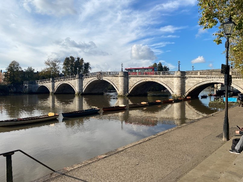
Figure 22 View of Richmond Bridge from the Richmond bank
The overall character, in contrast to the urban nature of the Richmond Riverside development to the north of Richmond Bridge, is one of buildings set in and subservient to a green and treed landscape and connected to the dramatic landform of Richmond Hill.
Figure 23 View of the Richmond bank from the Twickenham bank
Richmond bank
The river walk on the Richmond side is characterised by a number of green open spaces linked by the towpath, between Buccleuch Gardens and Bridge House Gardens adjacent to Richmond Bridge. These were mostly formed from former residential sites.
Figure 24 View of the Thames towards Marble Hill from the Richmond bank
There is considerable variety in the scale and appearance of the buildings along the riverside, with views of substantial buildings such as Hobart Hall and the Bingham Hotel, as well as single storey boathouses.
Figure 25 Northumberland Place as viewed from the Thames towpath
Northumberland Place, designed by local architects Brewer Smith Brewer in 1976, is a series of twelve houses built of brown brick. They are set back from the river and sit between it and Petersham Road, behind the terrace of shops on Hill Rise. The scale of the group is respectful of its setting and the design is a striking contrast to the predominantly more traditional architecture of the riverside.
The towpath is more urban in character than that on the Twickenham side, and it is essentially a public riverside walk with a recreational emphasis. Buildings are also more prominent on this side of the river.
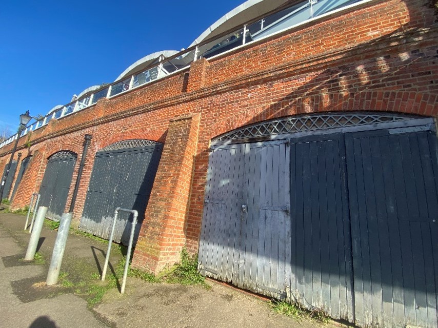
Figure 26 Boathouses
The row of boathouses fronts directly onto the towpath. These are an important reminder and link to the riverine history of the area and retain much of their original character when experienced at path level despite the modern additions of the early 2000’s Blade House development at first floor level. This latter development is well set back from the boathouse frontages, so they are quite respectful of their setting.
The boathouses are sited adjacent to the former Three Pigeons pub, once derelict for many years, but now converted to residential as part of the same development.
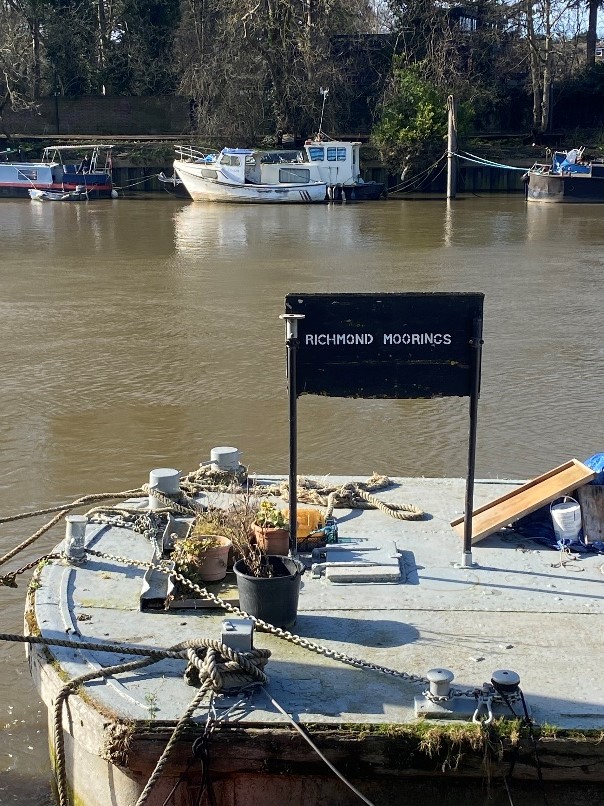
Figure 27 Richmond Moorings
The moorings are still well used and lend a lively atmosphere to this section of the River Thames.
Twickenham bank
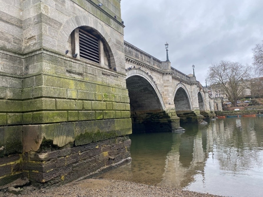
Figure 28 View of Richmond Bridge from the Twickenham bank
The towpath on the Twickenham side, Warren Footpath is more rural than the Richmond side with a much less obvious and direct relationship between the architecture, green spaces and the towpath. Between Marble Hill Park and Denton Road the path is narrow and more enclosed by vegetation. The setting becomes more landscape dominated as it progresses southwards towards Marble Hill Park.
Because of the landform and quality of buildings and open spaces on the Richmond side, there are some exceptional views, particularly to the top of Richmond Hill, and its landscape setting.
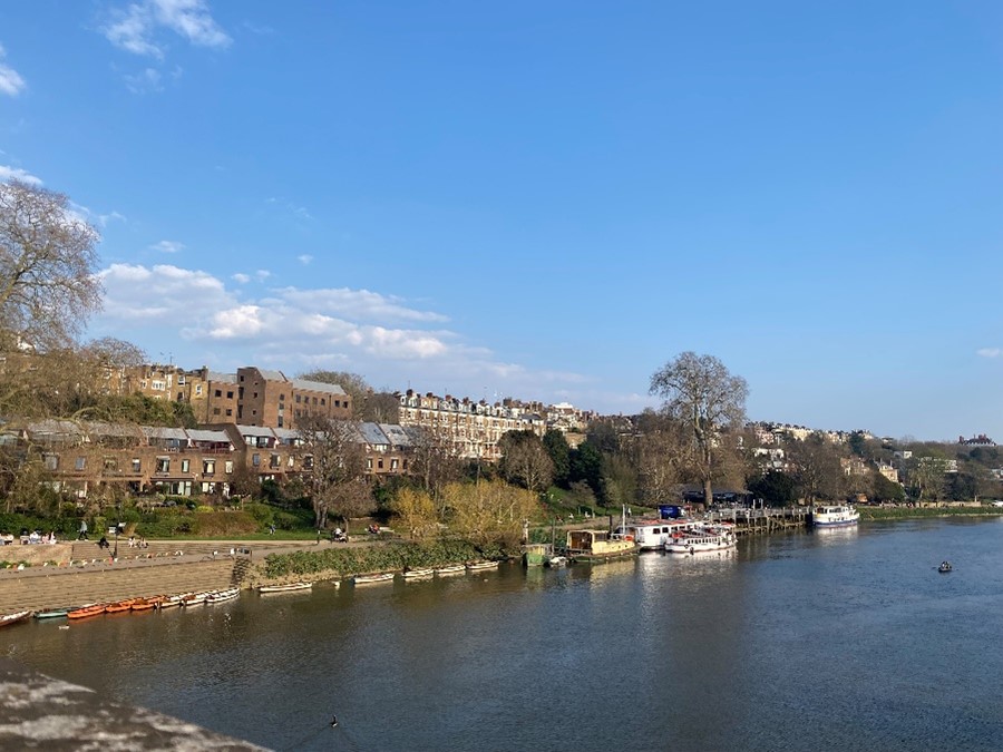
Figure 29 View of the Richmond bank from Richmond Bridge
The land between Meadowside and Cambridge Park in particular features an important belt of mature trees. There are a number of important landmarks visible from this side of the river, which include the Star & Garter Home, the Church of St. Elizabeth of Portugal, the Petersham Hotel and Richmond Bridge. Glover's Island provides a wooded wildlife haven, as well as a visual point of interest in the view from and to Richmond Hill and emphasises the rural character of this area.
Behind the towpath the character is that of buildings of varied scale and design contained and often hidden by the landscape.
Clevedon Road, parallel to Richmond Bridge and the A3004 comprises a series of five three storey Victorian red brick mansion blocks, namely Clevedon Mansions, North Court, Balmoral Mansions, Cambridge Court and Riverview Mansions. Another matching block, Heatherdene Mansions, lies opposite on Cambridge Road.
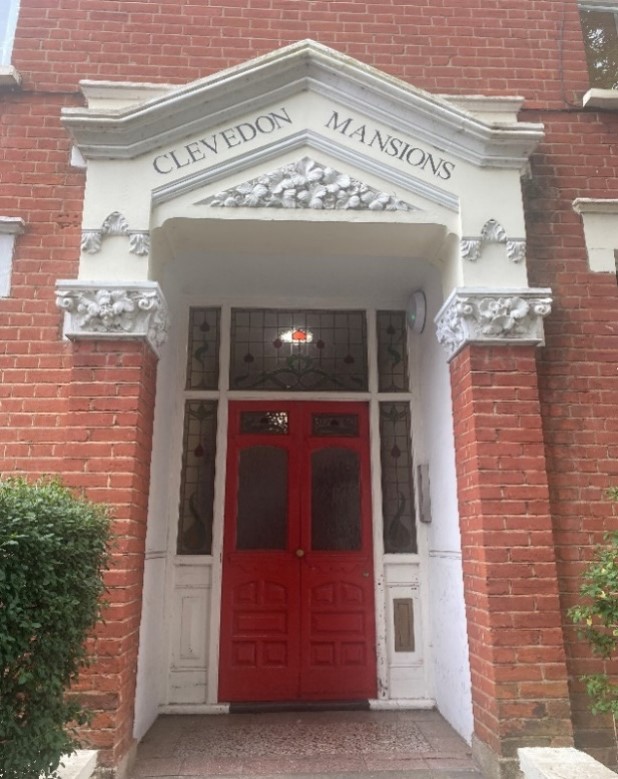
Figure 30 Clevedon Mansions entrance
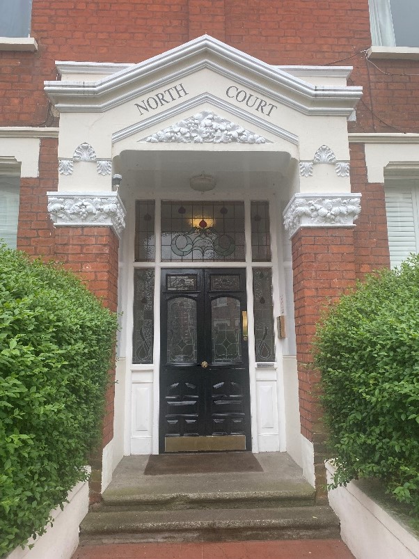
Figure 31 North Court entrance
Clevedon Mansions, on the corner of the A3004 and Cambridge Road, has commercial units at ground floor level including a hairdresser and restaurant.
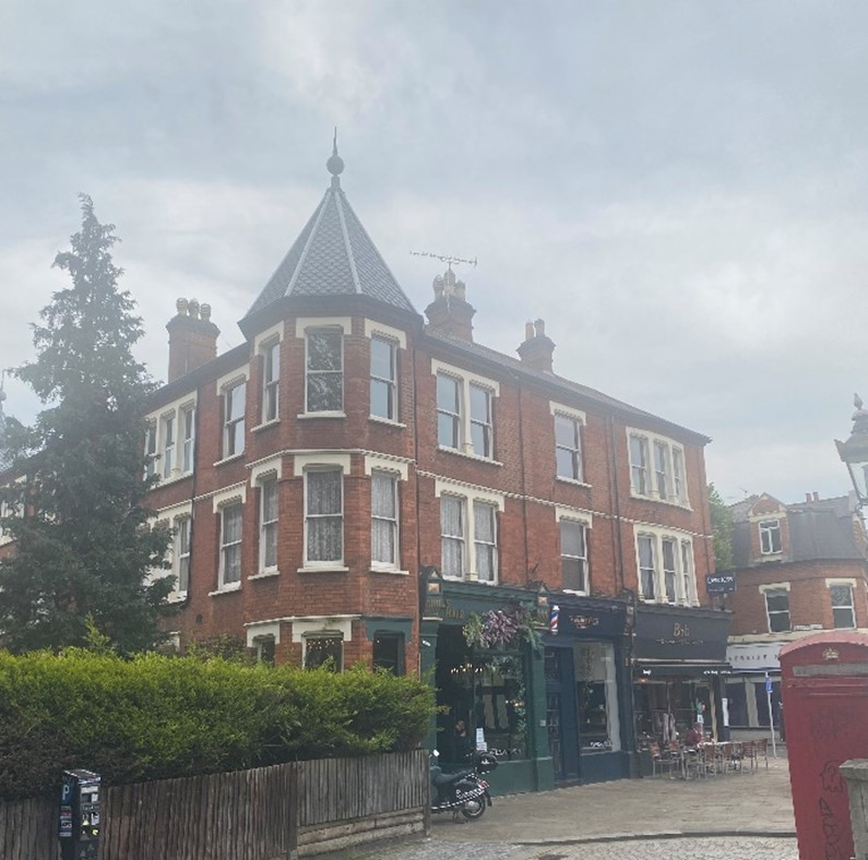
Figure 32 Clevedon Mansions as viewed from Richmond Bridge
The turreted full height canted bays are a particularly strong feature of these buildings and add visual interest to the roofscape.
64-66 Denton Road is a pair of semi-detached Edwardian two storey red brick houses. They do not match, number 64 having a canted double height bay while number 66 has a square bay. They have both had over sized dormers added to the front roofslope and number 64 has lost its original front boundary and has closed boarded fencing, unbalancing the pair. However, they both retain their original front doors complete with stained glass.
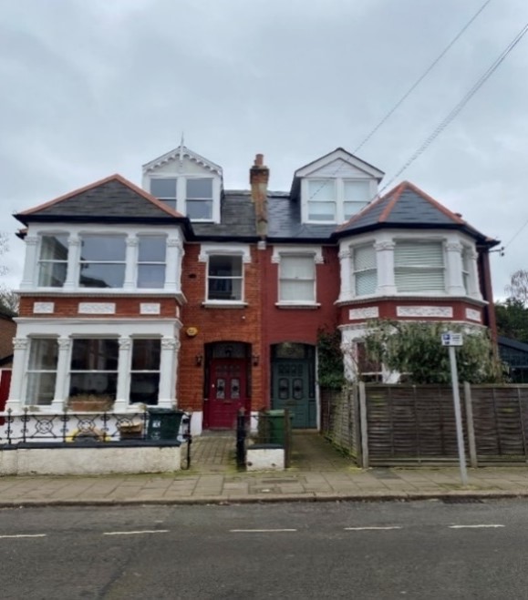
Figure 33 64-66 Denton Road
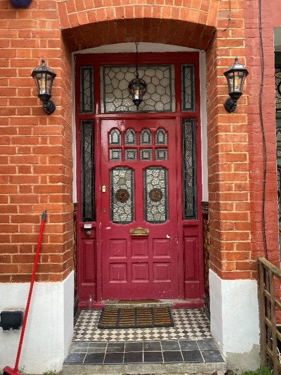
Figure 34 66 Denton Road doorway
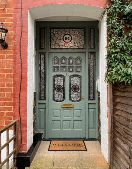
Figure 35 64 Denton Road doorway
Accessed from the towpath via Cambridge Path, Haversham Close lies south of Denton Road. Two groups of terraces have been included in the conservation area although there are further groups of the same design in Haversham Close which are not included. It is thought that these two terraces may have been included due to the presence of significant trees. These are now protected by Tree Preservation Orders.
These terraces (11-21) are two storey in height and built of red brick. They have plain clay tiles roofs and feature two sets of double height canted bays with tile hanging detail between ground and first floor. There do not appear to be any original windows or doors remaining. Several front rooflights have been added.
In summary, it is felt that these houses lack the special architectural and historic interest that would warrant inclusion in the conservation area. We are therefore proposing to remove them.
Figure 36 11-15 Haversham Close (proposed to be removed from conservation area)
Haversham Grange was rebuilt in 1980 behind a security gate, on a sizeable plot that runs around the house and down to the river’s towpath, designed by architects Rosenberg & Gentle and accessible via Haversham Close.
The Old Garden is not visible from the towpath or from Haversham Close.
Further south, the 1930s Art Deco block of flats, Meadowside is also largely obscured from view. Despite this, the scale of this vast L shaped red brick building and its landscape setting positively contribute to the conservation area.
5.2 Character area 2 - Petersham Road
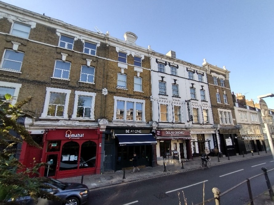
Figure 37 1-9 Petersham Road
1-13 Petersham Road adjoins 3-17 Hill Rise on its western side. This terrace follows the slope of the hill in a similar, slightly more formal character at four storeys with more decorative shopfronts framed by pilasters and corbels. They also have elaborate window details with decorative lintels and flat arches with key stones.
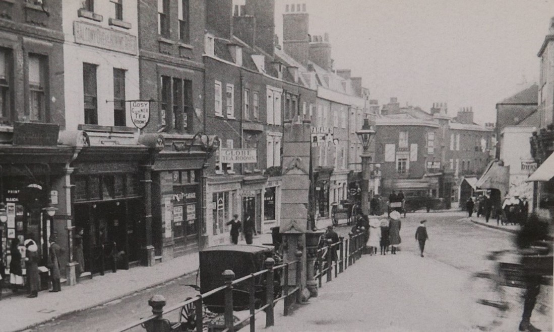
Figure 38 1-5 Petersham Road and Hill Rise c 1880
The Richmond Park Hotel, which has Art Deco-style geometric fenestration on the ground floor, adds to the visual interest of the group.
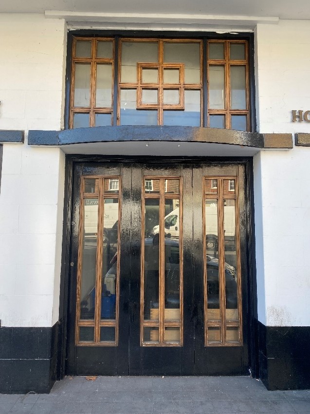
Figure 39 The Richmond Park Hotel entrance with geometric fenestration
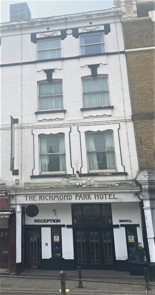
Figure 40 The Richmond Park Hotel, Petersham Road
Richmond Place is a 1980s office block. While out of character with its surroundings, it has some architectural merits. The stepped brick detail of the window surrounds adds interest. It is also of a sympathetic scale, subservient to the terrace of 1-13 Petersham Road.
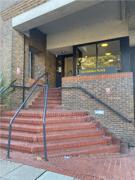
Figure 41 Richmond Place entrance
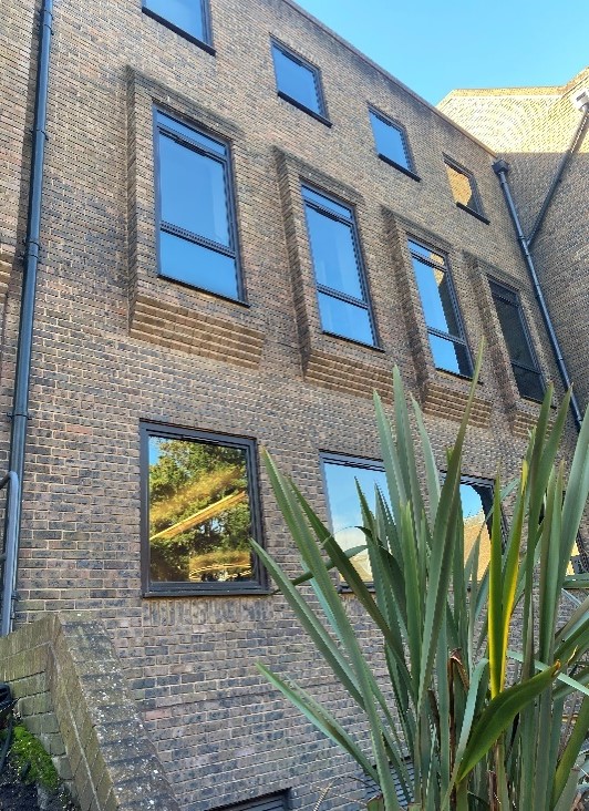
Figure 42 Richmond Place window details
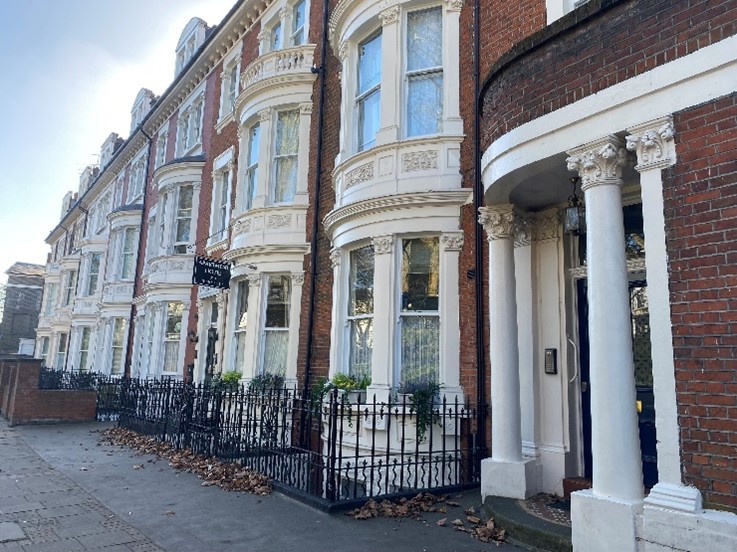
Figure 43 21-33 Petersham Road
21 -33 Petersham Road is a Victorian terrace of three storey houses with decorative double height rounded bay windows. They sit behind modest front gardens which are bounded either by brick boundary walls or wrought iron railings. Their rear elevations are quite visible from Rotary Gardens and the Thames towpath. As such they have two primary elevations.
Their domestic scale and elaborate decoration sit in direct contrast to the more monolithic industrial buildings further along Petersham Road. This variety in usage and design contributes to the character of the Conservation Area.
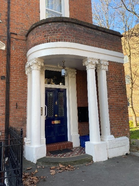
Figure 44 Unusual curved entrance to 21 Petersham Road
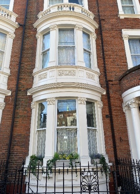
Figure 45 Double height rounded bays to the terrace of 21-33 Petersham Road
35-39 Petersham Road is a grade II listed late 18th century building known as Bellevue House. It was originally a detached house with its main front facing south. It has previously been in use as a hotel.
An arcaded red brick 19th century single storey section projects to front directly on to the pavement.
The entrance, in the central section, set back from the street is very modest and has an engaged door surround. This and the southernmost section are both built of yellow stock brick with a dentil eaves cornice.
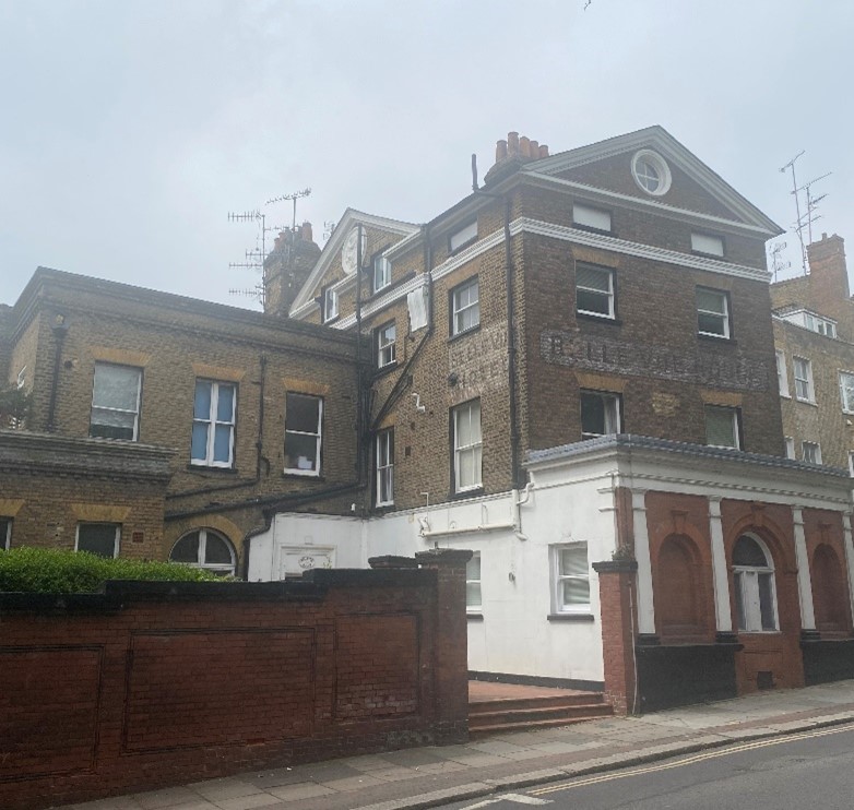
Figure 46 Bellevue House / 35-39 Petersham Road
Set back from the road with a forecourt area the old Ivy Hall Hotel, now Hobart Hall, at 43 and 47 Petersham Road is a substantial grade II listed 18th century ‘L’ shaped building built of red and mixed stock brick, red dressings and painted timber dentil eaves cornice. It also has an imposing river frontage with crenelated eaves and bays.
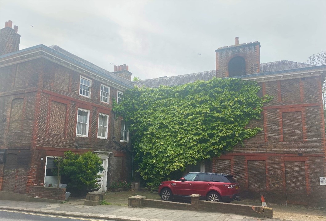
Figure 47 Hobart Hall / 43-47 Petersham Road
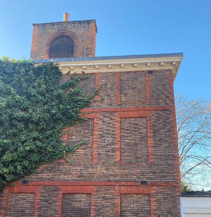
Figure 48 Eaves and chimney detail of Hobart Hall
18-20 Petersham Road, originally Richmond Brewery Stores, is a substantial industrial building built of red brick with black brick also featuring in the pilasters. Arcaded steel windows with key stones at first floor add visual interest to this long building. A contrasting additional floor was added in 2017. This increased height accords with the predominant building heights of similar scale buildings in this part of Petersham Road. This building, along with the Poppy Factory directly behind, provide important tangible links to the former industrial character of this area.
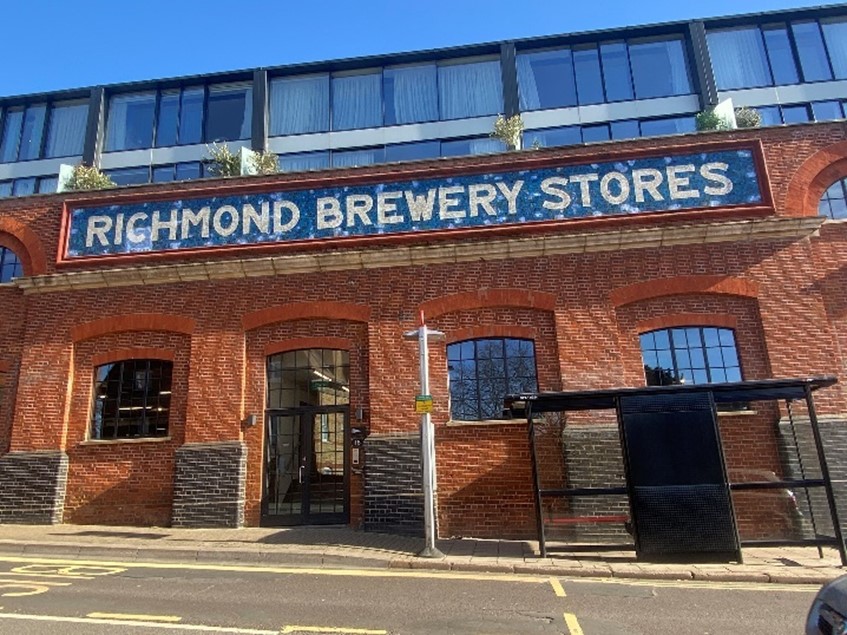
Figure 49 Richmond Brewers Stores / 18-20 Petersham Road
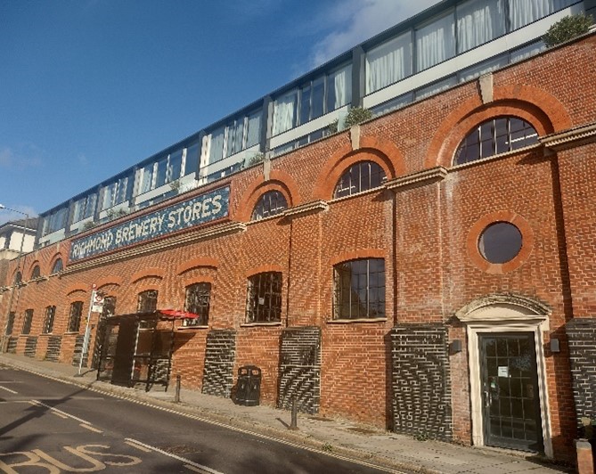
Figure 50 Richmond Brewers Stores showing arcading detailing
Figure 51 Bingham House
Further along Petersham Road, the Bingham House Hotel is an 18th century grade II listed three storey former house. Built partly of mixed stock brick, it has a parapeted roof and a cornice with dentil detail between the first and second floors. The main building has a front of 2 bays, each 3 windows wide, with the right-hand bay set forward.
The Poppy Factory lies just off Petersham Road. It sits on the site of the Lansdowne Brewery. It was established in 1926 when the factory outgrew its original site in south London. Work on a new factory building began in 1932 and was completed in 1933. It was designed in the Art Deco style and quickly became a local landmark. Its style and use are unique in the area, and although it does not face directly onto Petersham Road it is visible in a number of more distant views and adds an interesting contrast in relation to other buildings around it. Today, the production team is still based in this building, working year-round to create every Remembrance wreath by hand.
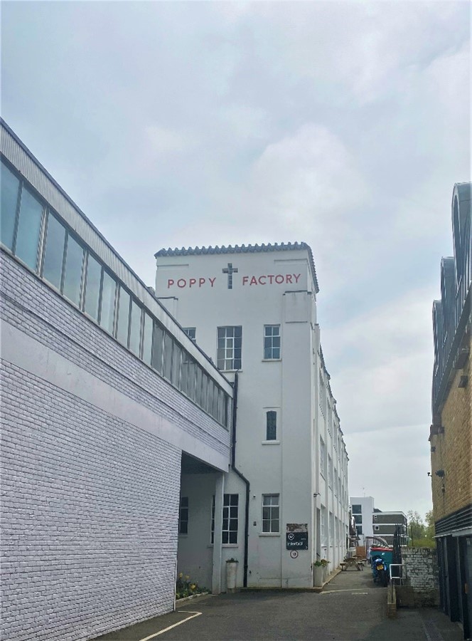
Figure 52 Poppy Factory
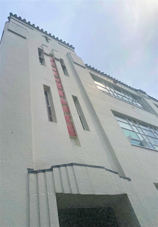
Figure 53 Poppy Factory entrance
There have been various 20th and 21st century developments on Petersham Road. For example,14 Petersham Road was redeveloped into flats namely Clarendon, Wolsey, Jarvis and Portland Houses. These have been designed and built to a good standard and are sympathetic to their setting in terms of scale and materiality.
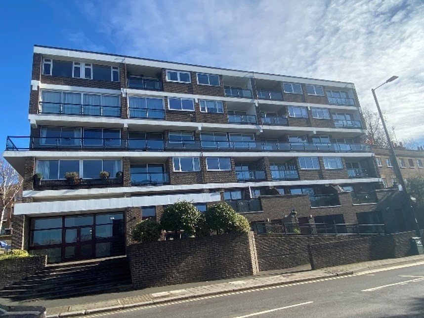
Figure 54 Robins Court
Figure 55 Clarendon, Wolsey and Jarvis House
There are pleasant views between the buildings on Petersham Road to the river. These gaps between buildings are an important part of the character of Petersham Road. Various gardens such as the Cambourne Path, Gothic Gardens and Riverdale Gardens provide glimpses through, connecting this road to the river scene. These now public spaces were part of the grounds of various private homes.
Figure 56 Gothic gardens affords a significant gap and view through to the Thames
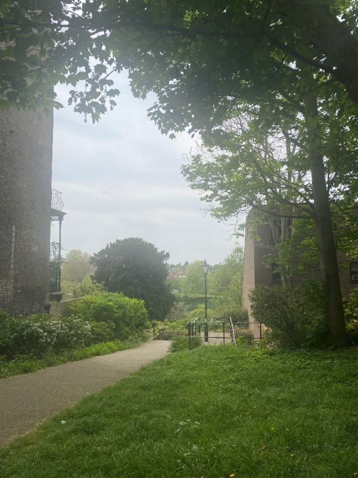
Figure 57 The Cambourne Path provides a verdant break in the streetscene and views to the Thames
The southern section of Petersham Road becomes more rural as it approaches Petersham Common, varying from open views around Petersham Meadows to an enclosed wooded character towards Star & Garter Hill. The buildings are subservient to their setting with the landscape dominating. Even the grand Petersham Hotel is well obscured by trees and due to its placement between the levels of Petersham Road and Nightingale Lane, it sits comfortably within the landscape.
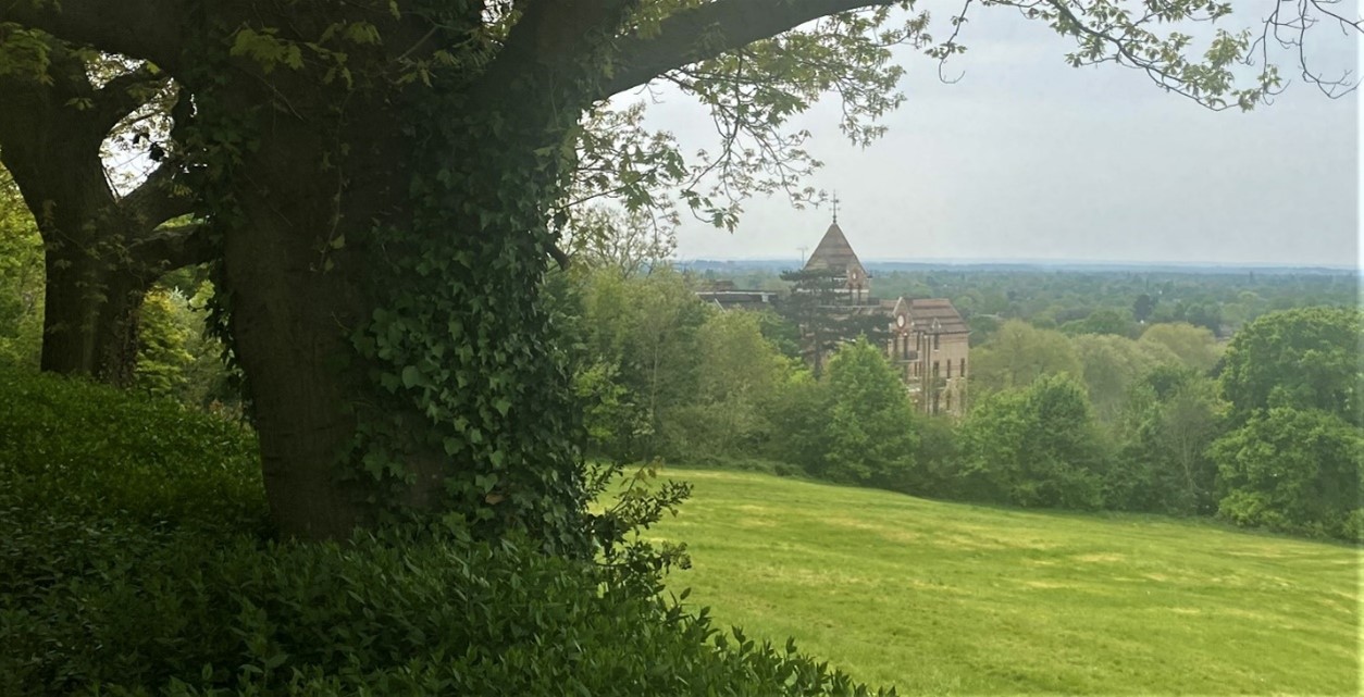
Figure 58 View of The Petersham Hotel from Richmond Hill
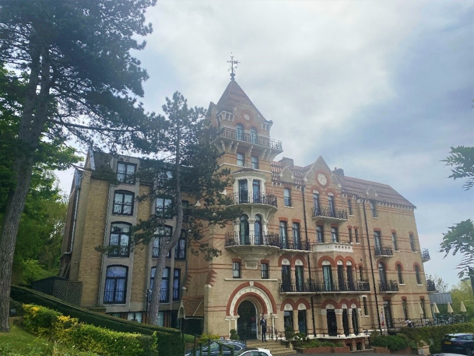
Figure 59 The Petersham Hotel as viewed from Nightingale Lane
5.3 Character area 3 - Richmond Hill

Figure 60 The view from Richmond Hill
This character area includes Hill Rise and Richmond Hill itself.
Along with Bridge House Gardens, Hill Rise constitutes the beginning of this Conservation Area and borders neighbouring Central Richmond and Richmond Riverside Conservation Areas.
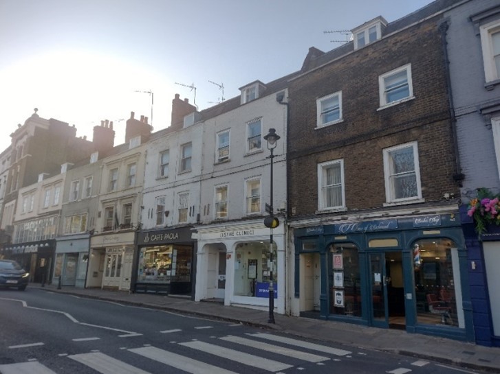
Figure 61 3-17 Hill Rise
Numbers 3-17 (odd) Hill Rise form an 18th century grade II listed terrace. This is the first group of buildings in the Conservation Area when approaching from central Richmond. They are modest at three storeys with shop units at ground floor level and residential accommodation above. They have parapeted mansard roofs and simple painted timber sash windows with flat brick arches above. Several of the buildings have more decorative bracketed cills and lintels. They are built of stock brick but have mostly been painted. The shopfronts at numbers 5 and 7 are very distinctive retaining their arched windows and cornices. 1 Hill Rise is a substantial building which turns the corner to Richmond Bridge. The rear of these buildings is visible from various viewpoints including from the bridge.
The road divides, ascending to continue Hill Rise and descending to form Petersham Road. This difference in level is striking, and there consequently is a substantial brick retaining wall and wrought iron railings on this section of Hill Rise. What is now a bank of lawn and trees between Hill Rise and Petersham Road was once home to several buildings as shown below in the archive photograph.
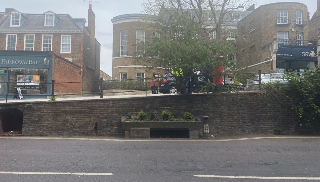
Figure 62 Retaining wall between Hill Rise and Petersham Road also showing early 20th century Metropolitan drinking fountain
24-30 Hill Rise is a series of three 19th century single storey shop units sitting in front of a pair of 18th century listed building. The shop fronts were built on the front gardens of the houses behind and are inconsistent in design and in varying states of original repair. The pair of houses is built of mixed stock brick and red dressings and has a hipped slate roof with pedimented dormers and tall chimney stacks. This group clearly shows how existing buildings were remodelled in the 19th century and adapted to new uses, providing an important connection to the evolution of Hill Rise.
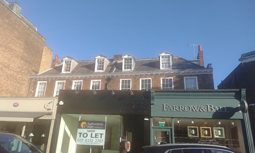
Figure 63 24-30 Hill Rise. Shop units with house behind
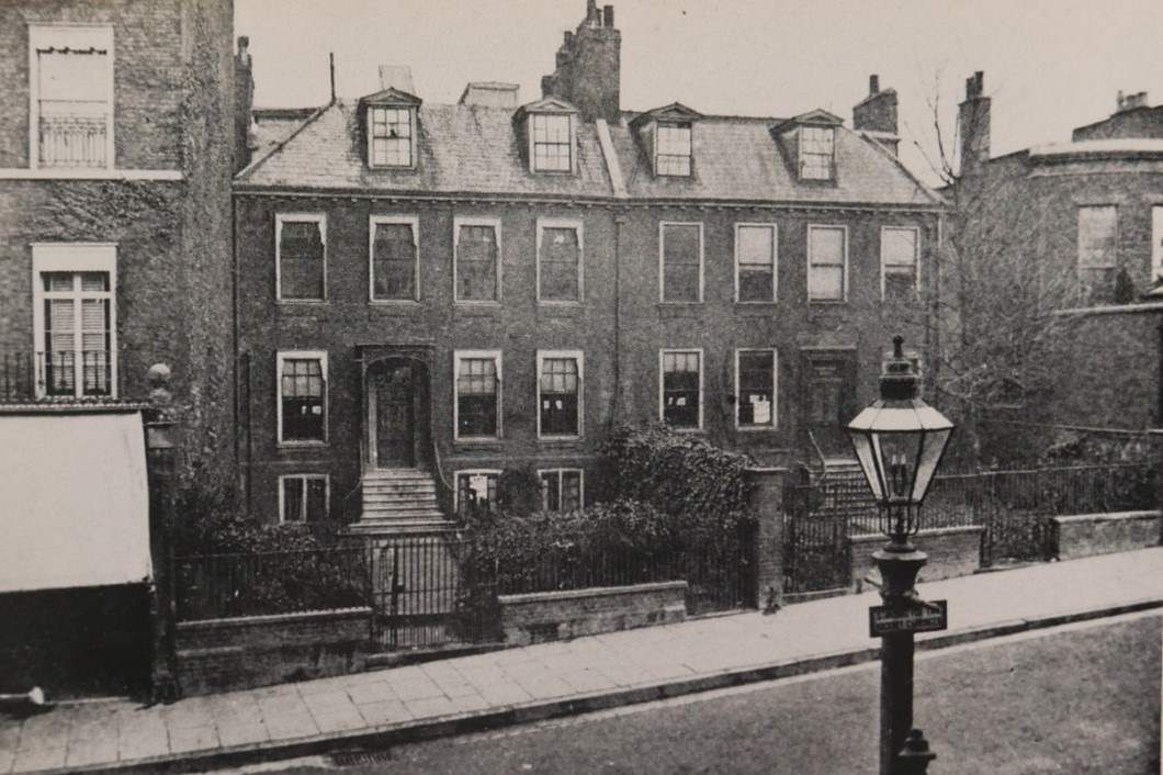
Figure 64 24- 30 Hill Rise c1800 with front gardens
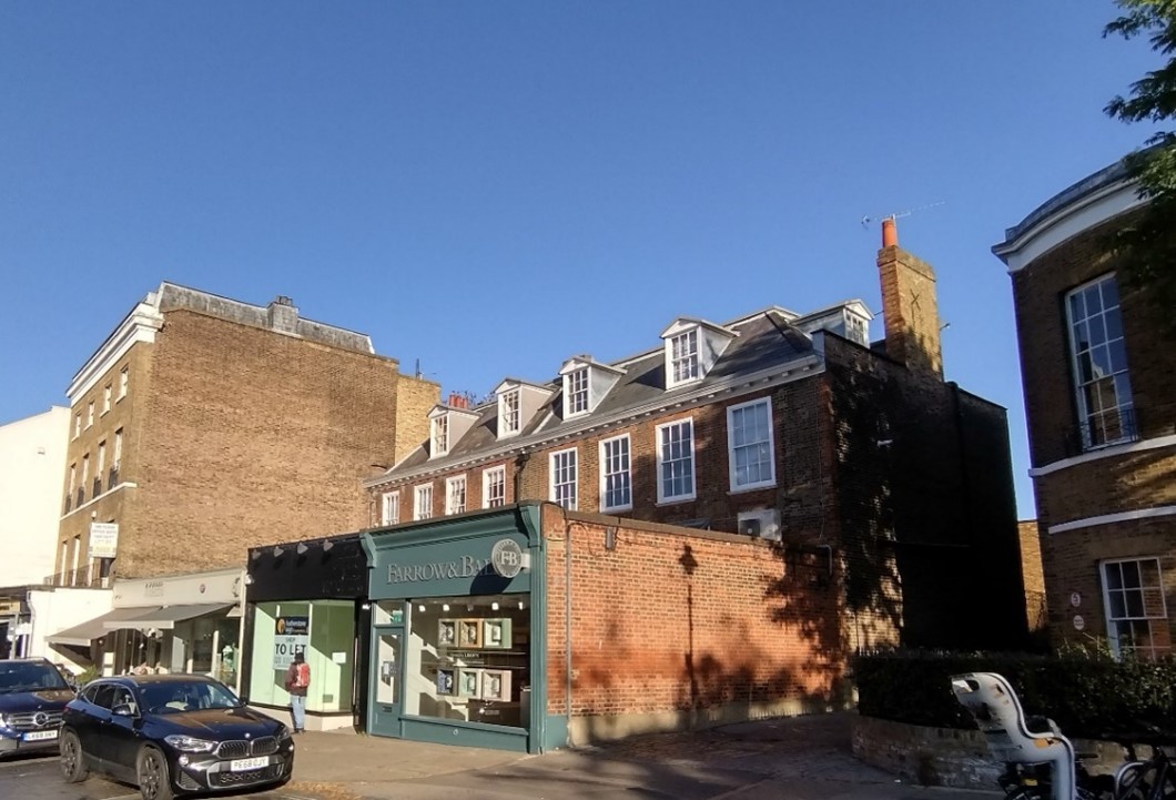
Figure 65 24-30 Hill Rise showing shop units in front
Holbrook House is an 18th century grade II listed building with a later 18th century bow fronted wing. The three-storey building is built of mixed stock brick and has painted timber sash windows and a slated mansard roof. It is set back from Hill Rise behind a small front garden with a brick boundary wall. As the only building in its immediate vicinity without a shopfront, it provides contrast in the street scene. Although now used as offices, it still reads as a domestic building in a Highstreet context.
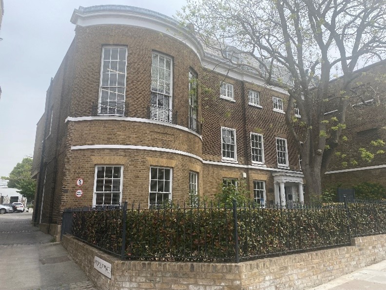
Figure 66 Holbrook House
Following the hill, although the scale is generally similar, a variety of rooflines with subtle changes in heights and shapes of buildings generates interest and diversity.
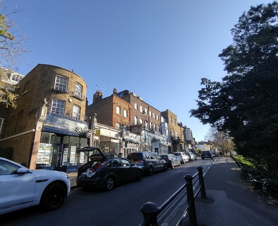
Figure 67 View of steep section of Hill Rise from number 38 onwards
Number 40 Hill Rise was originally a projecting wing of Holbrook House. As such is it also grade II listed. Now a shop unit with accommodation on first and second floors. This bow fronted stock brick building forms the beginning of the group of shop units on this steep part of Hill Rise. The 19th century shop units are all set forward of the older buildings behind, which are mainly 18th century in origin. The quality of the shop fronts in this group varies considerably from the plain modern shop front at number 46 to the highly decorative original shop front at number 62.
General advice on shopfronts is the subject of a separate, specific supplementary design guide is set out in the Council's Shopfronts (2010) Supplementary Planning Document (pdf, 2.4 MB).
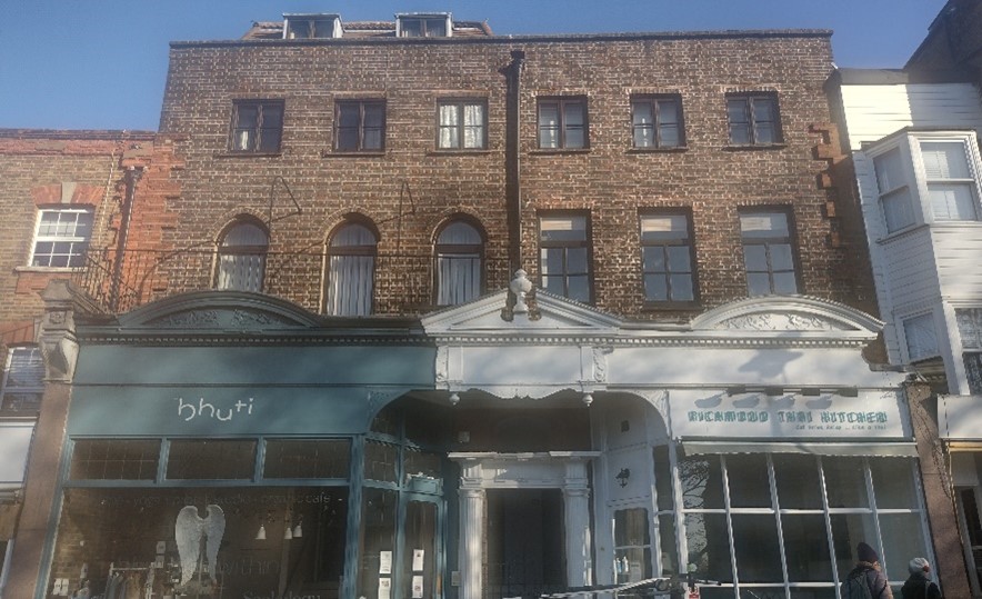
Figure 68 46-56 Hill Rise
Numbers 46-56 Hill Rise form a double shop front with access to residential accommodation between the two shop units.
The glazing on the shop front is canted / splayed back which draws attention to the classical door case of the entrance to the accommodation behind. The shop on the left is a recent re-instatement and was based on original plans.
There is a decorative entablature with dentil detail under variety of pediments.
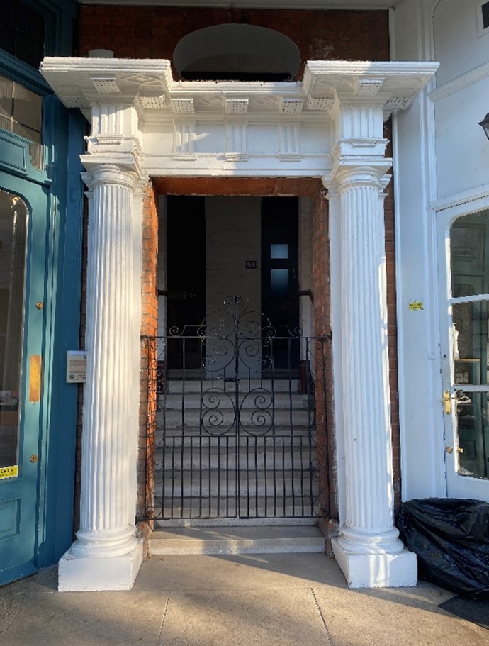
Figure 69 Central doorcase to flats behind at 46-56 Hill Rise
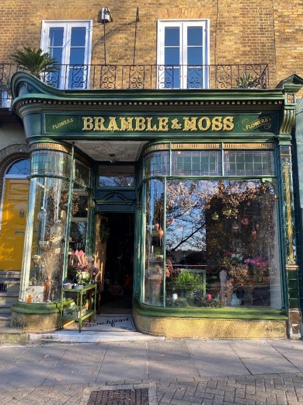
Figure 70 62 Hill Rise - very fine shopfront
Number 62 Hill Rise is a late 18th/ early 19th century grade II listed building. Built over three storeys the mixed stock brick building sits behind a very fine late 19th century shop front with curved glazing, leaded top lights, green and yellow glazed tiled pilaster and mosaic tiled stallriser. It is a shopfront of particularly high quality and enriches the street scene and wider conservation area.
Number 84 Hill Rise is an early 18th century grade II listed building with a hipped gable facing the street which is very different in design to its neighbouring properties. It was formerly a dairy and has a fine tiled interior depicting various pastoral scenes.
Figure 71 84 Hill Rise
There are wrought iron railings at first floor level. The 19th century shop front has tiled stallriser and a mosaic tiled entrance reading J Clarke & Sons. As it is in such a good state of repair and the decoration so clearly advertises its historical use, this building greatly contributes to the character of the Conservation Area.
Richmond Hill forms the distinctive ascent towards the historic view of the river from Terrace Walk and on to Richmond Park. The view to the entrance of the park is a key vista within the conservation area.
Number 2 Richmond Hill sits on the corner of Richmond Hill and The Vineyard. The three-storey 18th century house which was altered in the 19th century is grade II listed. It is brick built though the front elevation has been painted white and has band courses between floors. There are painted timber sash windows which are corniced at ground floor level. The pilastered entrance doorway is approached by steps with brick risers. A modest front garden sits behind a low rendered boundary wall with fleur-de-lis pattern railings.
Figure 72 2 Richmond Hill on corner of The Vineyard
Figure 73 2 Richmond Hill front elevation
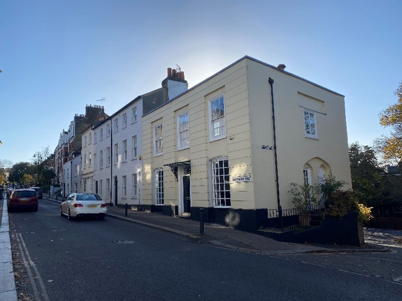
Figure 74 1-7 Richmond Hill
Number 1 Richmond Hill sits on the corner of Richmond Hill and Compass Hill. It is a two-storey painted rendered house with timber small pane bow windows at ground floor and timber sash windows at first floor level. The side elevation features a pointed arched recess in which two further pointed arched openings contain a window and a blocked-up opening. This adds visual interest as you turn the corner to Compass Hill.
Figure 75 2 Richmond Hill side elevation
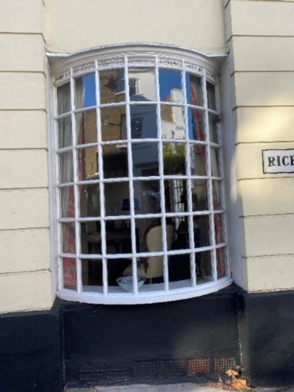
Figure 76 bowed window at 2 Richmond Hill
Numbers 13-17 Richmond Hill form a group of three shop units beside Cardigan mansions. These single storey plus attic buildings form an unusual group and have good quality shop fronts with pilasters featuring both corbels and rounded finials, corniced fascia boards and slate mansard roofs with pedimented dormers.
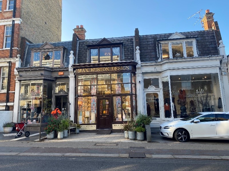
Figure 77 13-17 Richmond Hill
Figure 78 15 Richmond Hill
Numbers 28-40 Richmond Hill consist of a grade II listed mid-19th century terrace in an Italianate style. The three storey (plus basement) building is built of mixed stock brick with stucco dressings and slate roof. There is a moulded cornice and architraves, and the painted timber sash windows have vertical glazing bars with longer first floor windows acting as French windows onto continuous tented veranda with decorative cast iron railings and column supports.
The doorcases have rectangular fanlights and all except no 28 retain their original front doors. Most retain their original cast iron latticed flower guard below ground floor windows. They are set back from the street behind wrought iron railings and form a continuous frontage which unifies the character on this side of the hill at this point.
There is a modern mews development behind them, reached by a lane to the side which affords a glimpse through to the houses at the back.
Figure 79 24-40 Richmond Hill
Figure 80 Lancaster Mews
Cardigan Mansions is an imposing four storey (plus basement) Victorian red bricked mansion block. It features brick pilasters and cornices between floors. The entrance retains its original double doors and features a decorative masonry and red brick door surround bearing date inscription ‘1896’ in decorative pediment above.
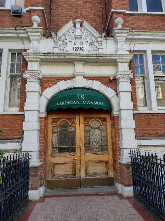
Figure 81 Cardigan Mansions entrance
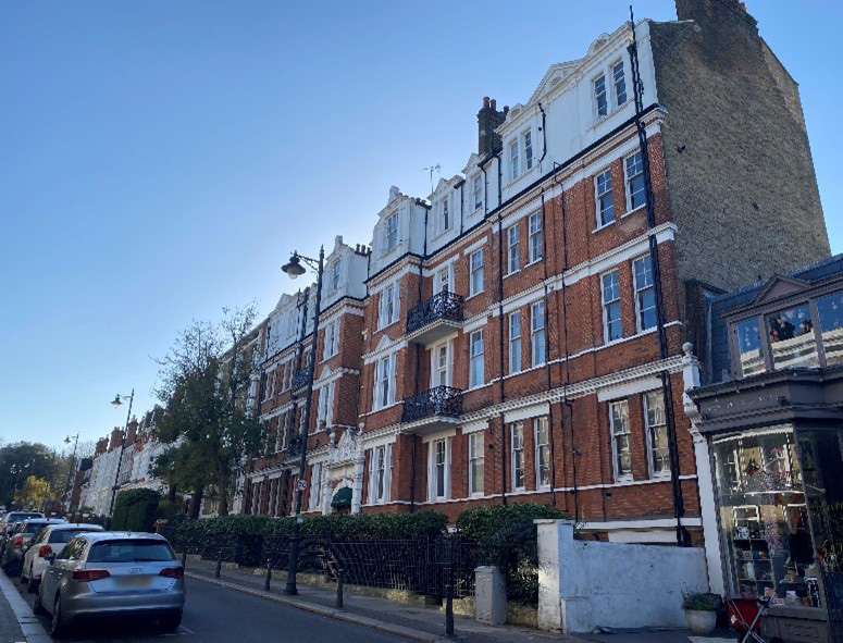
Figure 82 Cardigan Mansions
The 17th century Old Vicarage School is a grade II* listed building. It was originally a private house and was remodelled in 1809 in the neo gothic style. It is built over five storeys including an attic and basement. The attic storey is set back behind an embattled parapet.
Symmetrical in five bays, the central bay is canted at the upper storeys over the embattled porch. The entrance door is panelled and studded. The painted timber sash windows which have pointed arched details sit under hoodmoulds.
Facetted embattled turrets sit at the corners and facetted shafts flank the central bay, both with blind arrow slits.
Figure 83 The Old Vicarage School
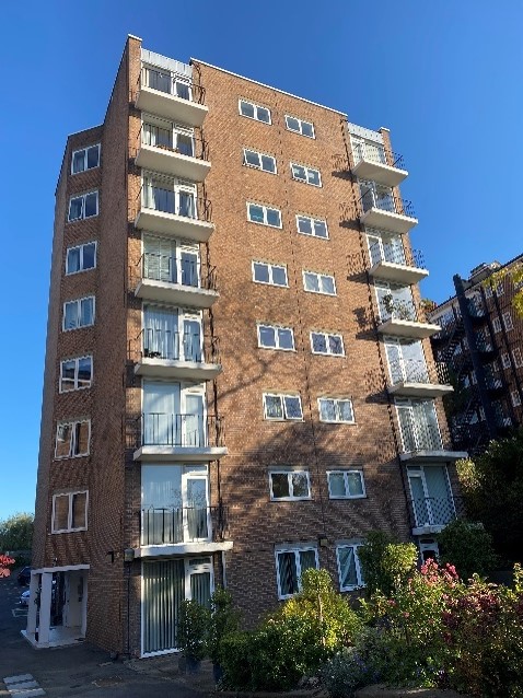
Figure 84 Priors Lodge
Priors Lodge is a mid-20th century red and brown brick 8 storey tower block which is entirely out of scale with its surroundings.
It is however set back from the road and sits in a well landscaped setting.
Bromwich House / Howson Terrace is a mid-20th century block of flats, opposite Priors Lodge. It is set very well set back from the road and is largely behind a high brick boundary wall. It does not contribute much to the Conservation Area and benefits from being well landscaped, with a terraced garden leading from street level to the entrance. It is located next to Cardigan Gate.
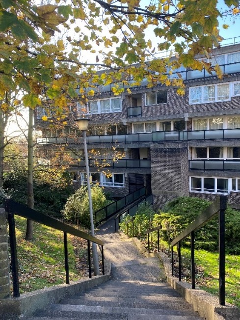
Figure 85 Bromwich House
This steep section of Richmond Hill is predominantly populated by blocks of flats before returning to individual houses on the summit.
The 1930s Richmond Hill Court is an impressive, imposing building built around a courtyard with tennis courts in the centre. This five storey, plus attic, neo Georgian building is rendered at ground and fourth floors and otherwise faced in brown brick with red brick flat arches over white painted steel windows. The plain clay tiled roofs have flat roofed dormers. There are several entrances, all of which are accessed through classical pedimented porches with Doric pillars. The scale, massing and its courtyard arrangement results in Richmond Hill Court having a very dominant presence.
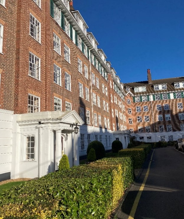
Figure 86 Richmond Hill Court
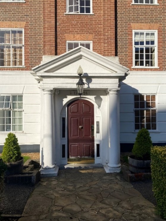
Figure 87 One of the entrances to Richmond Hill Court
Figure 88 Glenmore House
Neighbouring Glenmore House which faces onto Richmond Hill is built in a very similar style. It is also a five storey plus attic building with a painted rendered ground floor and similar coloured bricks and steel windows.
Figure 89 Hillbrow
Hillbrow is an imposing five storey mid- 20th century block of flats which turns the corner of Richmond Hill and Friars Stile Road. It is built of brown brick and though the windows have been replaced with uPVC, they retain their original fenestration pattern. The stairwell windows and door case show Art Deco influences on the design. This contributes to the character of the conservation area by adding architectural variety to the street scene.
Park House is a Victorian six storey (including basement and attic levels) apartment building. It is relatively simple in design, with bracketed eaves, rendered lintels, painted timber sash windows and canted bays at ground and first floor levels. Red brick is an unusual material in this part of Richmond Hill and contributes to its visual diversity.
Figure 90 Park House
Numbers 90-112 Richmond Hill form a substantial Victorian terrace of four storey houses with stock brick frontage and a painted render finish at ground floor. The windows are of a similar style to Park House, very simple painted timber sash windows, aside from the first floor which are tall timber casement French windows that open onto balconies.
Figure 91 90-112 Richmond Hill
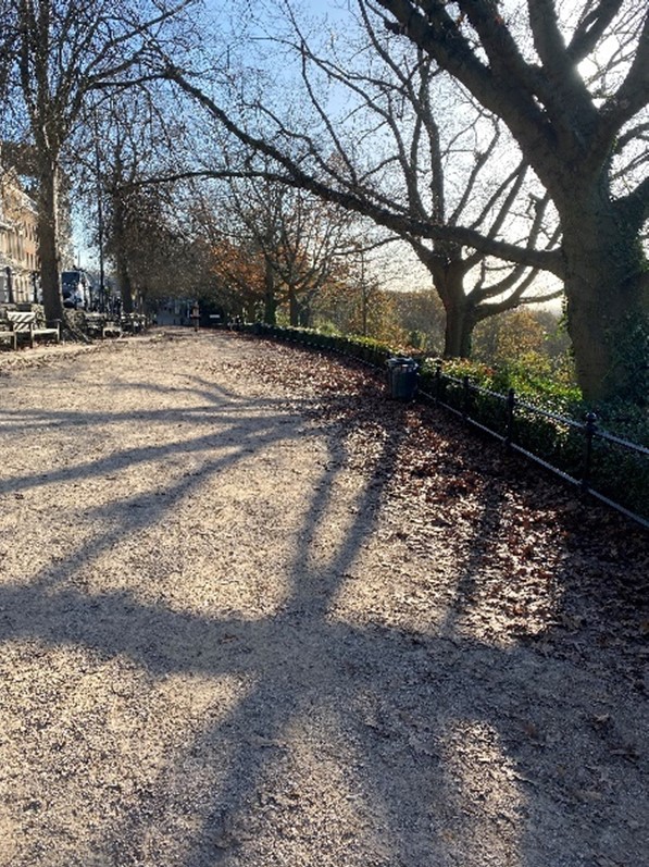
Figure 92 Terrace Walk
The grade II* listed registered park and garden, Terrace Walk, laid out in the 18th century, is a broad, gravelled walk which runs along the crest of the hill and is set back from the road behind a low brick retaining wall and wrought iron railings.
It is lined with trees and low hedging and has benches placed at intervals along its length, allowing pedestrians an uninterrupted view across the scenic panorama of the Thames valley.
There are visitor information boards describing points of interest and there is also a telescope for more distant views. This promenade surmounts parts of Terrace Gardens and Terrace Field.
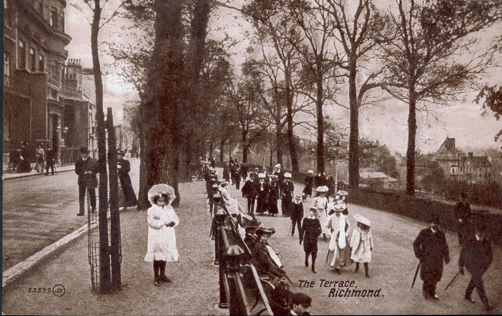
Figure 93 Terrace Walk c1900
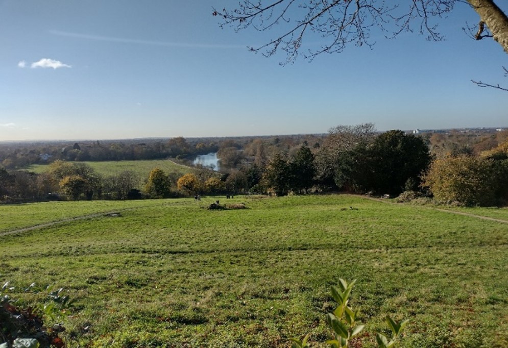
Figure 94 View from Richmond Hill
Norfolk Lodge / 114 Richmond Hill is a grade II listed 18th century house. Built over three storeys, this mixed stock brick house is rendered at ground floor and features a balcony at first floor level with square coupled columns. The slate roof lies behind a brick parapet with a stucco band below.
Next door lies Downe House / 116 Richmond Hill, which is also an 18th century grade II listed building. It is built of mixed stock brick with double height canted bays at ground and first floor level with modillion cornice and balustrading above. The 19th century porch has a heavy entablature on Doric pillars.
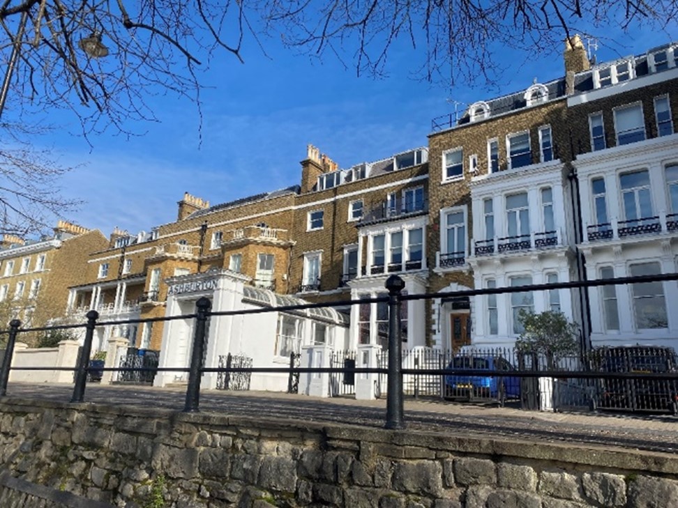
Figure 95 116-122 Richmond Hill
Completing the group is what was once the Ashburton Hotel (120) and 122 Richmond Hill. These two buildings project slightly forward of Norfolk Lodge and Downe House and though also built of mixed stock brick, are clearly 19th century in design and decoration. Double height square bays and plain painted timber sash windows characterise this pair.
This group, along with 90-112 Richmond Hill, forms a relatively consistent panorama when viewed from Terrace Gardens due to the similarity in their materiality and scale.
Numbers 124-126 Richmond Hill is an early 19th century grade II listed building. Built over four storeys as well as a basement, this double fronted mixed stock brick building with yellow dressings has rounded brick arches over the semi-circular ground floor windows. The remaining windows, which are generally timber sashes aside from long casements at first floor which act as French windows have flat yellow brick arches and wrought iron railings containing the first floor balcony. There is a cornice between the second and third floors. The entrance area also has iron railings, rising to an arch. The doorways are recessed in one segmental arch opening.
Adjoining this is 128 Richmond Hill, also grade II listed. This three storey, plus basement, 19th century Italianate style house is stuccoed with a projecting classical porch and a full height rounded bay. The ground floor is rusticated and has keystones over the casement windows. There is a wrought iron balcony at first floor level to facilitate the long casement windows operating as French windows. There is a deep bracketed cornice between the first and second floors.
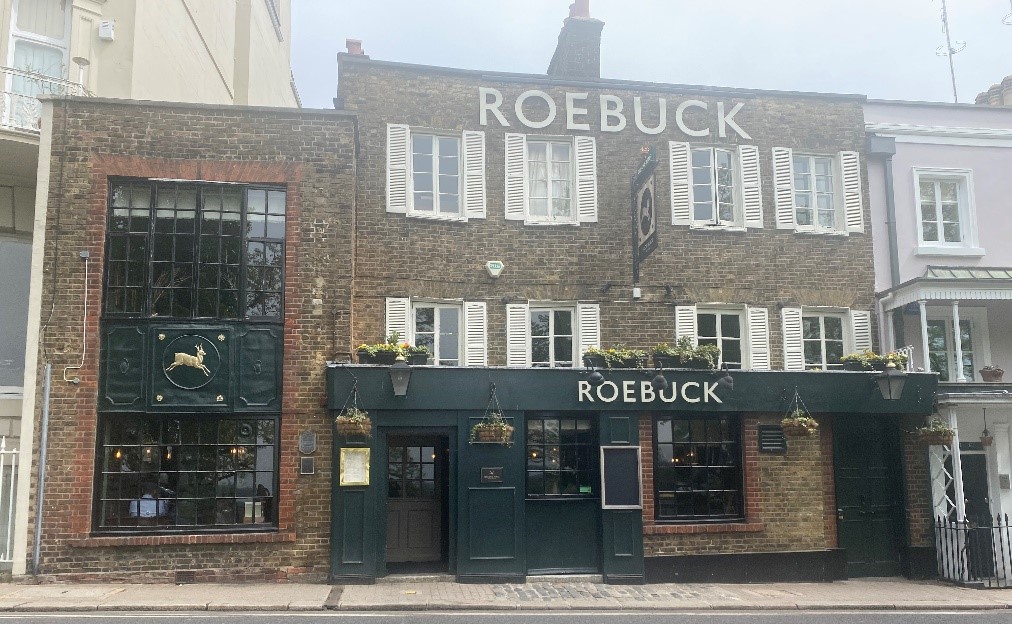
Figure 96 130 Richmond Hill / Roebuck public house
The Roebuck public house / 130 Richmond Hill is a three storey stock brick building with casement windows to the upper floors and bow windows to ground floor and northern projecting wing.
Figure 97 134-140 Richmond Hill
3 The Terrace /138 Richmond Hill is a grade II* listed three storey house, built of mixed stock brick with a stuccoed ground floor and pedimented parapet. It was built 1767 for Christopher Blanchard.
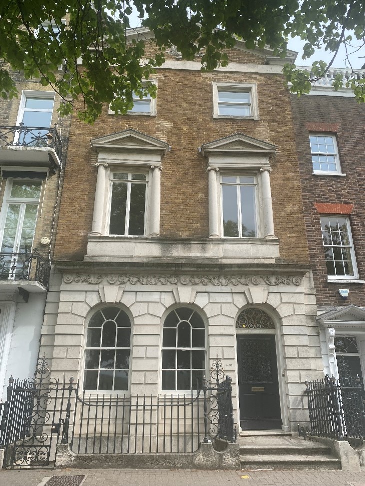
Figure 98 138 Richmond Hill
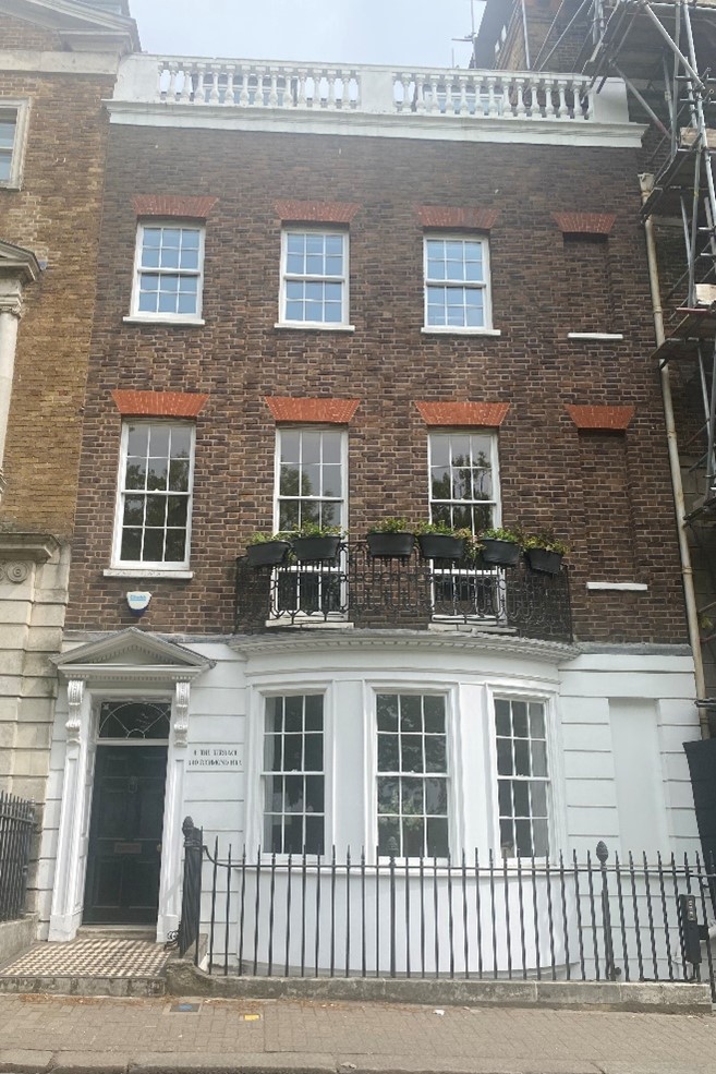
Figure 99 140 Richmond Hill
Number 140 Richmond Hill is a grade II listed early 18th century three storey house with attic and basement. It is built of brown brick with red dressings and has lined stucco to ground and basement floors. The entrance has a pedimented doorcase and the windows are timber painted sashes. There is a rounded bay at ground floor.
Number 142 Richmond Hill / Doughty House is a large 18th century grade II listed building. Built of stock brick with stone rustication at ground floor level, this large three-storey plus basement house, the three central storeys break forward under a triangular pediment with dentil cornice. The panelled front door is set in a decorative doorcase and accessed by stone steps. There is a long gallery to the rear with pilastered frontage.
Nightingale Lane provides steep views down to the Petersham Hotel, with its tower rising above the trees.
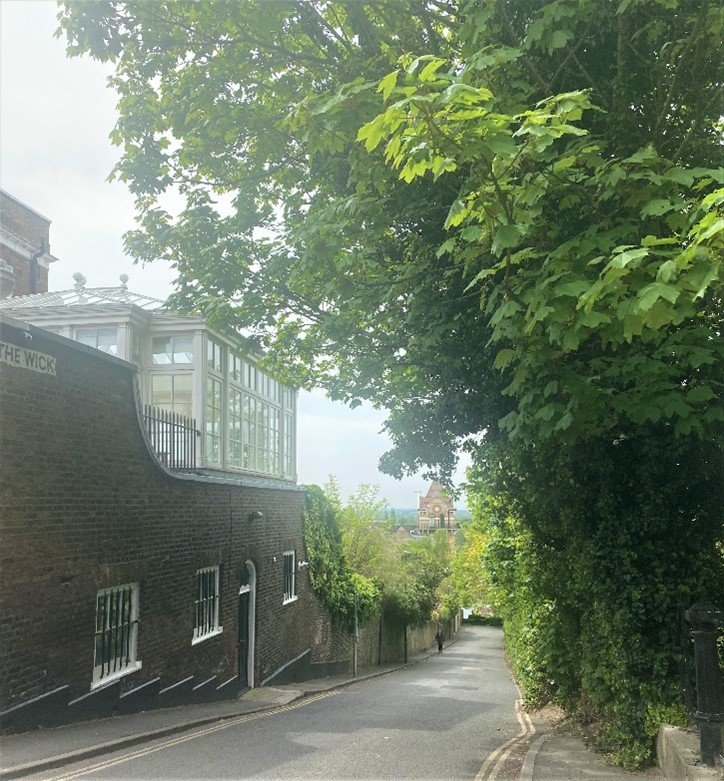
Figure 100 View down Nightingale Lane to the Petersham Hotel
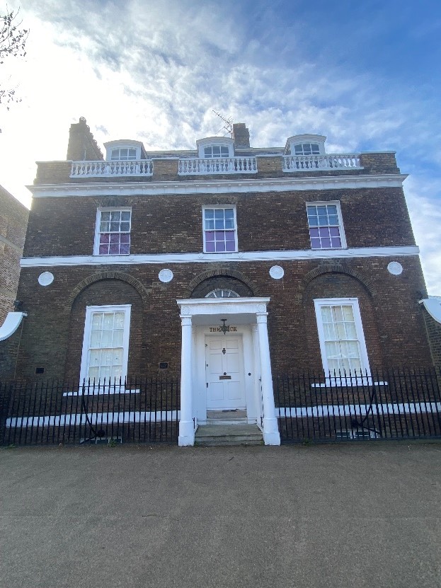
Figure 101 The Wick
The Wick is a late 18th century grade I listed detached house on the west side of Richmond Hill. It is built over four storeys including attic and basement levels. The ground floor has arcaded treatment to three recessed bays with round fluted stone medallions between the square headed painted timber sash windows. The projecting porch has Tower of the Winds columns, and a fluted and medallioned frieze, with fanlight above. There is a simple stone band course between ground and first floor levels and a bracketed cornice beneath the ballustraded parapet. The house features delicately carved triglyphs beneath upper floor windows. a slate mansard roof with rounded dormers sots behind the ballustraded parapet.
To the front is a listed iron overthrow lamp holder.
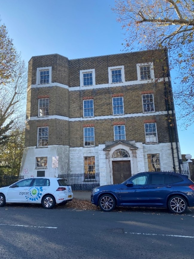
Figure 102 Wick House
Wick House is a grade II listed detached house, originally built by Sir William Chambers for renowned landscape painter Joshua Reynolds but much altered in the intervening years, including for use as a hotel and nurses home. The building bears a plaque commemorating its history.
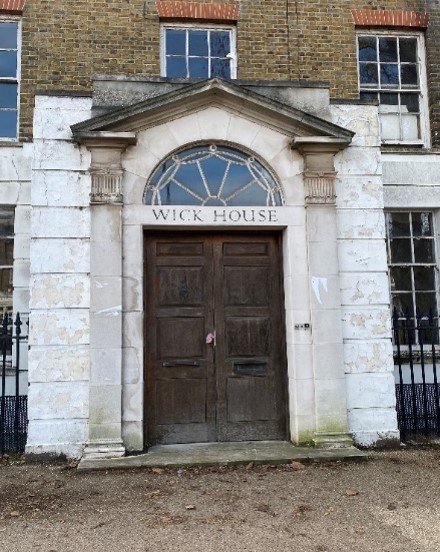
Figure 103 Entrance to Wick House
The four-storey house currently stands in a state of disrepair with significant cracking to the southern elevation. There is a full height canted bay to the left with a slightly splayed bottom. The house is built of stock brick with a rusticated stucco ground floor. There are stucco band courses between first, second and third floors. A later pedimented stone door surround features an ornamental fanlight. The painted timber sash windows seem to be original and have red brick flat arches over them at first and second floors. There are stucco surrounds to third floor windows.
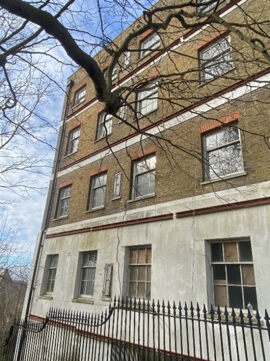
Figure 104 Crack on the side of Wick House
Figure 105 Richmond Hill Hotel
The grade II listed Richmond Hill Hotel comprises three once separate 18th century properties, numbers 146, 148 and 150 Richmond Hill now amalgamated and altered to form the hotel. Originally the area in front now covered with parking was a garden and shared drive.
Number 146 is a late 18th century four storey house built of stock brick with a slate mansard roof behind a brick parapet. Lead canopied balconies at first floor level are a key feature.
Number 148 is a late 18th century house of three storeys with an attic and basement. Built of mixed stock brick with red dressings, this also has a slate mansard roof behind a brick parapet.
Number 150 is an early 18th century house of three storeys with basement and attic again with a slate mansard roof and brick parapet, stock brick and red dressings. This building features two large double height canted bays. The central Corinthian doorcase which is now a window has fluted pilasters which continue at first floor level.
The three separate buildings are unified by their material palette and roof formation.
The Richmond Gate Hotel / Harbour Hotel is similar in character to the Richmond Hill Hotel in that is made up of a series of former separate houses dating from the 18th and 19th centuries. The three former houses are unified by their similarity in scale and stuccoed exterior.
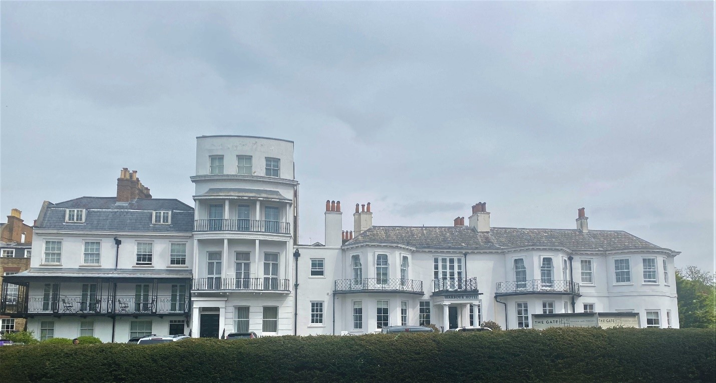
Figure 106 Richmond Gate Hotel / Harbour Hotel
Both hotels along with the Star and Garter dominate this section of Richmond Hill and dilute its predominantly domestic, residential character.
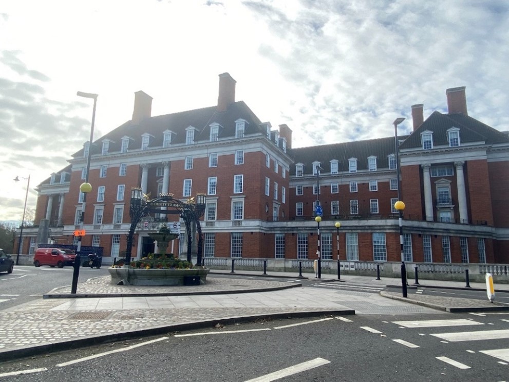
Figure 107 The Star and Garter
The Star and Garter occupies a very commanding position on the hill and is a major landmark visible over a very wide area, particularly from the Twickenham bank.
Along with the gates and gatehouses to Richmond Park, it forms a major termination point at the summit of Richmond Hill, and the refurbished Grade II listed RSPCA fountain in the middle of the adjoining roundabout adds a further point of interest. The view up Richmond Hill to the park gates is a key feature in this Conservation Area.
This immense red brick building with imposing chimneys, stone dressings and hipped pantile roof features heavy modillion eaves and band cornices. The figure of eight plan on a steeply sloping site results in a building, which is even more imposing from the rear at six storeys. The vast front elevation of seven bays with a central door dominates its setting.
The name 'Star and Garter' stems from the royal insignia of the Garter. It is possible that it received its name because the Earl of Dysart, who owned the land on which the original Inn was built, was a member of the Order.
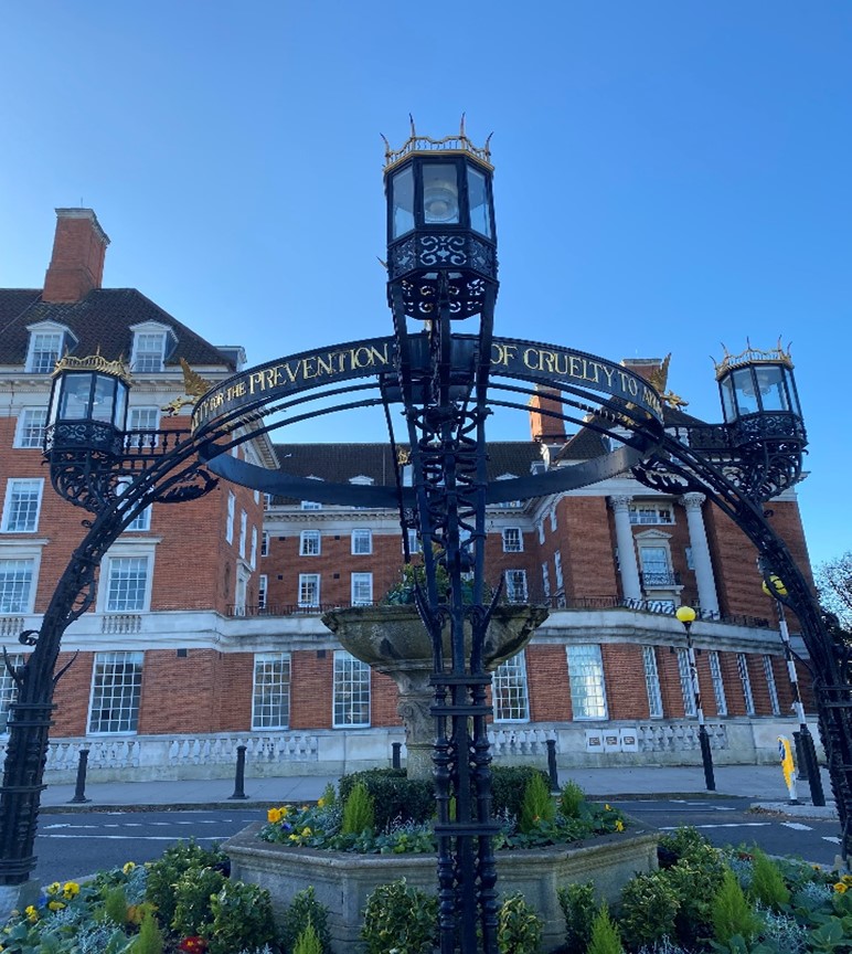
Figure 108 RSPCA fountain
he Star and Garter has had many uses since it was first established as an Inn in 1738. It was extended in the 19th century and became a very popular hotel. John Evans, in his book ‘Richmond and its vicinity’ (1825), describes the building thus "the renowned tavern and hotel, the 'Star and Garter', more like a mansion of a nobleman than a receptacle for the public." Famous visitors include Charles Dickens, for whom it was a favourite place at which to celebrate an anniversary or the publication of a new work.
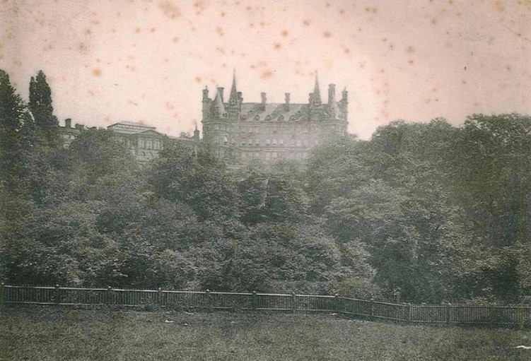
Figure 109 Star and Garter Hotel as viewed from Twickenham bank c1850
At the end of the Victorian era, the hotel suffered a gradual decline in business. In 1915 the hotel was purchased for use as a hospital for paralysed soldiers. But being found unsuitable for its new role, it was demolished in 1919 and rebuilt in 1924 by Sir Edwin Cooper (architect of County Hall) based on a plan by Sir Giles Gilbert Scott as a purpose-built home for disabled sailors, soldiers and airmen. This was opened in July 1924 by George V and Queen Mary. Although the building now has a new use as luxury flats, the memorial chapel still remains with its own entrance onto Petersham Hill.
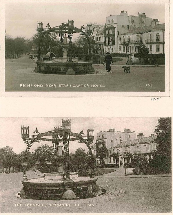
Figure 110 RSPCA fountain 1915
To the right of the entrance to Richmond Park lies the memorial to the Duchess of Teck, Princess Mary Adelaide who was the granddaughter of George III. She lived for many years in the White Lodge in the park.
5.4 Character area 4 - Queens Road
This area has an edge of park character distinct from that of Richmond Hill, away from the famous views but bounding Richmond Park. It is mainly residential with development mainly dating from the Victorian era onwards.
This character area includes the streets of Hobart Place, Chisholm Road, Reynolds Place and Cambrian Road, King George Square and part of Grove Road.
This quiet character area is in complete contrast to the adjoining Richmond Gate to Richmond Park major traffic thoroughfare.
It borders Richmond Park Conservation Area to the south and Richmond Cemetery to the east, and this setting influences its landscape character.
Queens Road
The beginning of Queens Road, closest to the Star and Garter has several detached houses set back behind high brick boundary walls. This sense of enclosure and privacy is common throughout Queens Road.
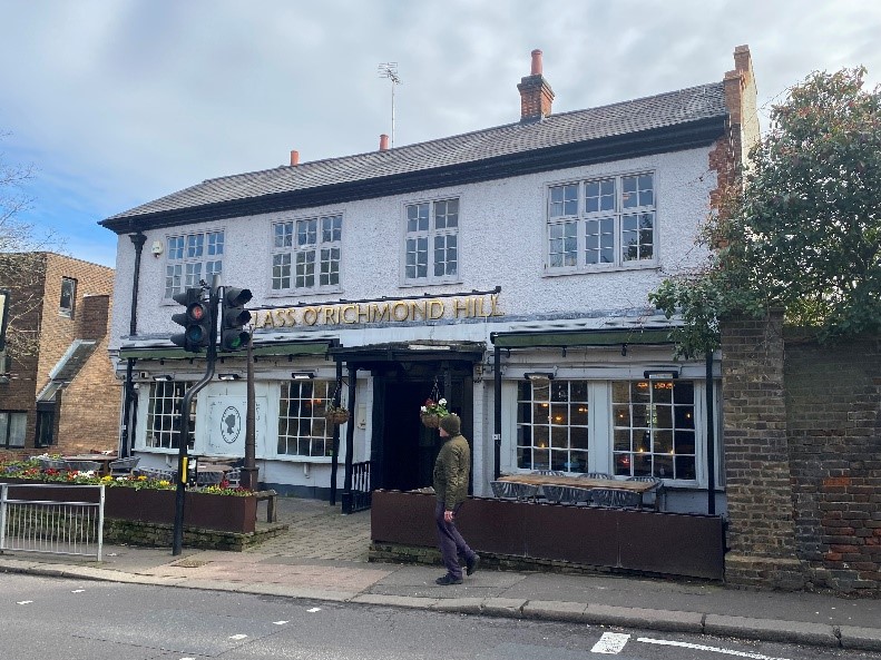
Figure 111 Lass O'Richmond Hill public house
Lass O’ Richmond Hill is a public house on Queens Road. Built over two storeys it has a painted brick finish at ground floor with painted roughcast render at first floor, red brick quoins and timber casement windows.
This public house, which serves its parkside community, further reinforces the sense of remoteness from central Richmond.
Richmond College
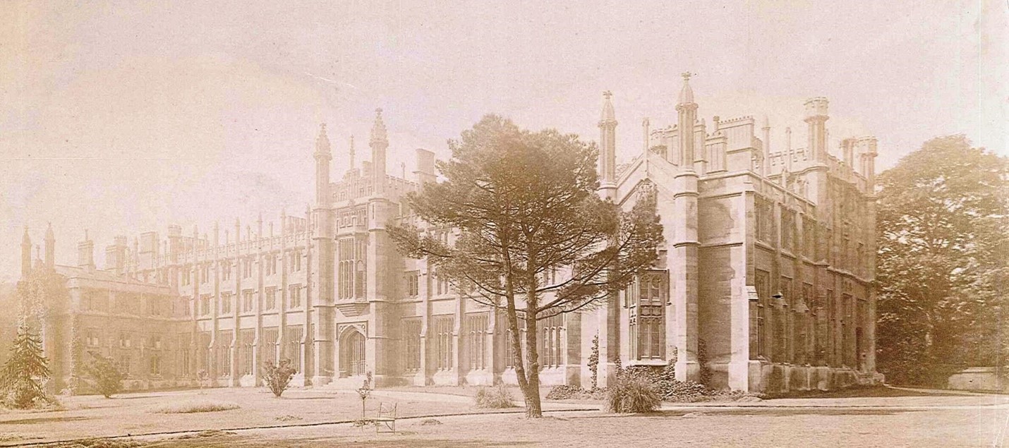
Figure 112 Archive photograph of Richmond College, undated
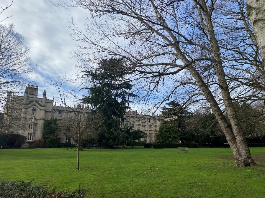
Figure 113 Richmond College
Built between 1841 and 1843 by A Trimmer in the Tudor Gothic style as a Methodist Training college, this long, four-storey ashlar building, set in extensive grounds with lawns and mature trees, is an impressive structure with seven bays on either side of central gate tower. There are projecting gable wings at either end. The mullioned windows have cusped heads. The gate tower has octagonal buttresses, ogee capped finials and a two-storey oriel over the entrance.
Oriels, buttresses and ogeed pinnacles to ends of wings. There are battlements and ogee-capped pinnacles to the central range.
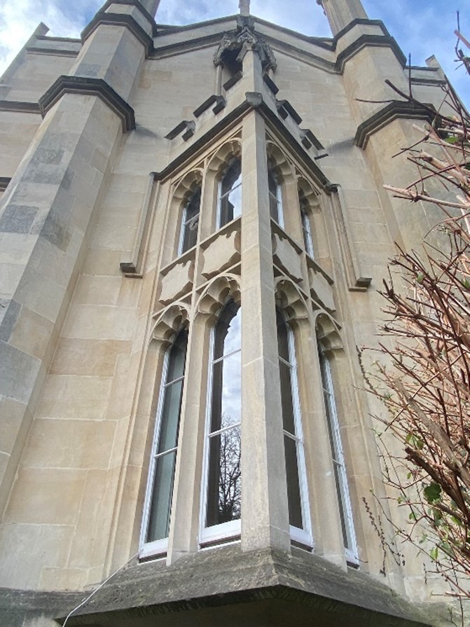
Figure 114 Triangular oriel window
The buildings in Queen's Road, and particularly Richmond University, with its impressive landscape setting, are often hidden away behind high walls and planting with only glimpses of the buildings from the road. This and the presence of mature street trees adds to the rural leafy quality of the area.
Opposite the entrance to Richmond College is the first section of the Queens Road Estate. It continues over a considerable area to dominate much of the south side of Queens Road.
Designed by local architects Darbourne and Darke, Phase 1 of the Queen's Road Estate was developed between 1971 and 1983 by London and Quadrant Homes Ltd for Richmond Parish Lands Charity to provide affordable housing. It includes the houses of Hobart Place and Reynolds Place.
It is grade II listed due to its architectural merit and dynamic housing design, attention to detail and use of high-quality materials.
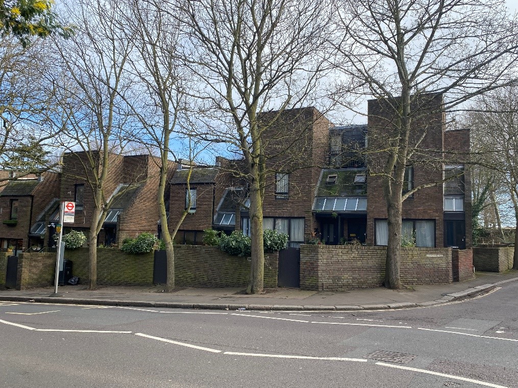
Figure 115 Hobart Place
The Queens Road Estate includes Hobart Place, Reynolds Place and the entrances to Chisolm and Cambrian Roads.
These terraced houses are built over three storeys with integral garages at ground floor.
Built of red-brown brick with brown aluminium windows which have soldier course detail over the window openings, the houses have a mixture of flat parapeted and slate roofs and steel railings to the steps and balconies. The frontages have no boundary walls and coarse aggregate concrete driveways are bounded by red-brown coloured block pavers.
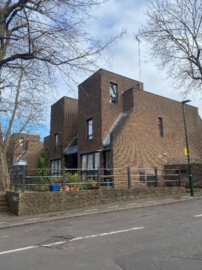
Figure 116 Reynolds Place
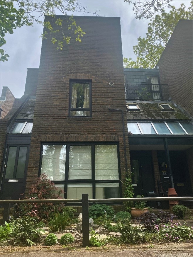
Figure 117 Reynolds Place
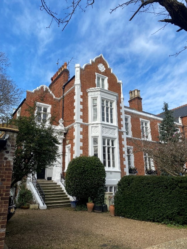
Figure 118 5 Queens Road
In contrast, east of Richmond College lies an imposing pair of red brick Jacobean style houses with double height canted bays and painted stone quoins. These sit behind generous front gardens and give way to a series of Victorian buildings of a similar scale.
15-19 Queens Road is a group of three Victorian red brick terraced houses. Built over four storeys including basement, these substantial buildings have lost their front gardens and boundary walls to provide car parking. This has an adverse effect on the setting of the buildings.
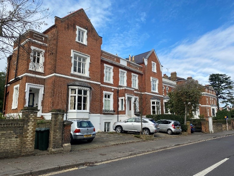
Figure 119 15-19 Queens Road
23 and 25 Queens Road is a pair of red brick three storey plus basement detached houses with central double height rounded bays. Number 21 is very similar in design but is smaller at two storeys plus basement.
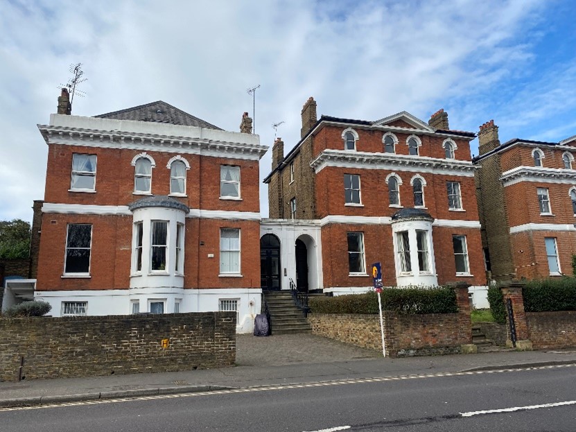
Figure 120 21 and 23 Queens Road
On both Chisholm and Cambrian Roads, the houses of the Queens Road Estate turn the corners and give way to Victorian terraced and semi-detached houses behind leafy front gardens.
Chisolm Road
Figure 121 Semi-detached pair of houses typical of Chisholm Road
Chisholm Road comprises a series of semi-detached Victorian houses built of mixed stock brick and shallow slate roofs. These sit behind modest front gardens and brick boundary walls, often with black railings and hedging. They have white painted rendered canted bay windows and white painted door surrounds. The windows have painted masonry lintels with a keystone.
Figure 122 Original brick boundary wall in Chisholm Road
Figure 123 Uncharacteristic modern concrete wall in Chisholm Road
Cambrian Road
Cambrian Road is much more architecturally varied with different designs and materials but with a similarity in scale.
Figure 124 2-8 Cambrian Road
Two groups of four terraced villa style houses with a white painted render finish sit at four storeys including attic and basement. They have bracketed canted bays at ground floor level and bracketed cills and lintels at first floor. The recessed porches are quite plain. Their slate mansard roofs sit behind a corniced parapet. They sit behind low brick boundary walls and do not have front gardens as such but rather accessways to the basement levels. These houses are quite formal in character and provide contrast to the predominantly relaxed nature of these roads.
Figure 125 10-24 Cambrian Road
Further along Cambrian Road on the east side is a terrace of three storey plus basement stock brick houses with painted timber sash windows, moulded window surrounds and bracketed eaves. Again, as there is external step access to the basement, they do not have front gardens, but this area sits behind low brick walls with iron railings.
Figure 126 13 Cambrian Road
Opposite this terrace is a group of three pairs of semi-detached two storey houses. built of mixed stock brick with painted stone quoins, the painted timber sash windows sit under flat brick arches at first floor level and bracketed lintels at first floor. They sit behind modest front gardens with low brick boundary walls and / or picket fencing.
They are much more modest in scale and design in comparison to the other houses on Cambrian Road.
Both Cambrian and Chisholm Roads bound Richmond Park. This provides an important 'bookend' to each street of mature trees and high walls.
Phase 3 of the Queens Road Estate was developed in the late 1980s by different developers and architects, leading to a less cohesive group. It includes blocks of flats, Caplan Court, Dickson House and Isabella Court. These have a more orange toned brown brick with aluminium windows. This phase is of reduced architectural quality with less detail.
Figure 127 Isabella Court
Figure 128 Dickson House
King George Square is a square of seven terraces located around the old workhouse building. These appear to be late 20th century in date but traditional in design.
Figure 129 King George Square
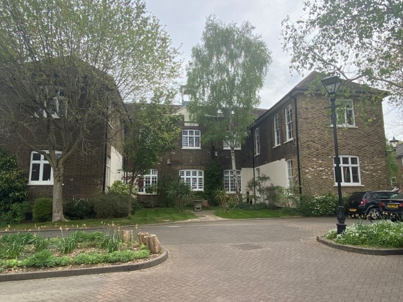
Figure 130 Richmond Workhouse building
The old workhouse building, was the central block of Kingsmead and Grove Road Hospital, formerly known as Grove Road Institution.
The mixed stock brick building is grade II listed and dates from 1786. It has two projecting wings on the front and rear elevations, forming an overall ‘H’ shape. There is a central pediment with a clock face and bell tower. The painted timber casement windows have varying glazing bar configurations.
Figure 131 Gatehouse to Richmond workhouse / King George Square
There is an associated gate house which adds to the character of the site in giving it context so that the original use of the site is still tangible.
The proximity of the various phases of the Queens Road Estate to the workhouse continues the social history of this particular area of the conservation area.
The south easterly boundary of the conservation area is Grove Road Gardens, a pleasant, well treed backwater backing onto Richmond Cemetery, with a visual and physical link to the cemetery chapel.
5.5 Character area 5 - The Vineyard
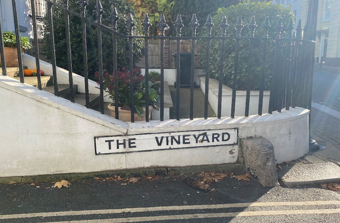
Figure 132 Entrance to the Vineyard from Hill Rise
This is the most urban part of the Conservation Area, a dense residential enclave close to the town centre. In contrast to Richmond Hill, the building height is mainly two storey, with stock brick and slate roofs predominating. This character area has a particularly high number of listed buildings.
The area is well provided with trees but, with the exception of the graveyard at Vineyard Passage, these are mainly in front gardens as opposed to street trees. The graveyard provides a welcome quiet open space of historical interest.
The enclaves of Ormond Avenue, Michel's and Bishop Duppa's Almshouses and Lancaster Cottages add considerable interest to the 18th and 19th century townscape, with alleyways, entrance gates, courtyards and gardens leading off the main streets. A characteristic of this area is the ceramic street signs to several streets, inset into walls.
The Vineyard is characterised by variety rather than similarity of buildings, with a sinuous and narrow approach to the Church of St. Elizabeth at one end giving identity to the whole street, its prominent tower serving as a local landmark.
The decorative ridge tiles and distinctive chimneys make an important contribution to the varied skyline with height and direction of roof ridge variations.
Front boundary walls and planting are very important in this character area, reinforcing the enclosure of the street and forming a setting to the buildings.
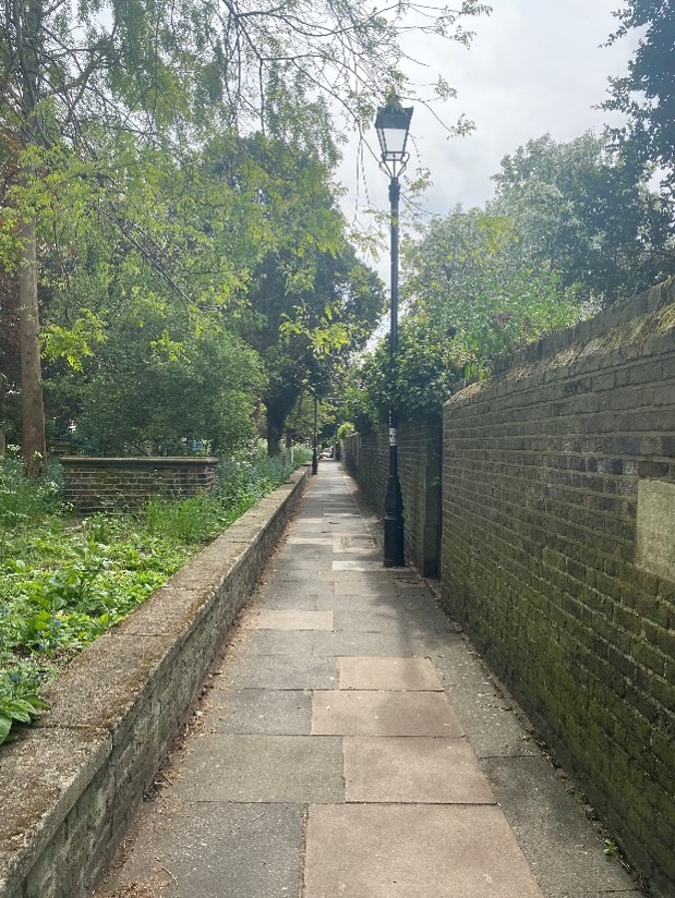
Figure 133 Vineyard Passage
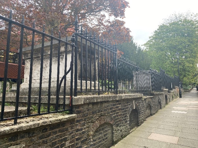
Figure 134 Vineyard burial ground
The Vineyard Passage burial ground dates from the early 1790’s and was in use until the 1870s. in the 1960s the graveyard was declared a public open space and place of rest. It is managed by the London Borough of Richmond upon Thames. It includes table tombs, sarcophagi, an obelisk and a large Grecian tomb of T. Cundy, 1825, the architect of Pimlico. There are also monuments to members of the French émigré community who settled in Richmond in the 1790s. The vault arches are visible in the brick walls along the Vineyard Passage path. The brick walls and iron railings are grade II listed.
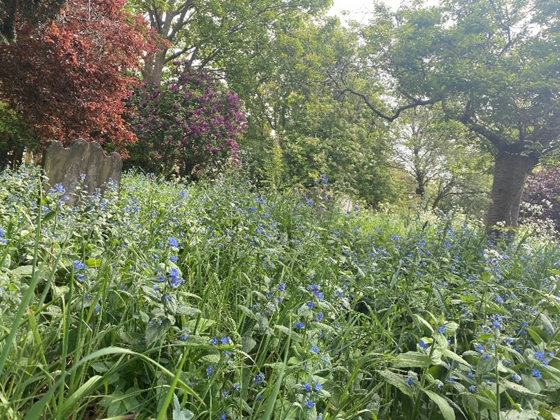
Figure 135 Wildflowers in the Vineyard burial ground
The Vineyard
At the eastern end of The Vineyard, closest to Vineyard Passage, there is a very high-quality townscape accentuated by bends in the road and distinctive buildings. The curved frontage of 30 The Vineyard, built of mixed stock brick with red brick banding reflects the bend in the road.
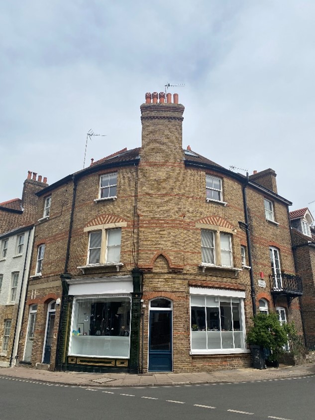
Figure 136 30 The Vineyard
This forms part of the same group as the 18th century grade II listed Vineyard House.
There is a grade II listed K6 telephone box outside number 20 of the 1935 Giles Gilbert Scott design.
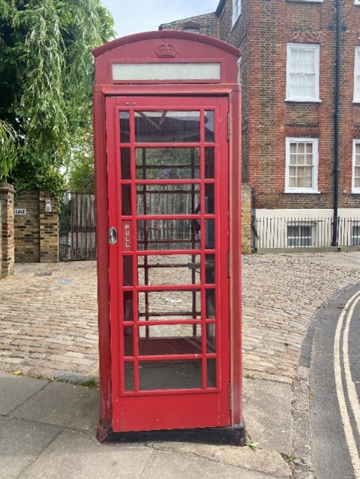
Figure 137 K6 Telephone box
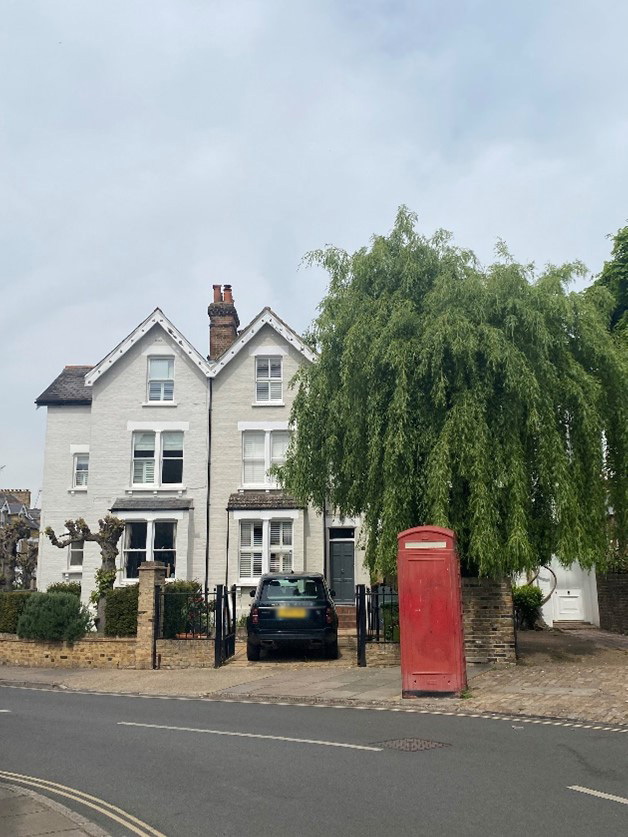
Figure 138 20-24 The Vineyard
Figure 139 31 The Vineyard
Figure 140 23-29 The Vineyard
Immediately next door are numbers 23-29 The Vineyard, a group of two pairs of Georgian semi-detached two storey houses built of mixed stick brick with painted timber sash windows. The easternmost pair has retained its front boundary wall and garden but the other has lost these to facilitate car parking.
Figure 141 16-18 The Vineyard
Opposite lies a semi-detached pair of Victorian mixed stock brick houses built over two storeys. The painted masonry canted bay windows and gabled dormers add to the visual interest of these buildings.
Even from this point of the Vineyard, the spire of St Elizabeth of Portugal is visible, and this view unifies the road.
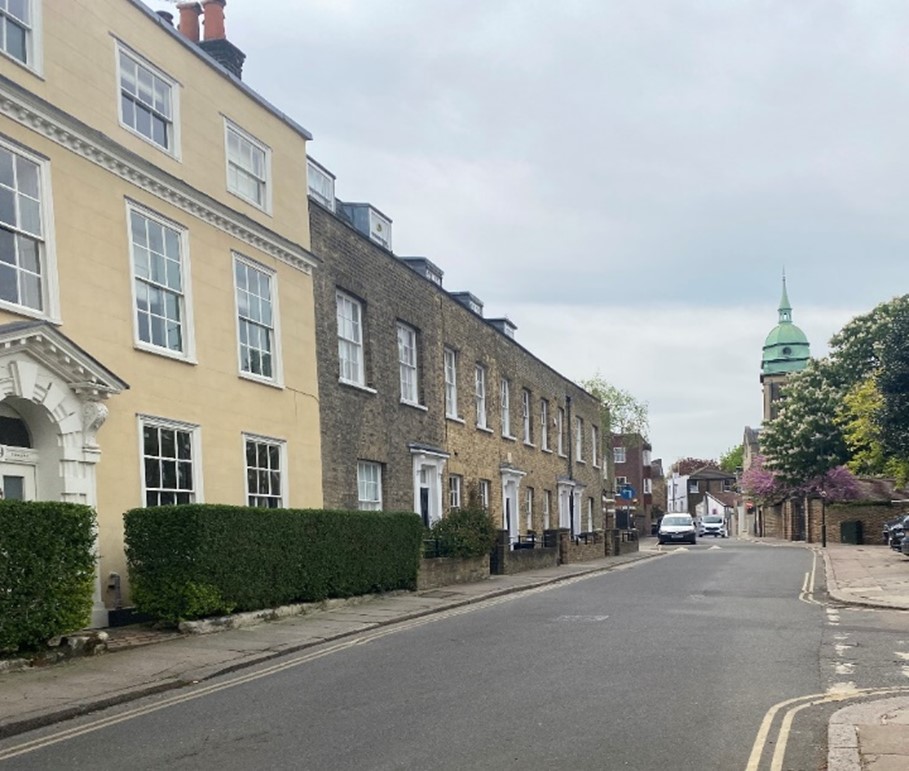
Figure 142 View of the spire of St Elizabeths church
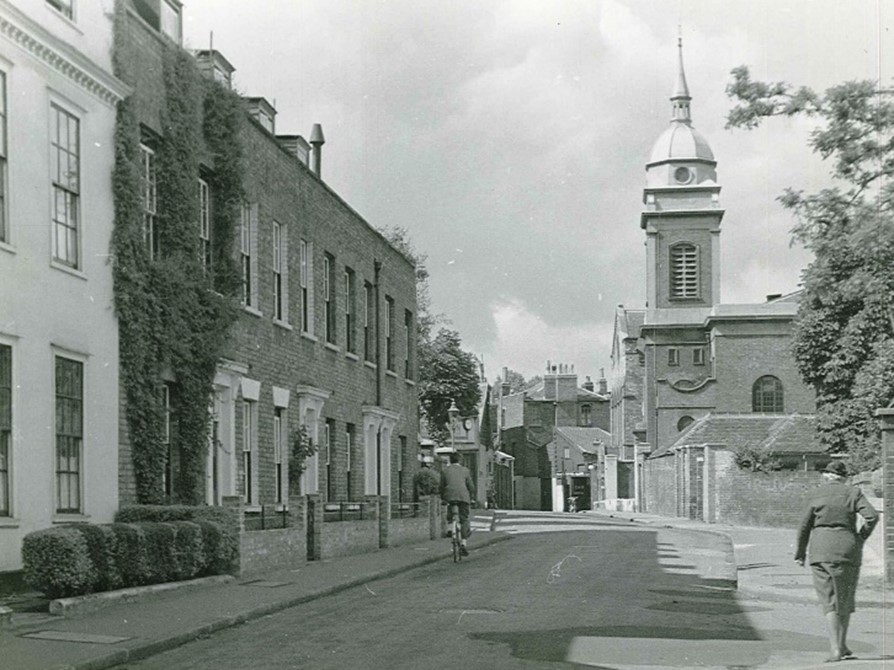
Figure 143 Similar view of St Elizabeths c1950
Almshouses are a strong feature of the Vineyard.
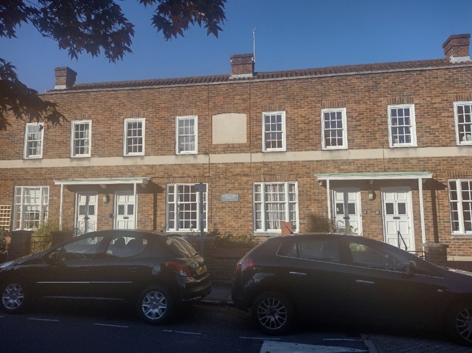
Figure 144 St Elizabeths Almshouses
St Elizabeth Almshouses were originally founded in 1606 and have been rebuilt a number of times in a number of locations. The first almshouse built on this site was built in 1767. The present building was constructed in 1955 following bomb damaged from the second world war. It is a simple red brick building with painted timber sash windows and a parapet roof. There are simple copper roofed porches to the entrance doors.
Bishop Duppa’s Almshouses were first founded in 1651 but rebuilt in 1850 to the current design. The Jacobean style yellow brick building is centred around a central archway leading to the gardens beyond. The tripartite timber sash windows have a modest character. The stone parapet roof has stone strapwork finials at regular intervals. The monumental classical central gateway is arched with a pedimented head. The prominent Jacobean style chimneys add greatly to the skyline of The Vineyard. The brick and flint boundary wall with its pedimented entrance and gates adds significant visible interest to the street scene.
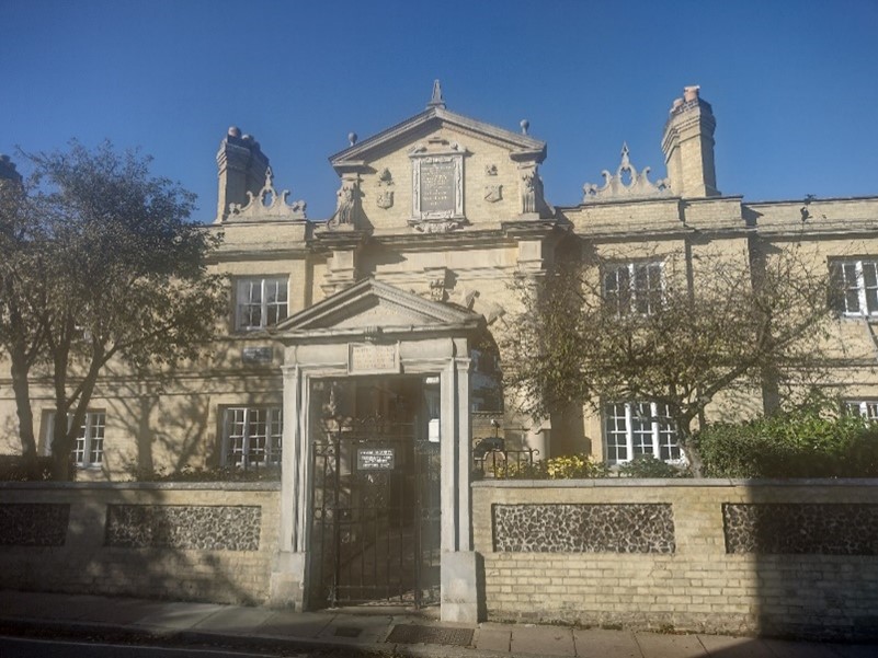
Figure 145 Bishop Duppa's Almshouses
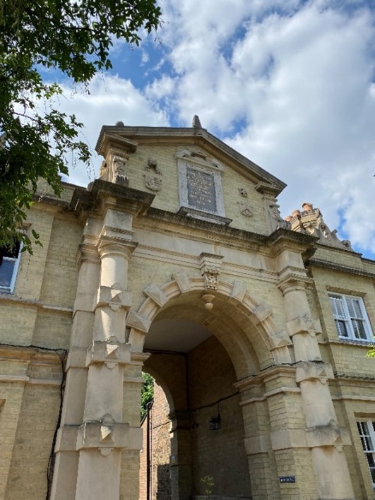
Figure 146 Arched entrance to Bishop Duppa's Almshouses
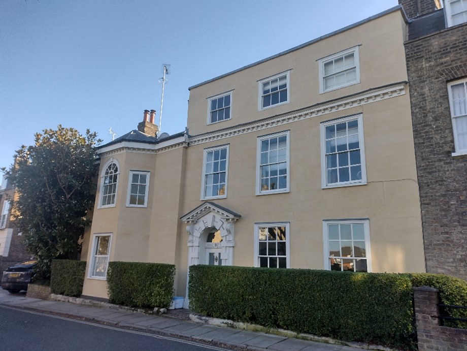
Figure 147 Newark House
9 The Vineyard / Newark House is a grade II* listed 18th century house. Faced in stucco with a modillion cornice between first and second floors, it has a slate mansard roof behind the parapet. The front door has a rusticated surround and open pediment.
This adjoins Michel’s Place, 1-7 The Vineyard, which is a modest grade II listed early 19th century terrace. Built of mixed stock brick with slate mansard roofs behind the brick parapets, the most distinctive feature of these house is their stucco door surrounds with bracketed cornice hoods and corbels.
Figure 148 Michel's Place
A third set of almshouses, Michel’s Almshouses was built in 1811 on the site of the 1659 foundation. These almshouses follow the predominant scale of the Vineyard at two storey. They are built of mixed stock brick and have pitched slate roofs to eaves. The buildings are centred around a pleasant garden of lawn and flower beds. This arrangement is unusual for the Vineyard and adds variety and softens the streetscape.
Figure 149 Michel's Almshouses
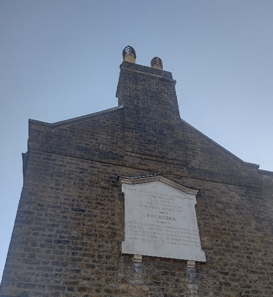
Figure 150 Plaque at side of Michel's Almshouses
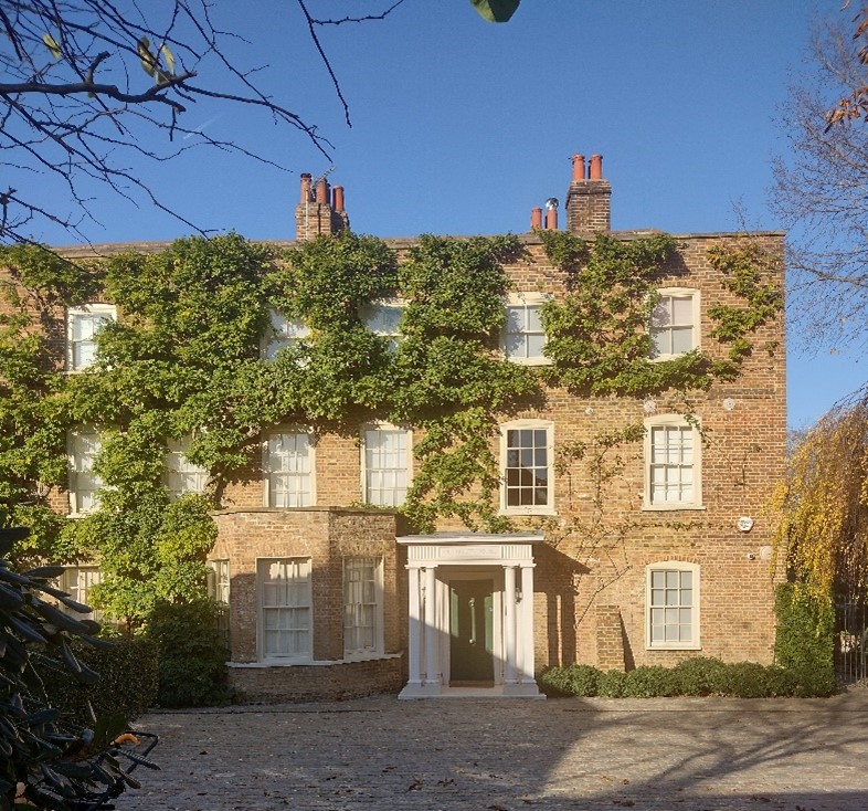
Figure 151 Clarence House
Clarence House, 2 The Vineyard, is a grade II listed 18th century detached house. It is well set back from the road behind a large front garden, high brick walls and gates. The gardens borders Patten Alley which links the Vineyard to Ormond Road. It is built of mixed stock brick with a slate mansard roof behind a brick parapet. The off-centre entrance door sits under a simple classical porch. A blue plaque to Bernardo O’Higgins is mounted on the boundary wall.
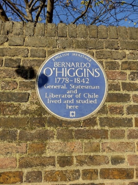
Figure 152 Blue plaque to Bernardo O'Higgins outside Clarence House
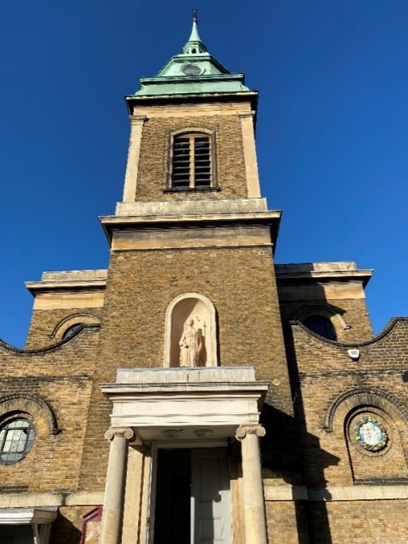
Figure 153 Church of St Elizabeth
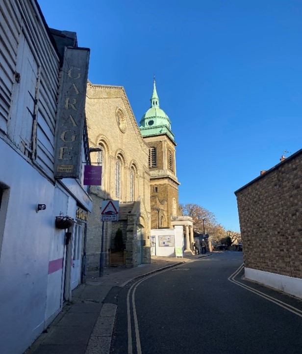
Figure 154 Church of St Elizabeth as viewed from Hill Rise
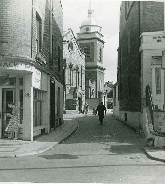
Figure 155 Church of St Elizabeth as viewed from Hill Rise, 1952
Located just south of The Vineyard, is grade II listed Vine Row. This group of 18th century rendered timber framed cottages have timber sash windows with a mixture of timber glazing bars and leaded lights. The bracketed eaves have dentil details, and the clay tiled mansard roof has three flat topped dormers.
Figure 156 Vine Row
The nearby Lancaster Cottages built in the 1830s are of similar proportions and character. Built of mixed stock brick, these modest cottages have painted timber sash windows. They are tucked away in a narrow lane which adds to their charm.
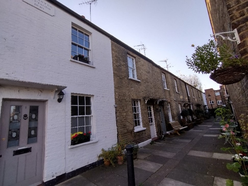
Figure 157 Lancaster Cottages
Ormond Road
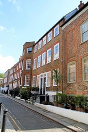
Figure 158 Ormond Terrace
Ormond Road appears as little more than a laneway when accessed from Hill Rise. The road is very narrow between the cinema and Ormond Terrace.
Its tight knit spatial character and enclosed atmosphere gives a sense of drama to the narrowness of the road given the three storey plus basement heights of the terraced houses and cinema opposite.
Ormond Terrace is an important and intact early 18th century group of grade II and II* listed houses. A variety of red and mixed stock brick adds diversity to the terrace, but it is unified in scale and overall design. The painted timber sash windows are identical across all houses in the group.
The front door treatment varies from Doric porches, bracketed canopies, to a complete lack of door surround. The fanlights also vary in design and reflect the development history of the row.
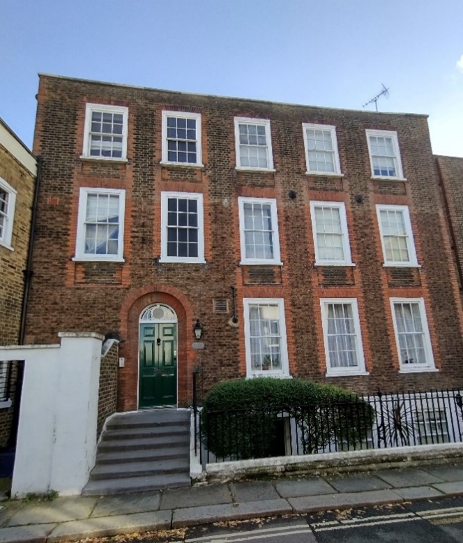
Figure 159 Ormond House
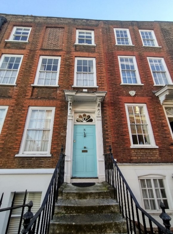
Figure 160 6 Ormond Terrace
The road widens slightly to reveal the contrasting Victorian red brick Richmond and Putney Unitarian church, built in 1896 and set back from the road behind a low brick wall and hedge.
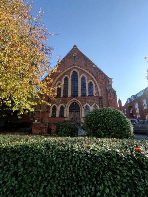
Figure 161 Richmond and Putney Unitarian Church
Opposite the church lies Ormond Avenue, a secluded leafy enclave accessible only by a central pedestrian path. It leads to a terrace of two storey houses, built in 1896 of brick construction, though the majority have been painted. There is a narrow central communal garden which greatly adds to the character of the Avenue and gives privacy to the houses, forming a leafy barrier between overlooking houses.
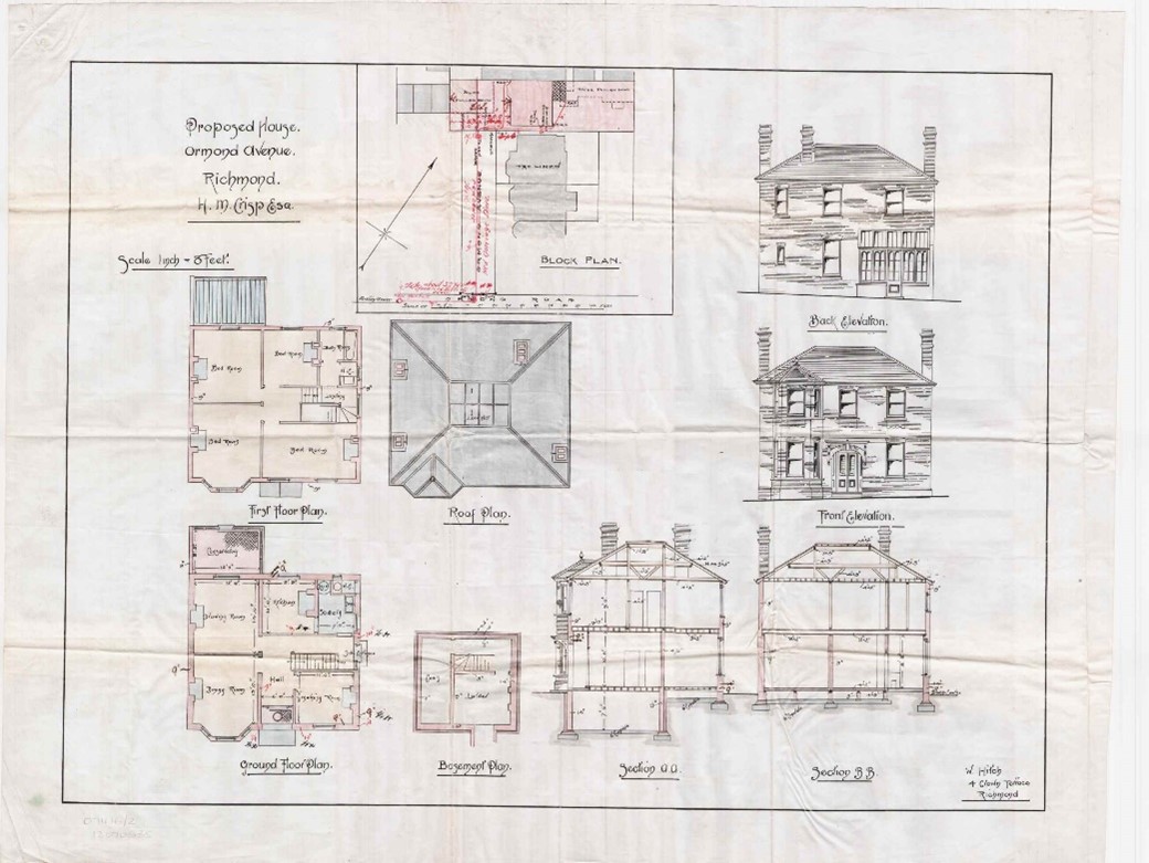
Figure 162 Original drawing for house in Ormond Avenue, undated
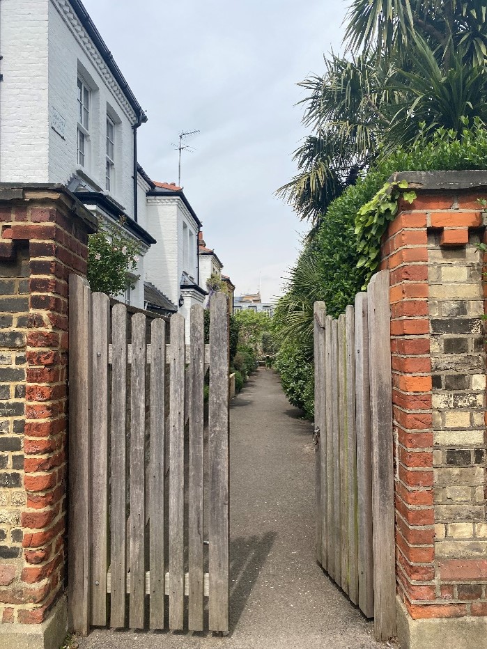
Figure 163 Entrance to Ormond Avenue
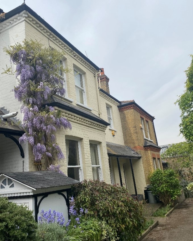
Figure 164 West side of Ormond Avenue showing central communal garden
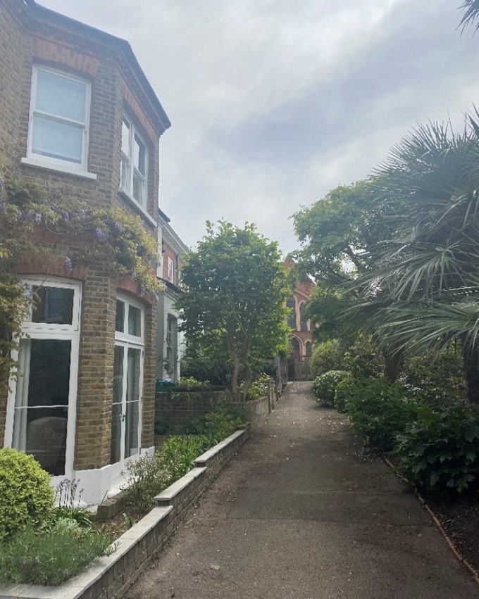
Figure 165 East side of Ormond Avenue showing view of Unitarian church beyond
The grade II listed 18th century pair of houses, The Hollies and The Rosary sits within Ormond Avenue. Its side elevation faces Ormond Road and shows its distinctive M shaped roof to best advantage. These are shallow houses, with The Rosary being accessed from the “front” elevation and The Hollies from the rear.
Figure 166 The Rosary / The Hollies
Figure 167 The Vicarage / Ormond Lodge
The Vicarage / Ormond Lodge is a late 18th / early 19th century mixed stock brick house, which is set well back from the road behind high brick boundary walls.
Opposite the Vicarage is a timber framed building, currently home to The Stables and Richmond Guitar Workshop. This is an unusual building in its context and forms a definite termination point for Ormond Road.
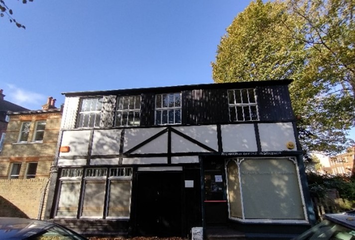
Figure 168 24 Ormond Road
The grade II* listed Bethlehem Chapel sits on the corner of Church Terrace and Ormond Road. Built in 1797, this was originally a Calvanist church. The single storey church is modest in scale and design, providing contrast within the street scene on a prominent corner. While it is now a detached building with planting and trees occupying the corner site, it was once part of a cramped series of buildings as seen below in the archive photograph.
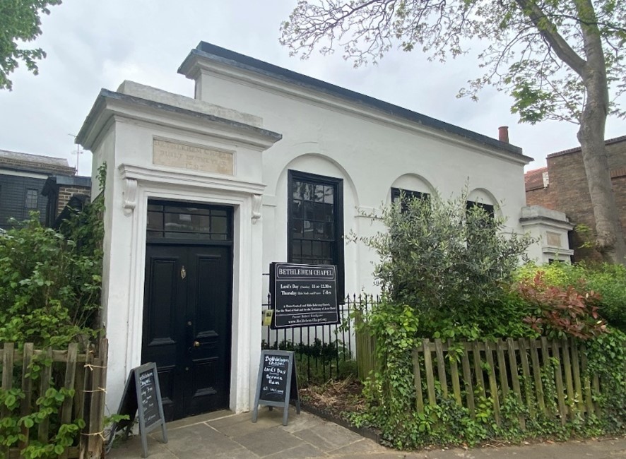
Figure 169 Bethlehem chapel
Wakefield Road is dominated by Richmond Bus Station. It suffers from views to the rear elevations of shops on Red Lion Street. The Elephant restaurant now occupies the former cricket pavilion.
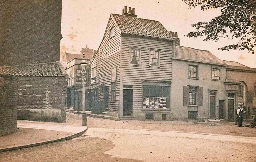
Figure 170 Corner of Church terrace and Ormond Road showing buildings adjoining Bethlehem chapel. Undated
The Hermitage
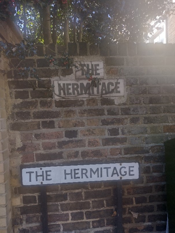
Figure 171 Old and new street signs of The Hermitage
The Hermitage has a uniform character in contrast to that of The Vineyard insofar as it comprises three groups of buildings.
Five pairs of two storey plus basement houses lie at the west side of the road and another five pairs of semi-detached three store plus basement houses sit at the eastern side.
These are built of mixed stock brick with painted stone quoins, painted masonry canted bays at ground and basement level and simple recessed porches with Doric pilasters. They have stepped access to recessed porches with rendered columns and entablature, timber doors and fanlights.
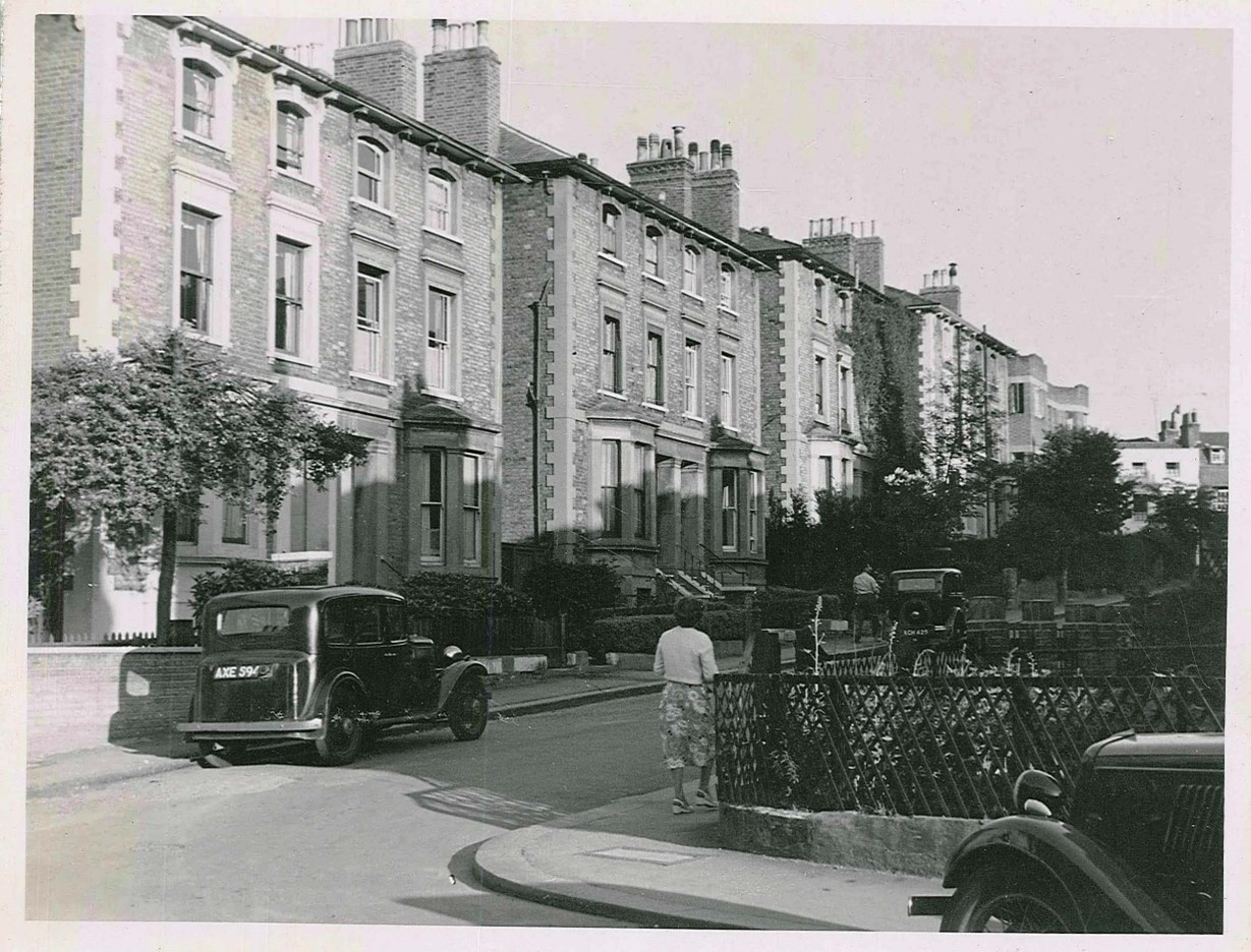
Figure 172 The Hermitage 1952
All of the front gardens have been lost to car parking, with many entirely devoid of boundary walls. This loss of the front boundary separating the road from the building compromises the setting of the building and in turn, its character. The loss of planting also has a detrimental effect on the character of the building and overall street scene. Loss of greenery is also damaging from an environmental point of view.
Guidance on the use of front gardens for car parking can be found in the Council’s Transport SPD (pdf, 865 KB) (2020). The Council will normally resist replacement of gardens with hard standings for car parking, where planning consent is required. However, in the limited cases where it would be acceptable (for example, where the removal of kerbside parking would enable the widening of a pavement, the provision of a cycle lane or relieve traffic congestion) it is very important that off street parking, should be designed to cause minimum intrusion and harm.
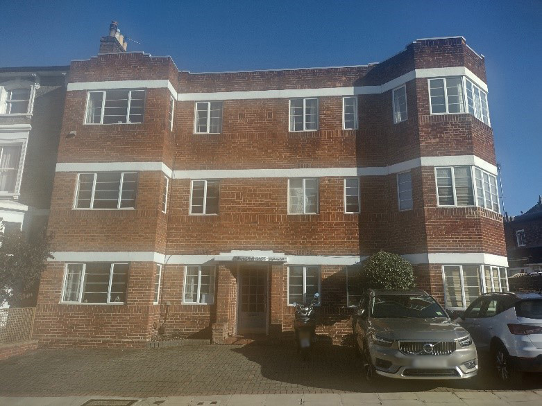
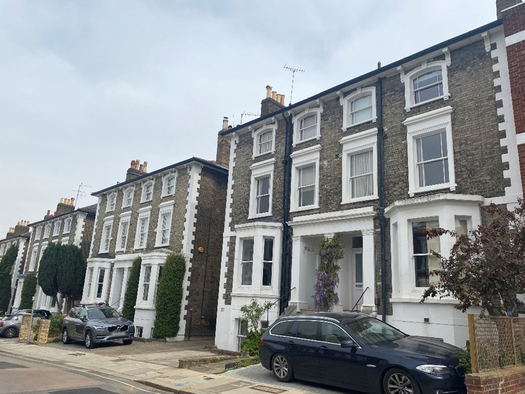
Figure 174 23-28 The Hermitage
The west side of The Hermitage is more modest in scale, at two storeys plus basement.
It comprises six semi-detached pairs of Victorian houses with cornice detail between ground and first floors as well as at parapet level. Slate mansard roofs with dormers sit behind. These have also lost their front gardens to car parking. Two of the houses have been painted and two pairs have canted bays. Otherwise, the group is unified in design.
Figure 175 West side of The Hermitage showing prevalent car parking in front gardens
Halford Road
Halford Road, parallel to The Hermitage is even more consistent in design. The two-storey mixed stock brick houses all have painted masonry canted bays at ground floor, shallow rounded arches over the recessed porches, gabled dormers and painted timber sash windows. The terraces closest to The Vineyard have a basement storey. This difference in height accentuates the slope of the land.
Figure 176 East side of Halford Road
Figure 177 Details of original doors in recessed porches
The loss of front gardens and boundary walls to car parking is also prevalent here though there are many boundary hedges between properties which helps to soften this.
Figure 178 Example of front garden parking in Halford Road
Figure 179 View of Halford Road showing presence of hedges between properties
6. Architectural Details
Figure 180 Street art on side of steps to 62 Hill Rise
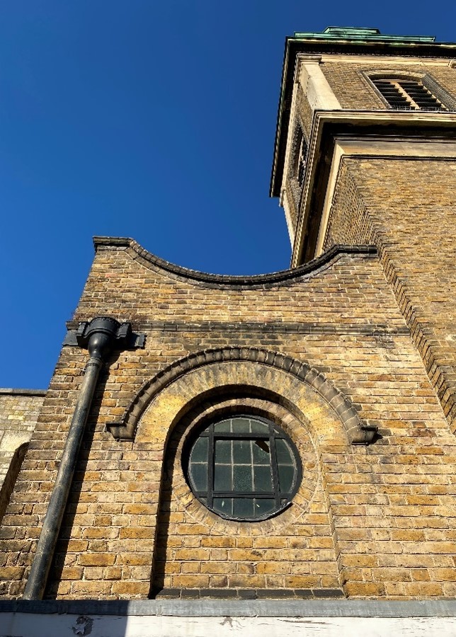
Figure 181 Round window detail at Church of St Elizabeth
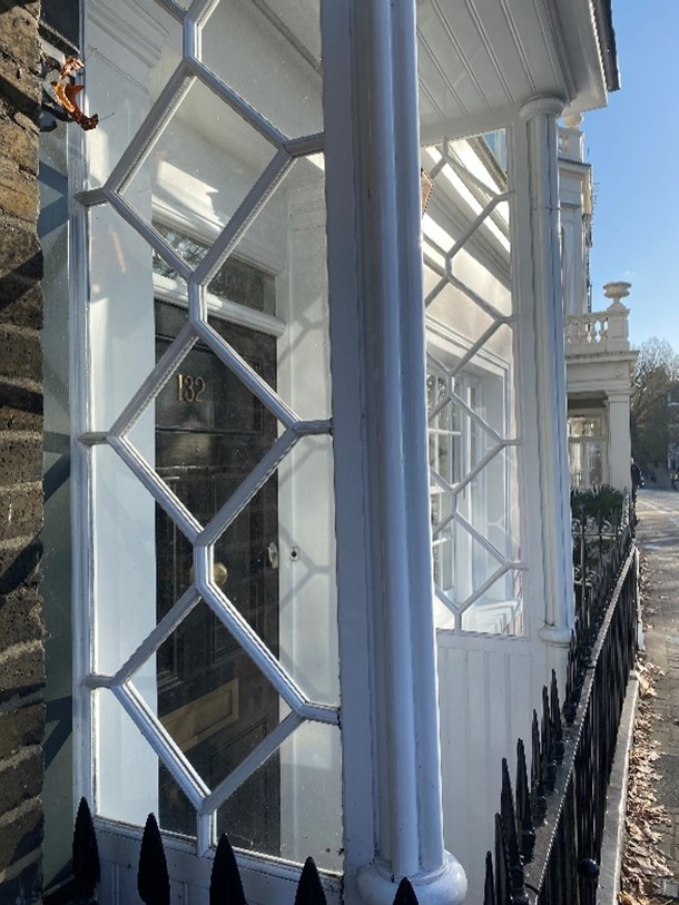
Figure 182 132 Richmond Hill
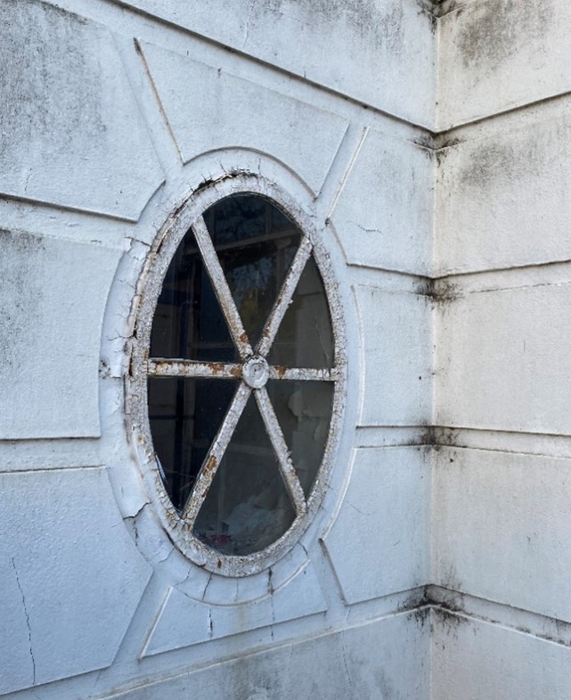
Figure 183 Round steel window at Wick House
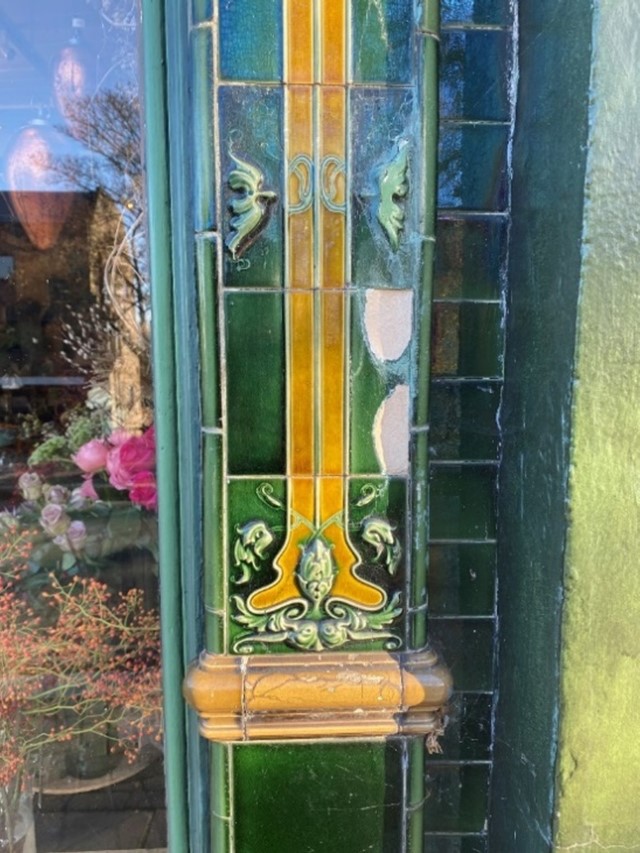
Figure 184 Glazed tile details at 62 Hill Rise
Figure 185 Doorcase detail at 46-56 Hill Rise
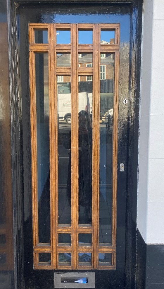
Figure 186 Geometric door detail at Richmond Park Hotel
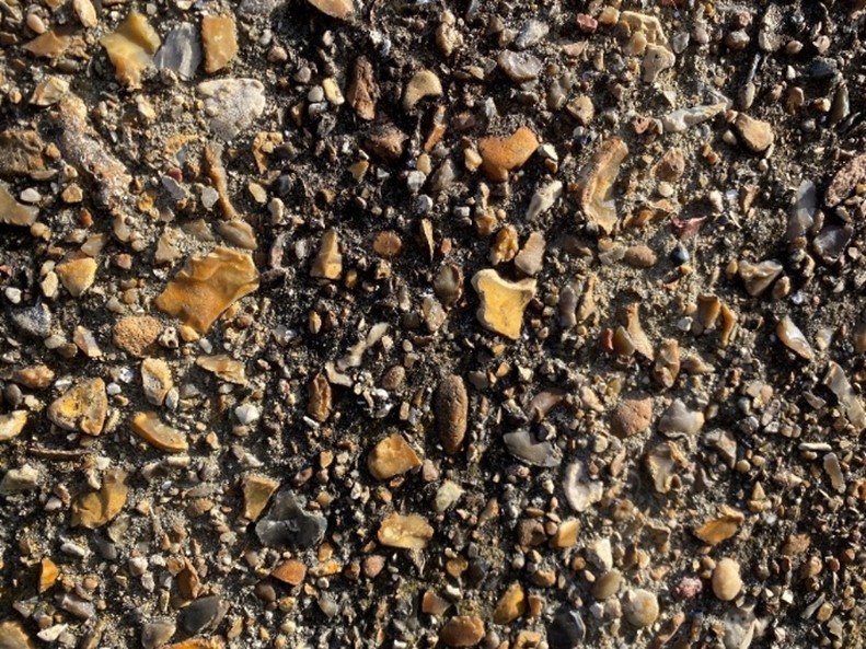
Figure 187 Pebbledash wall on Thames towpath
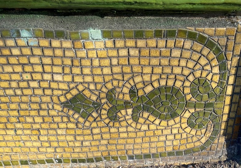
Figure 188 Mosaic detail at 62 Hill Rise
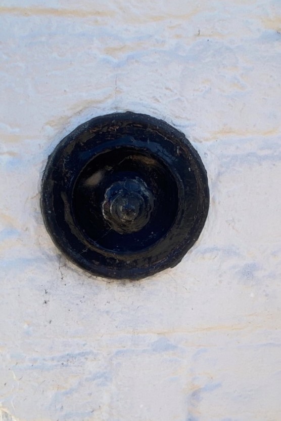
Figure 189 Doorbell of 34 Petersham Road
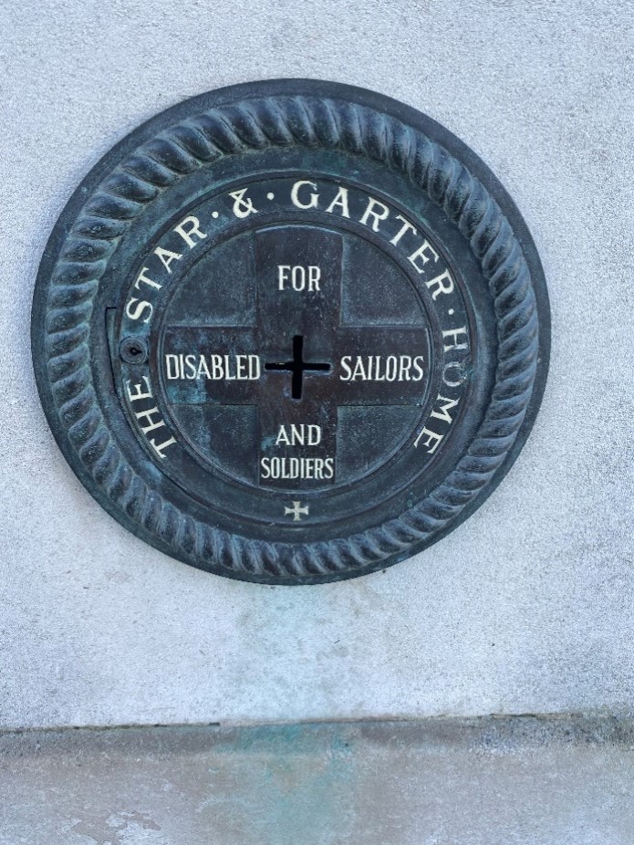
Figure 190 The Star and Garter memorial
Figure 191 Shutter details under Richmond bridge
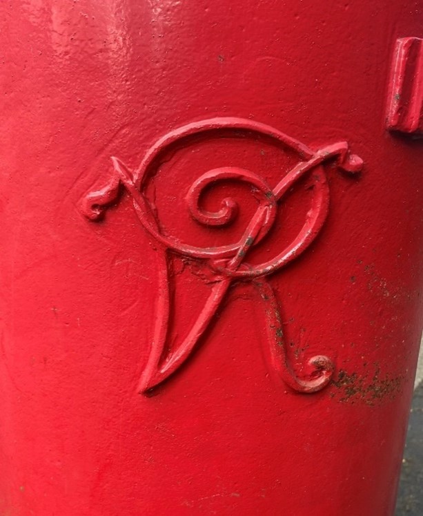
Figure 192 Detail of Victorian postbox
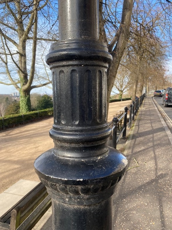
Figure 193 Lamp post detail on Richmond Hill
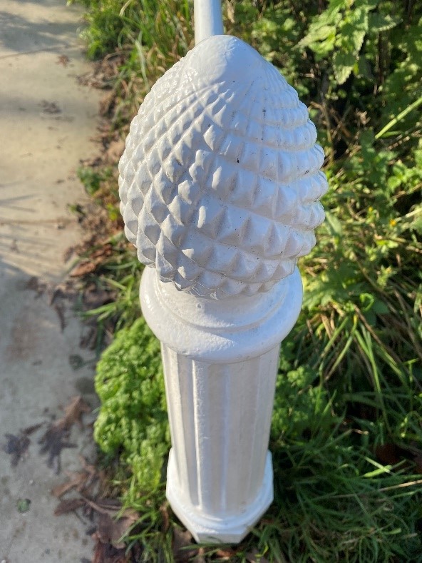
Figure 194 Distinctive bollard detail on Terrace walk
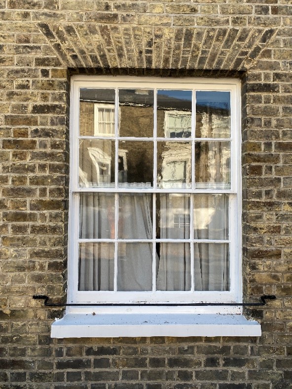
Figure 195 Timber sash window in Michel's Place
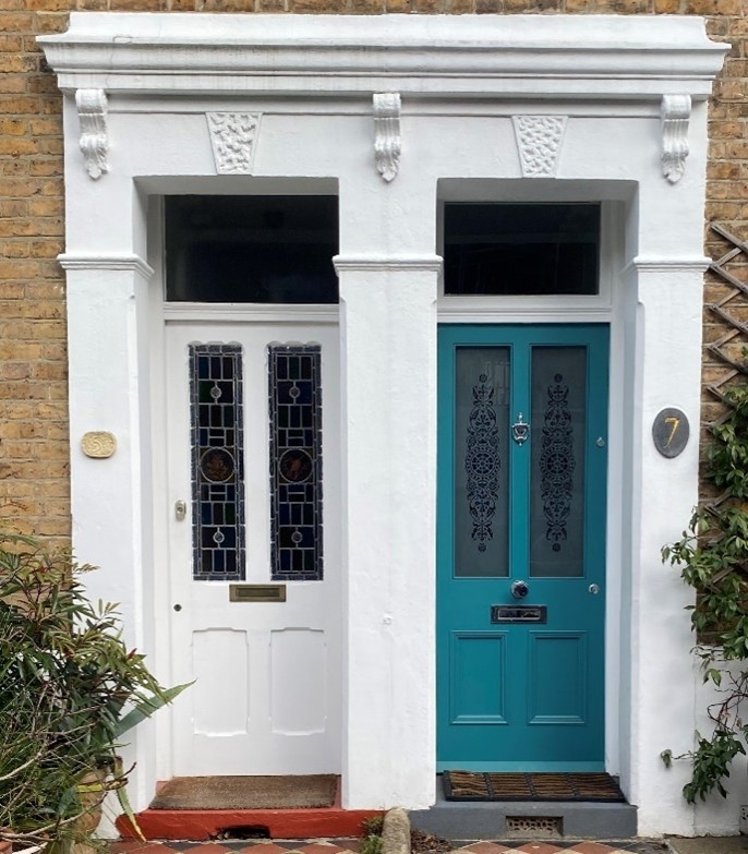
Figure 196 Pair of doorcases in Chisholm Road
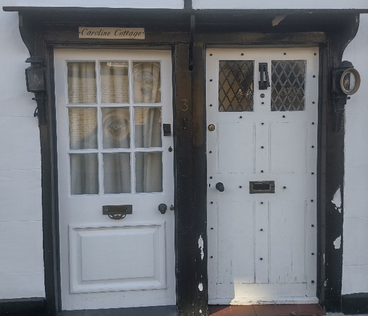
Figure 197 Pair of doors in Vine Row showing a replacement door beside an original
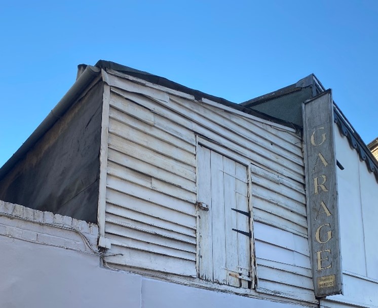
Figure 198 Surviving upper floor hay loft in The Vineyard
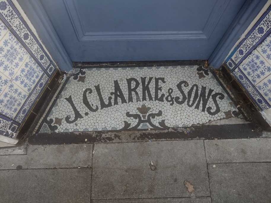
Figure 199 Mosaic tiled entrance to 84 Hill Rise
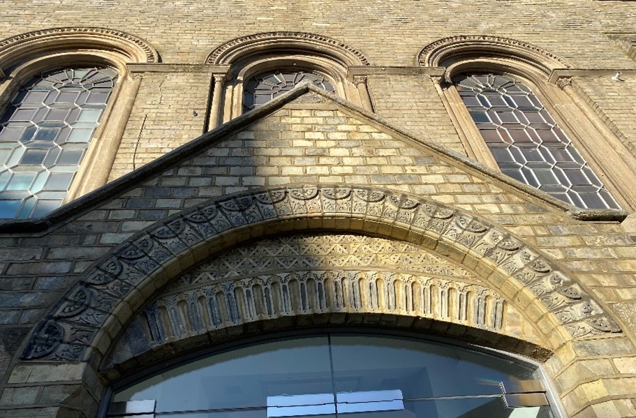
Figure 200 A series of arches over the entrance to the Church of St Elizabeth
Figure 201 Arch in the brickwork of the Vineyard Passage Burial Ground
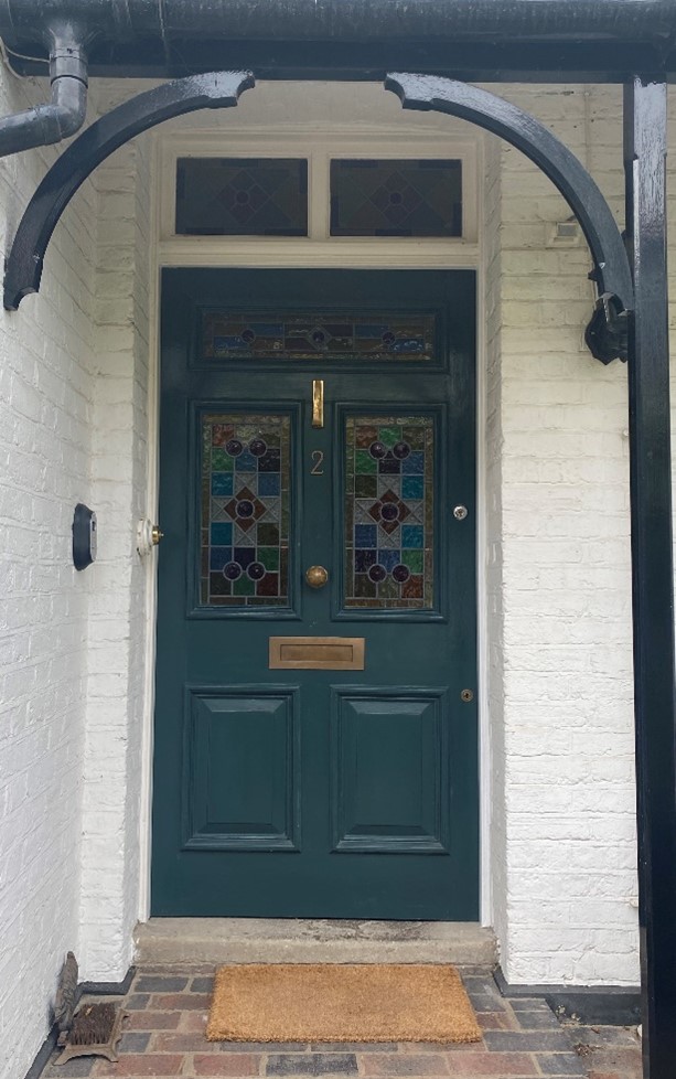
Figure 202 A Replacement door at 2 Ormond Avenue which carefully replicated the original pattern of the stained glass
7. Open Space, Parks, Gardens and Trees
An overview of private and public spaces; front gardens, trees, hedges, street planting, historic parks and gardens, civic spaces and their contribution to the character and experience of an area.
Overview
This is a major area of metropolitan open land of rural character, forming a great contrast to the surrounding townscape, and also to the more manicured landscapes of Terrace Gardens, Buccleuch Gardens and adjoining riverside open spaces. It is a part of a large-scale structural belt of open land from Richmond Park through to Marble Hill and Ham Lands, and along the riverside into the Old Deer Park and Kew Gardens.
These areas form an important part of the 'Arcadian Landscape' of visually interlinked landscapes of historic importance associated with the Thames. More background can be seen in the Thames Landscape Strategy.
Bridge House Gardens is a small garden south of Richmond Bridge, affording impressive views of same. The land slopes away from the level of the bridge to the riverside, with the greenery generally confined to this incline. There is lawn, hedging and several mature trees. A bust in memorial to Bernardo O’Higgins is within this part of the garden.
The area closest to the river is generally level and has a gravel finish but has several mature London Plane trees. There are a considerable number of benches, taking advantage of the view of the river and the bridge. A brick retaining wall separates this from the Thames towpath.
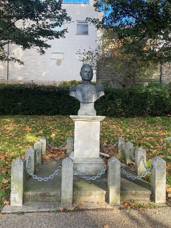
Figure 203 Bust of Bernardo O'Higgins in Bridge House Gardens
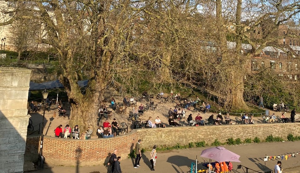
Figure 204 Bridge House Gardens as viewed from Richmond Bridge
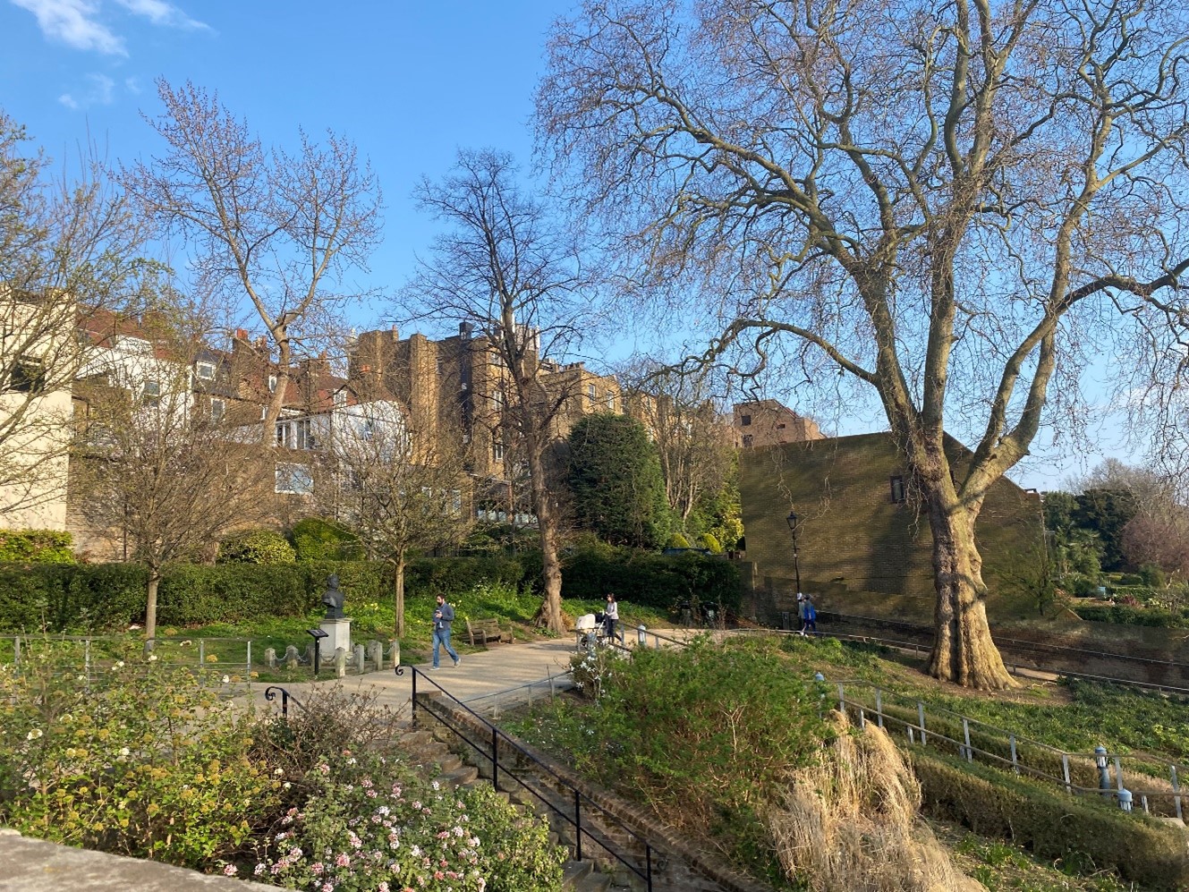
Figure 205 Upper section of Bridge House Gardens
Rotary Gardens is a modest amount of lawn which lies between 21-47 Petersham Road and the Thames towpath.
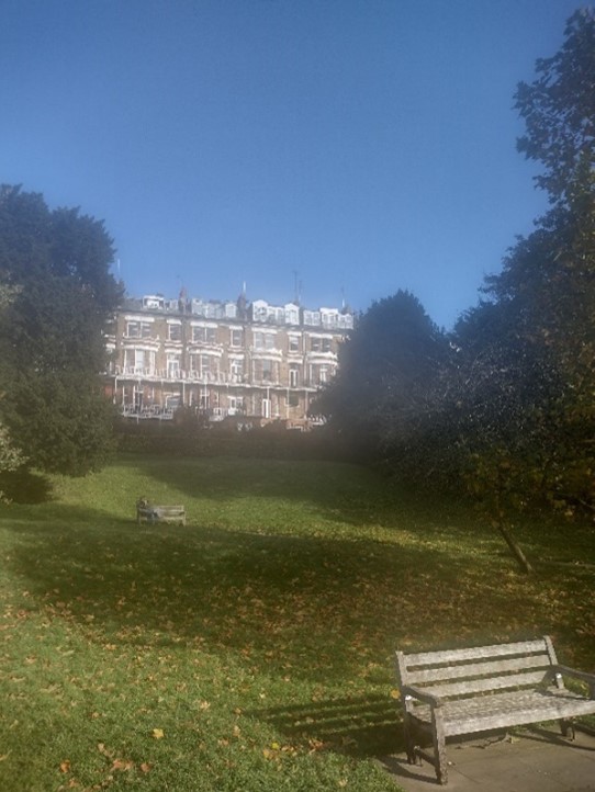
Figure 206 Rotary Gardens as viewed from the Thames towpath
Gothic Gardens is a small, terraced garden with lawn, sculpted hedging and benches overlooking the river.
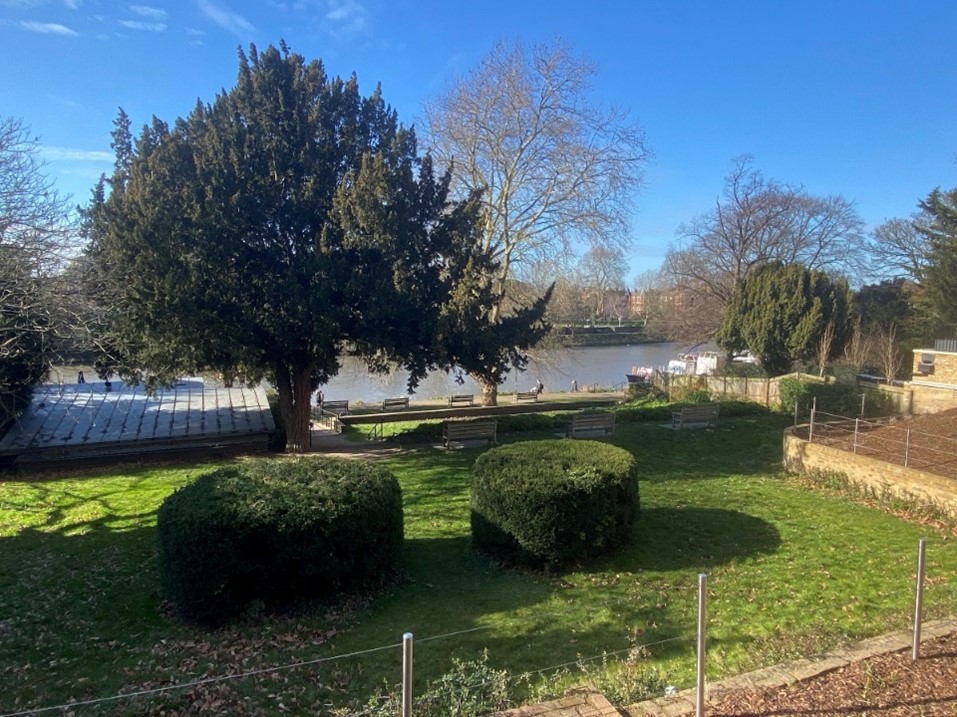
Figure 207 Gothic Gardens
Riverdale Gardens slopes from Petersham Road to the river. It is generally made up of lawn and mature trees but has some contemporary brick walls close to the towpath which feature raised flowerbeds.
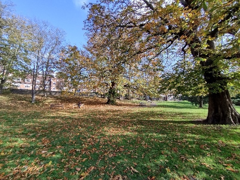
Figure 208 Riverdale Gardens
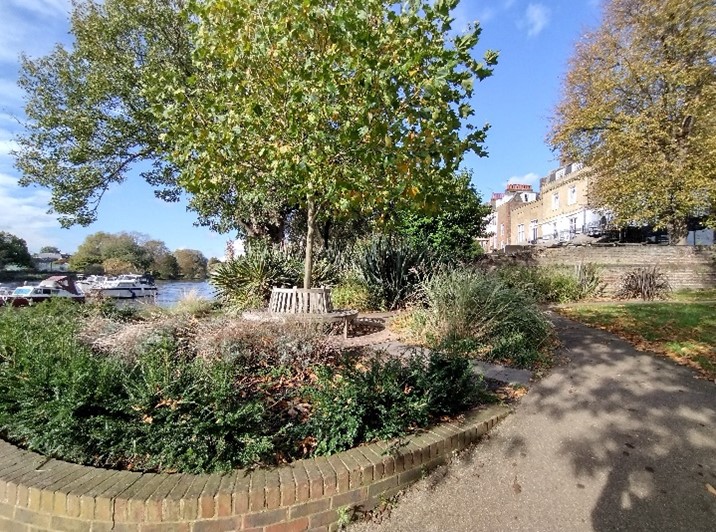
Figure 209 Riverdale Gardens with flower beds
Terrace Gardens
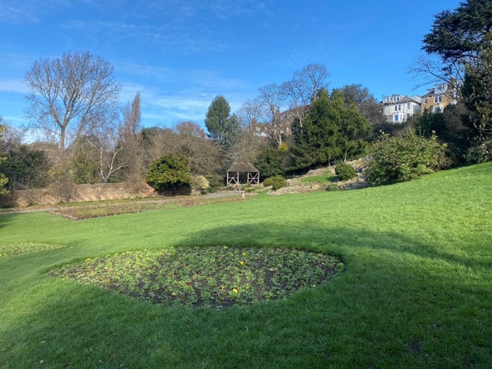
Figure 210 Lower section of Terrace Gardens
This grade II registered park and garden is the most substantial and significant green space within this Conservation Area.
It slopes from Richmond Hill towards the river and has a Victorian parkland character.
Formerly the grounds of Buccleuch and Landsdowne Houses, it opened in 1887. It includes serval small buildings including a greenhouse and a 19th century thatched cottage ornee-style tearoom. It retains much of the intimate feel of a private garden despite being located between two main roads.
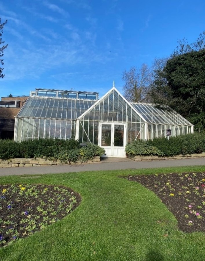
Figure 211 Greenhouse in Terrace Gardens
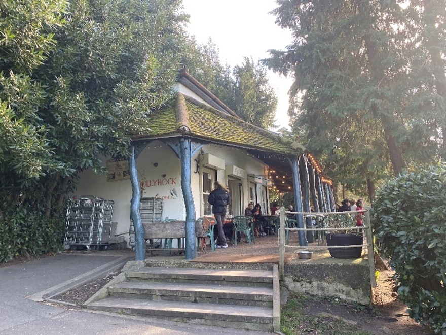
Figure 212 Tearoom in Terrace Gardens
The grounds of neighbouring Cardigan House were incorporated in the 1920s. These gardens are a tangible link to the grand houses which once stood here and the aristocratic families who lived in them.
Mature trees and lawn are broken up by flower beds. There are many benches within the gardens as well as bins for public use. There is an ornamental pond and a green timber hut which is unfortunately prone to vandalism.
Terrace Field lies directly to the south of Terrace Gardens. There is no formal distinction between the two areas of green space.
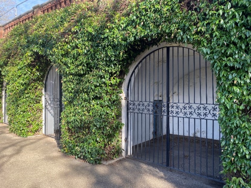
Figure 213 Arches under Petersham Road
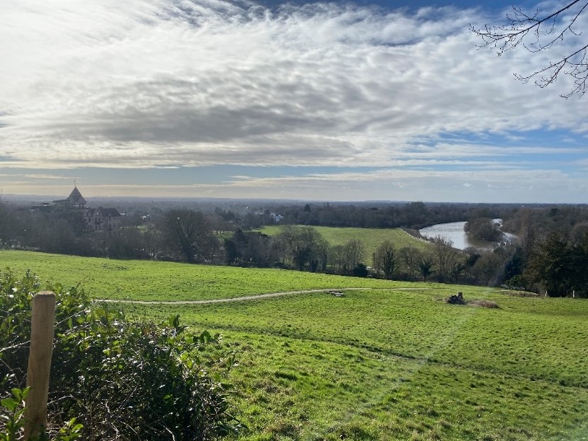
Figure 214 Terrace Field
There is a grade II listed tunnel under Petersham Road connecting Buccleuch Gardens with Terrace Gardens. It is approached on the Terrace Gardens side by a double set of steps surrounded by cast iron railings and gates. From Buccleuch Gardens, the entrance to the tunnel has the appearance of a decorative grotto, which may have been influenced by that belonging to Alexander Pope in Twickenham. The walls are lined with flint, and this is a feature which adds considerable interest to the gardens.
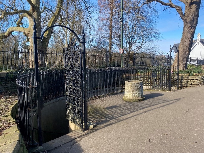
Figure 215 Entrance to subterranean tunnel from Terrace Gardens
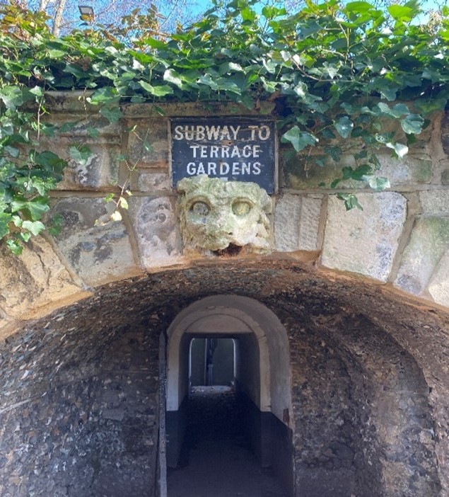
Figure 216 Entrance to tunnel from Buccleuch Gardens
Buccleuch Gardens lies to the west of Terrace Gardens and Terrace Fields, separated by Petersham Road. When viewed from Richmond Hill, these gardens blend together as Petersham Road is not visible, giving the impression of a more expansive green space. Buccleuch House originally stood here before it was demolished in the 1930s. The gardens contain substantial London Plane trees including one which is a Great Tree of London. It has a notable view towards the grade I listed Richmond Bridge. The view to the south is an almost completely rural outlook towards Petersham Meadows and the bend in the river.
Terrace Field, and Petersham Meadows with its grazing-cattle, make possible outstanding views to and from Richmond Hill. Petersham Meadows provides a blaze of buttercup colour in spring. Though it is not located within this conservation area, it contributes to it through its proximity and being part of the overall landscape.
Petersham Common, though once open, is a broad-leafed area of woodland forming a defining edge to Terrace Field, and a visual foil to the Star & Garter Home. It provides a striking rural contrast so close to the town centre. It provides a landscape link between Richmond Park, Petersham Meadows and the Thames.
There are outstanding river views towards Ham in the south and Richmond to the north, dramatised by the curve in the river, and by the landscape of mature trees on the Twickenham bank. The Star & Garter Home and Petersham Hotel are landmarks, the Star & Garter Home being the major landmark and aligned visually to the avenue to the front of Ham House. There is an exceptional view from the bottom of River Lane and Petersham Meadows towards the top of Richmond Hill. Nightingale Lane, Star & Garter Hill, and the southern end of Petersham Road all have a rural atmosphere. The whole area is of nature conservation importance, in particular the riverside, Petersham Common and Meadows.
Cambridge Gardens on the Twickenham Bank is a modest park, generally laid to lawn. It includes several tennis courts and a small playground. There is also a stone memorial to the Belgian refugees, who settled here during the First World War.
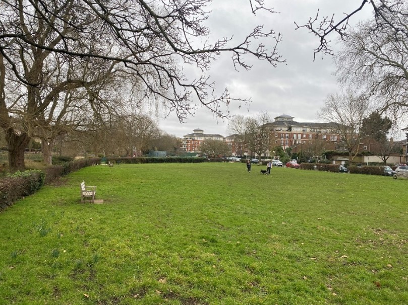
Figure 217 Cambridge Gardens
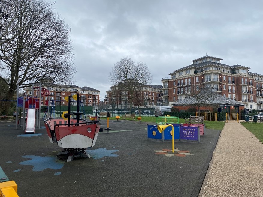
Figure 218 Playground in Cambridge Gardens
Figure 219 Tennis Court in Cambridge Gardens
Meadowbank also lies on the Twickenham bank and has a less formal character.
Richmond College has significant grounds with extensive lawns and mature trees and provides an excellent setting to the college buildings.

Figure 220 Grounds of Richmond College / The American University
Street Furniture, Paving, Lighting etc.
There are several 20th century pillar boxes in this Conservation Area.
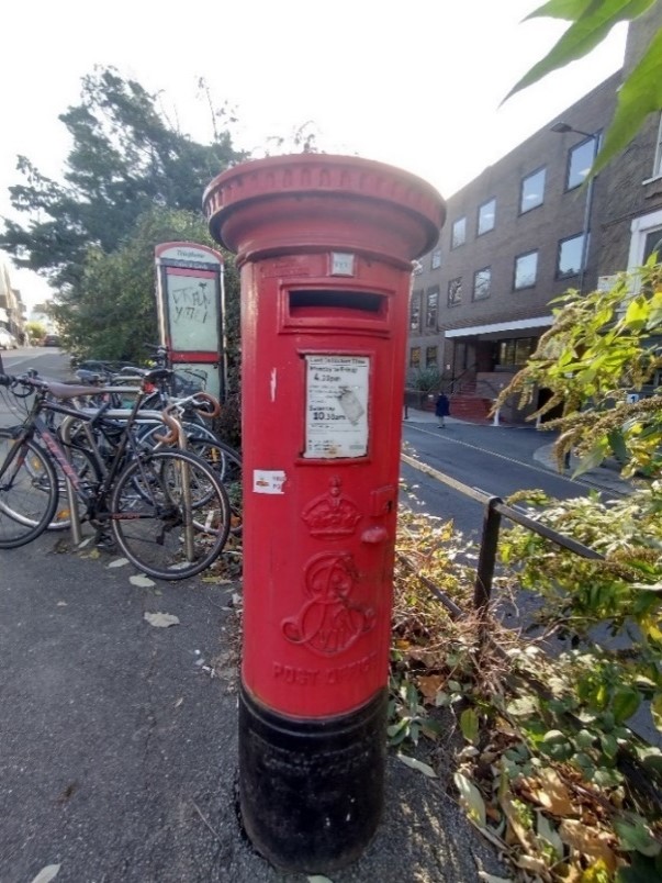
Figure 221 Edward VII postbox
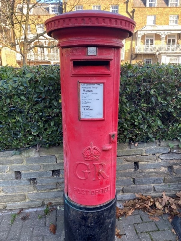
Figure 222 George V postbox
There are several designs of bollard in the Conservation Area, depending on location. The Manchester style is dominant but the bollards on the riverside are of a different style and size.
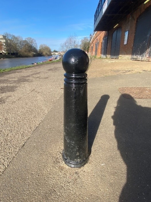
Figure 223 Small bollard on Thames towpath
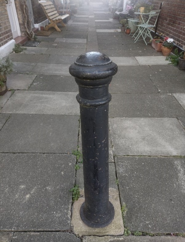
Figure 224 Manchester style bollard at entrance to Lancaster Cottages
The Conservation Area is well provided with bins, particularly in parks and gardens and located close to bus stops.
The quality of paving in this Conservation Area is fair. There is significant variety across the Conservation Area, from high load concrete paving slabs, poured concrete, tarmacadam, brick paving and cobble stones to gravel walkways. The granite kerbs provide a welcome sense of continuity.
Figure 225 High load concrete slab paving
Figure 226 Block paving in herringbone pattern
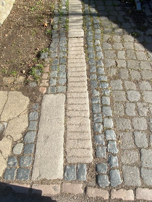
Figure 227 Cobble stones on Petersham Road
Figure 228 Gravel finish to Terrace Walk
The streetlights also vary considerably across the Conservation Area. There are lantern style street lights on Hill Rise and along Richmond Hill, with more modern streetlights on Petersham and Queens Roads.
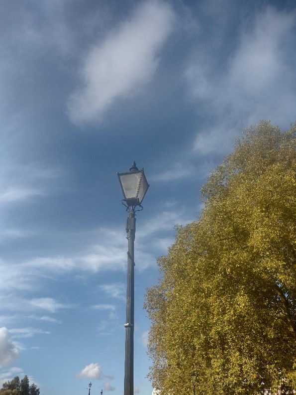
Figure 229 Traditional lantern streetlight
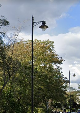
Figure 230 Hanging lantern streetlight
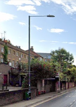
Figure 231 Modern projecting downlighting streetlight
8. Management Plan
Detailed Proposals for the preservation or enhancement of the character of the conservation area.
This Management Plan outlines how the Council intends to preserve and enhance the character and appearance of the Conservation Area in future. The Council has a duty to formulate and publish these proposals under the Planning (Listed Buildings and Conservation Areas) Act 1990.
Problems and Pressures
The attractiveness of the location causes pressure for development, which might harm the balance of the landscape-dominated setting. Problems and pressures for the whole Conservation Area are identified in more detail below.
- Loss of traditional architectural features and materials due to unsympathetic alterations and extensions.
- Pressure for development, which may include taller buildings that could be out of scale and out of character with the Conservation Area and could intrude visually into valued landscapes.
- Pressure for the conversion of shops into residential dwellings.
- Lack of coordination of street furniture and pavements within the character areas.
- Lack of street trees and planting in some locations.
- Domination of traffic and poor pedestrian safety, leading to clutter of signage and street furniture.
- Loss of original or quality shopfronts and unsympathetic alterations and advertisements such as disproportionate signage, excessive illumination, loss of detailing such as plinths, pilasters etc.
- Use of poor-quality materials in building works such as UPVC, roofing felt and GRP (Glass fibre reinforced polymers) products.
- Loss of historic outbuildings and rear alterations, which remove historic interest of the rear of properties.
- Loss of boundary walls and garden space in residential areas for hard standing, lightwells and vehicle parking.
- Development pressure, which may harm the balance of the river and landscape-dominated setting, and the obstruction or spoiling of views, skylines and landmarks.
Opportunities for Enhancement
Because of the size and diversity of the Conservation Area, only general guidance is given here. Please refer to the Council’s Public Space Design Guide.
- Preservation, enhancement and reinstatement of architectural quality and unity that is preferably based upon historic evidence.
- Protection and preservation of key views and vistas particularly in relation to development proposals and tree management.
- Protection of skylines, particularly in relation to proposals for rooftop alterations, telecom equipment etc.
- Improvement and protection of river and landscape setting.
- Riverside design guidance to be developed in accordance with the Council’s Urban Design Study (2021) and Thames Landscape Strategy.
- Improvement of highways conditions and pedestrian convenience as well as rationalisation of existing signage and street furniture.
- Planting of more street trees.
- Retain and refurbish where necessary cast street nameplates.
- Retain and improve the quality of shopfronts and advertisements, seeking that illumination is minimised and justified.
- Prioritise the retention of the original use of shop units rather than a change of use to residential.
- Seek that hard standing is kept to a minimum in favour for front gardens.
- Retain and enhance front boundary treatments.
- Seek the reinstallation of boundary treatment and front garden planting alongside planning applications for refurbishment or development where appropriate and feasible.
- Seek that any lightwells are placed to the side and rear of properties and that they are of modest proportions.
- Seek good quality and proportionate design and quality materials that are sympathetic to the period and style of the building.
- Pursue improvements in the following locations:
- The Duchess of Teck fountain and its setting
- The boundary area between Petersham Road and Buccleuch Gardens/ Petersham Meadows
- Coordination of colour and design of street furniture and an improvement in the quality of pavements.
- Paving – retain granite kerbs and channels and use traditional slab paving. Where particular high-quality paving such as York stone is used, this should be retained and possibly extended if opportunity arises.
- Street furniture – This should relate to the individual setting. It is important that distinctive elements are retained, such as historic bollards and railings. The distinctive white finish to elements at the entrance to Terrace Field should be retained.
- Revise the conservation area boundary to exclude the small section of Haversham Close (11-21) which is currently included. It is felt that these properties are not of sufficient architectural value to warrant inclusion in the conservation area. It will also rectify the anomaly of the fact that only these two terraces were included in the conservation area while several other matching terraces in Haversham Close were excluded. By removing this uncharacteristic section of the conservation area, its special character will be better protected.
References
Listed building information: The List Search Results for Richmond Hill | Historic England
Historic maps: National Library of Scotland - Map Images (nls.uk)
Archive photographs: Local Studies Library - London Borough of Richmond upon Thames
Up to: Conservation areas
Updated: 02 July 2026
